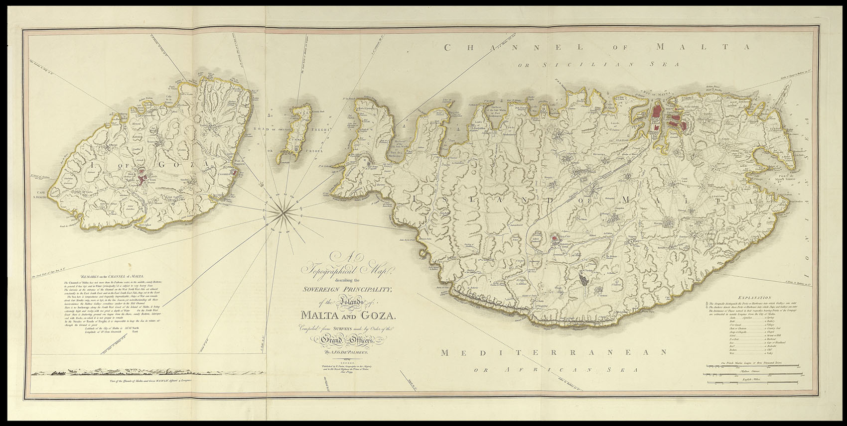
This rare map of Malta and Gozo, is based on surveys first published by Palmeus in 1752 as 'Carte generale de la principauté des isles de Malte et du Goze, dressée sur les mémoires des grands officiers de l'ordre, par A.F.G. Depalmeus, 1752', published by Jean Lattre. Palmeus and Lattre also collaborated on a proposed series of eight engraved views of Malta, 'Vues de la ville capitale de Malta', in 1753, probably after originals by local painter Alberto Pullicino (1719-1...
This rare map of Malta and Gozo, is based on surveys first published by Palmeus in 1752 as 'Carte generale de la principauté des isles de Malte et du Goze, dressée sur les mémoires des grands officiers de l'ordre, par A.F.G. Depalmeus, 1752', published by Jean Lattre. Palmeus and Lattre also collaborated on a proposed series of eight engraved views of Malta, 'Vues de la ville capitale de Malta', in 1753, probably after originals by local painter Alberto Pullicino (1719-1765). Palmeus, self-described as "Ingenieur-Dessinatur-Geographe", published several maps of the 'Ville de Malthe' from 1751.
Faden's map was published shortly after Napoleon captured the island of Malta on his way to Egypt in 1798. William Faden (1750-1836) began his career in cartography after taking over the business of Thomas Jefferys, a highly respected British mapmaker. Initially publishing under the name Faden and Jefferys, he followed his predecessor by specialising in maps of North America, resulting in the publication of a collection of them in the 'North American Atlas' in 1777. Twice honoured by the Royal Society for his work, he became Geographer to the King in 1783, and was chosen in 1801 to create and print the first of the Ordnance survey maps.