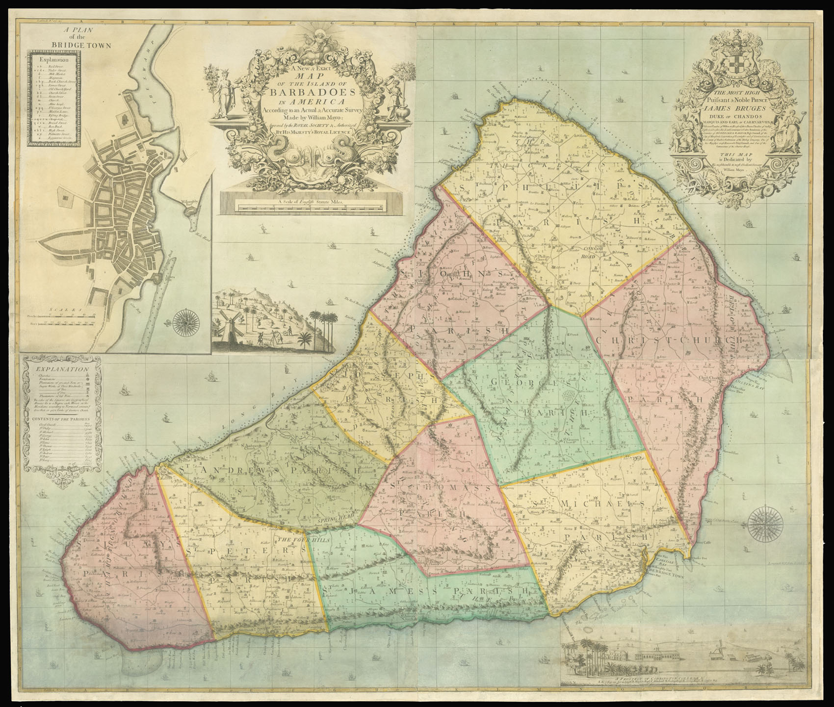
Engraved map on four sheets, in original full wash colour, dissected and mounted on linen, dedication to 'The most High Puisant & Noble Prince James Bruges Duke of Chandos [&c.]' at upper right, three inset maps: 'A Plan of the Bridge Town'; 'A Prospect of Codrington College'; and an untitled view of the mapmaker (Mayo) in the act of surveying the island, some toning, and a few tears skilfully repaired, mounted on linen.
The second state of the finest early map of Barbados, and one of the most impressive made for any English colony in the eighteenth century.
The map was originally published in 1722, based upon William Mayo's 1717-21 survey of the island. This second state was published in 1750, with no alterations other than the removal of the old dates and Senex's name as engraver. A one sheet reduction was published by Robert Sayer in 1756, and a second reduced version appeared...
The second state of the finest early map of Barbados, and one of the most impressive made for any English colony in the eighteenth century.
The map was originally published in 1722, based upon William Mayo's 1717-21 survey of the island. This second state was published in 1750, with no alterations other than the removal of the old dates and Senex's name as engraver. A one sheet reduction was published by Robert Sayer in 1756, and a second reduced version appeared in Jefferys' West India Atlas of 1775. Mayo relocated to Virginia in 1723. He became one of the leading surveyors in the colony, and participated in the surveying of the Virginia-North Carolina boundary in 1728, the survey of the Northern Neck of Virginia in 1733, and laid out the City of Richmond in 1737.
Barbados was by far Great Britain's richest American colony in the eighteenth century. Sugar cane, the principal crop, was so profitable that the island's exports were more valuable than those from all the other American colonies combined. Mayo's map identifies approximately 986 plantations, and was the first map to delineate the boundaries between the islands eleven parishes.
bibliography:
bibliography:
Pritchard & Taliaferro, Degrees of Latitude, 22; Campbell, 'Printed Maps of Barbados' (MCS 21), 21, plate 8; Campbell, Early Maps, pp.58-60; British Museum Cat., 9, col. 773; NMM, Cat., 453 (19-20); Not in Sellers & Van Ee.