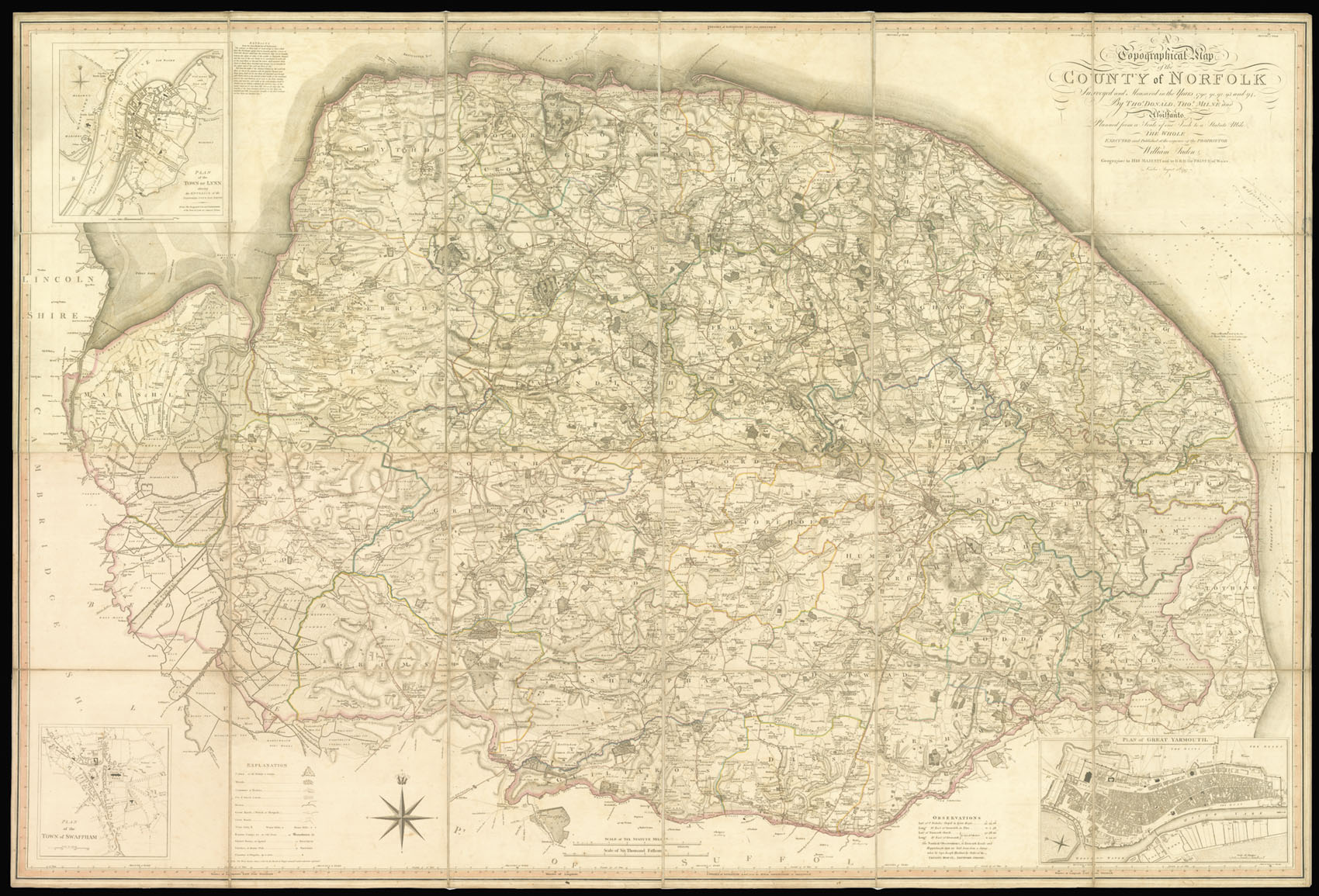
Surveyed and Measured in the Years 1790, 1791, 1792, 1793, and 1794. By Thos. Donald, Thos. Milne and Assistants. Planned from a Scale of one Inch to one Statute Mile. The Executed and Published at the Expense of the Proprietor William Faden.
William Faden, Geographer to His Majesty and to H.R.H. the Prince of Wales
August, 1st, 1797.
Engraved map on six sheets, original hand-colour in outline, dissected and mounted on linen, inset plans of Kings Lynn, Great Yarmouth, and Swaffham, key to map lower left.
William Faden was a prolific publisher of atlases, maps and plans who started his career working for Thomas Jefferys around 1770. Following the latter's death in 1771 he took over the business, which traded as Jeffery's and Faden until 1783, after which it traded under Faden's own name. The stock acquired from Jefferys was considerable, but it did not include a one inch to one mile of Norfolk; indeed the only large-scale surveys of the county up to this time were a number o...
William Faden was a prolific publisher of atlases, maps and plans who started his career working for Thomas Jefferys around 1770. Following the latter's death in 1771 he took over the business, which traded as Jeffery's and Faden until 1783, after which it traded under Faden's own name. The stock acquired from Jefferys was considerable, but it did not include a one inch to one mile of Norfolk; indeed the only large-scale surveys of the county up to this time were a number of maps published in the first half of the eighteenth century on a scale of 2/3 inch to one mile.
Andrew Armstrong's son, Mostyn John, who had been involved with his father in the 1769 survey of Northumberland had moved to Norfolk a few years later. There he issued "Proposals" for large-scale maps of Norfolk, and Cambridgeshire, neither of which came to fruition. It was therefore left to William Faden to produce his own map as he had done with Hampshire and he again engaged the services of the surveyor of that map, Thomas Milne. The latter was joined by Thomas Donald who had worked for Jefferys on several surveys and would therefore be well known to Faden.
The map took five years to complete and was the first survey of the county on this scale, finely engraved on six sheets. The work is superbly detailed and includes information upon towns, villages, hills and parks, gentleman's seats, churches and chapels, broads, farms and marshes, commons, heaths and woods, Roman camps, mills, great roads and cross-roads, rivers, drains and dykes. In 1797 Faden applied to the Society of Arts for an award fir the map but despite the competence of the survey and his high standing in the map world, the application proved unsuccessful.
The second edition includes a small note or legend of some nineteen lines to the side of the plan of Kings Lynn being "Extracts from the Eau Brink Act of Parliament" which involved a river or cut from Kings Lynn south to St. Germans Bridge.