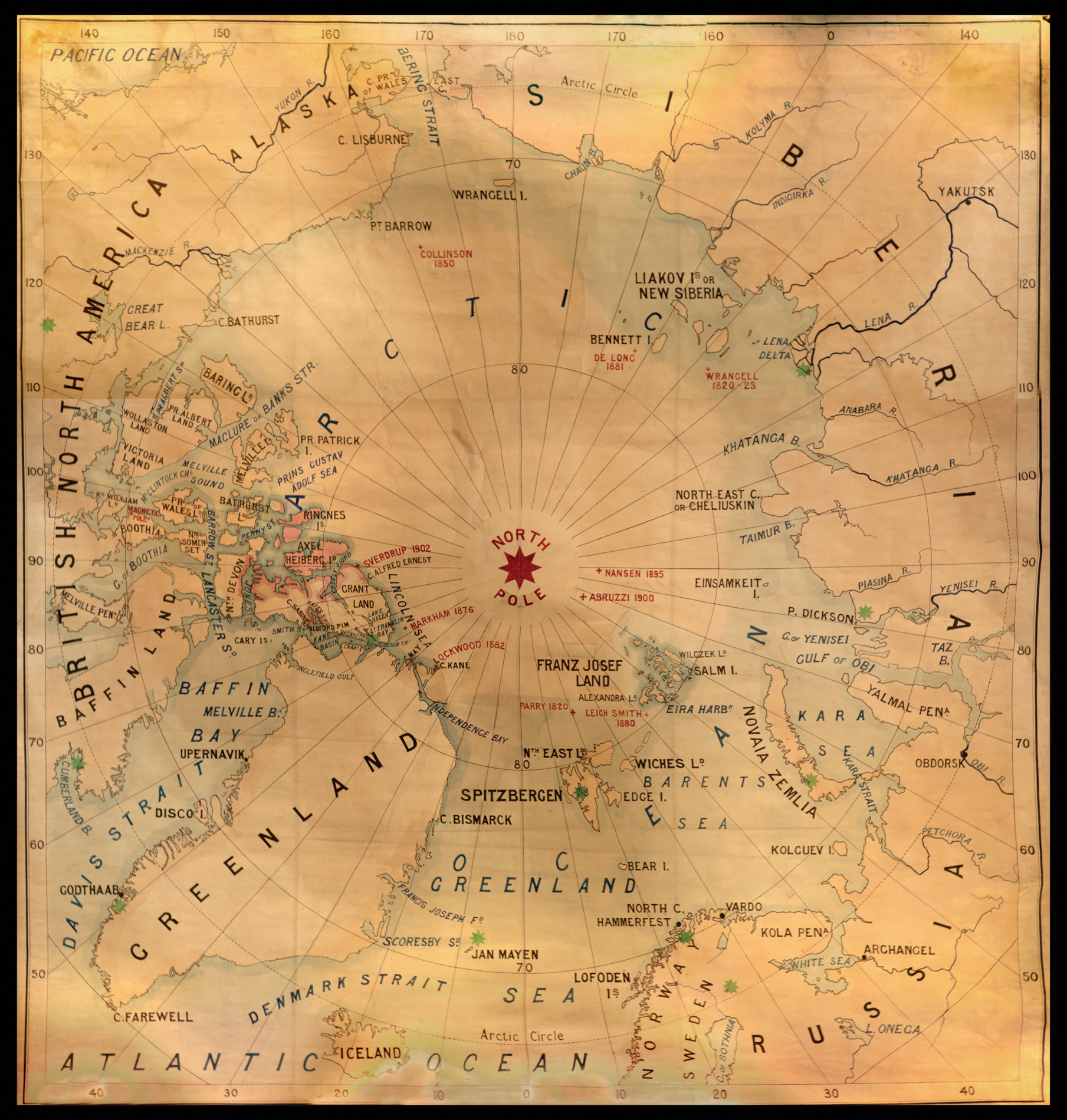
A magnificent massive manuscript map from the library of The Royal Scottish Geographical Society (RSGS). Created in c.1902 (Sverdrup's voyage of 1902 is the most recent expedition noted), the map was made during the heyday of the RSGS, and, presumably, was made to demonstrate the achievements of recent arctic exploration as a method of drumming-up interest in the Society's forthcoming "Scotia" expedition to the Antarctic.
The RSGS was founded in 1884. The origina...
A magnificent massive manuscript map from the library of The Royal Scottish Geographical Society (RSGS). Created in c.1902 (Sverdrup's voyage of 1902 is the most recent expedition noted), the map was made during the heyday of the RSGS, and, presumably, was made to demonstrate the achievements of recent arctic exploration as a method of drumming-up interest in the Society's forthcoming "Scotia" expedition to the Antarctic.
The RSGS was founded in 1884. The originator of the idea for a national society of geography in Scotland was John George Bartholomew, of the Bartholomew map-making company in Edinburgh. In his initial attempts, Bartholomew was assisted by Mrs A.L. Bruce, the daughter of David Livingstone. She herself was a keen geographer, with a particular interest in Africa. With an outline for the proposed society, they sought the support of Professor James Geikie, Professor of Geology at Edinburgh University. Geikie had a keen interest in the advancement in geographical research and teaching, willingly giving his support to the project, and in December 1884 The Scottish Geographical Society (S.G.S.) was established.
The map shows the voyages of Parry (1820); Wrangell (1820-23); Collinson (1850); Markham (1876); Leigh Smith (1880); De Long (1881); Lockwood (1882); and Sverdrup (1902).