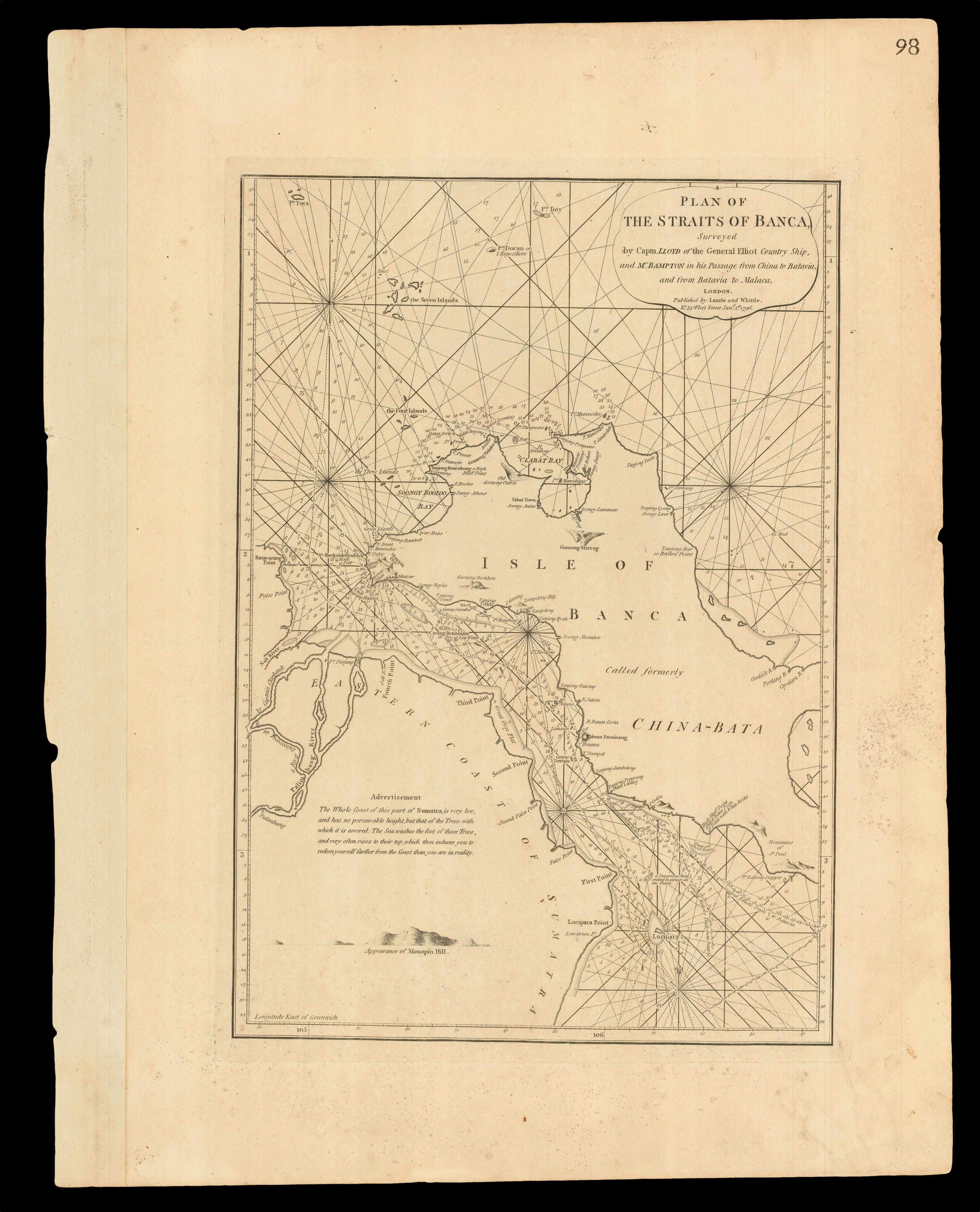
Navigational chart of the waters around the Island of Bangka. Off the east coast of Sumatra, the island had long been a source of tin. The chart includes a plethora of depth soundings based on the surveys of the 'General Elliot', described as a "Country Ship", a term reserved by the British authorities in India to refer to local vessels operating between India and other Asian countries, as distinct from the trade routes between Asia and Europe. British vessels, not in the s...
Navigational chart of the waters around the Island of Bangka. Off the east coast of Sumatra, the island had long been a source of tin. The chart includes a plethora of depth soundings based on the surveys of the 'General Elliot', described as a "Country Ship", a term reserved by the British authorities in India to refer to local vessels operating between India and other Asian countries, as distinct from the trade routes between Asia and Europe. British vessels, not in the service of the East India Company, plying these waters, were therefore known as English country traders.
The "Advertisement" on the map warns that "the Whole Coast of this part of Sumatra, is very low, and has no perceivable height, but that of the Trees with which it is covered. The Sea washes the foot of those Trees, and very often rises to their top, which then induces you to reckon yourself farther from the Coast than you are in reality".
The chart is from an early edition of Laurie & Whittle's rare 'East India Pilot', and one of the first charts published after their purchase of Robert's Sayer's business. Laurie & Whittle's 'East India Pilot' was published as a practical guide to navigators aboard ships of the Royal Navy and East Indiamen, and often taken to sea, and this chart appears to be no exception, as it is gently spotted. All variants of Laurie and Whittle's 'Oriental' pilots of eastern waters are scarce, and were published under several titles, each with a different complement of charts. Variants include: 'The Country Trade East-India Pilot, for the Navigation of the East-Indies and Oriental Seas, within the limits of the East-India Company', 'The Complete East-India Pilot, or Oriental Navigator', 'The East-India Pilot, or Oriental Navigator', and 'The Oriental Pilot; Or, East-India Directory' focusing on the most important charts used for the journey.
The foundation of the partnership of Robert Laurie (1755–1836) and James Whittle (1757–1818) was the existing stock of Robert Sayer's printing plates, both for maps and atlases and also decorative prints. Laurie had originally apprenticed to Robert Sayer in 1770, and made free in 1777. He was a skilled artist, who exhibited at the Society of Artists from 1770, winning a silver palette for a drawing in 1770, and he was also an accomplished engraver of mezzotint portraits and produced views and other decorative items. In about 1792 he returned to the Sayer business and took it over from the ailing Sayer in 1794. Whittle was apprenticed into the Needlemakers' Company, evidently made free by 1792, and joined with Laurie to take over the Sayer business in 1794.
Laurie retired in 1812. His son Richard Holmes Laurie replaced him in the partnership and, eventually, took over the firm after Whittle's death in 1818. Presumably under the influence of Richard Holmes Laurie, the partnership became noted as chartmakers and publishers, with the business existing to the current day as Imray, Laurie, Norie and Wilson.