Published by the Proprietor, W. Faden, Geographer to His Majesty and to His Royal Highness the Prince of Wales,
August 12th, 1803.
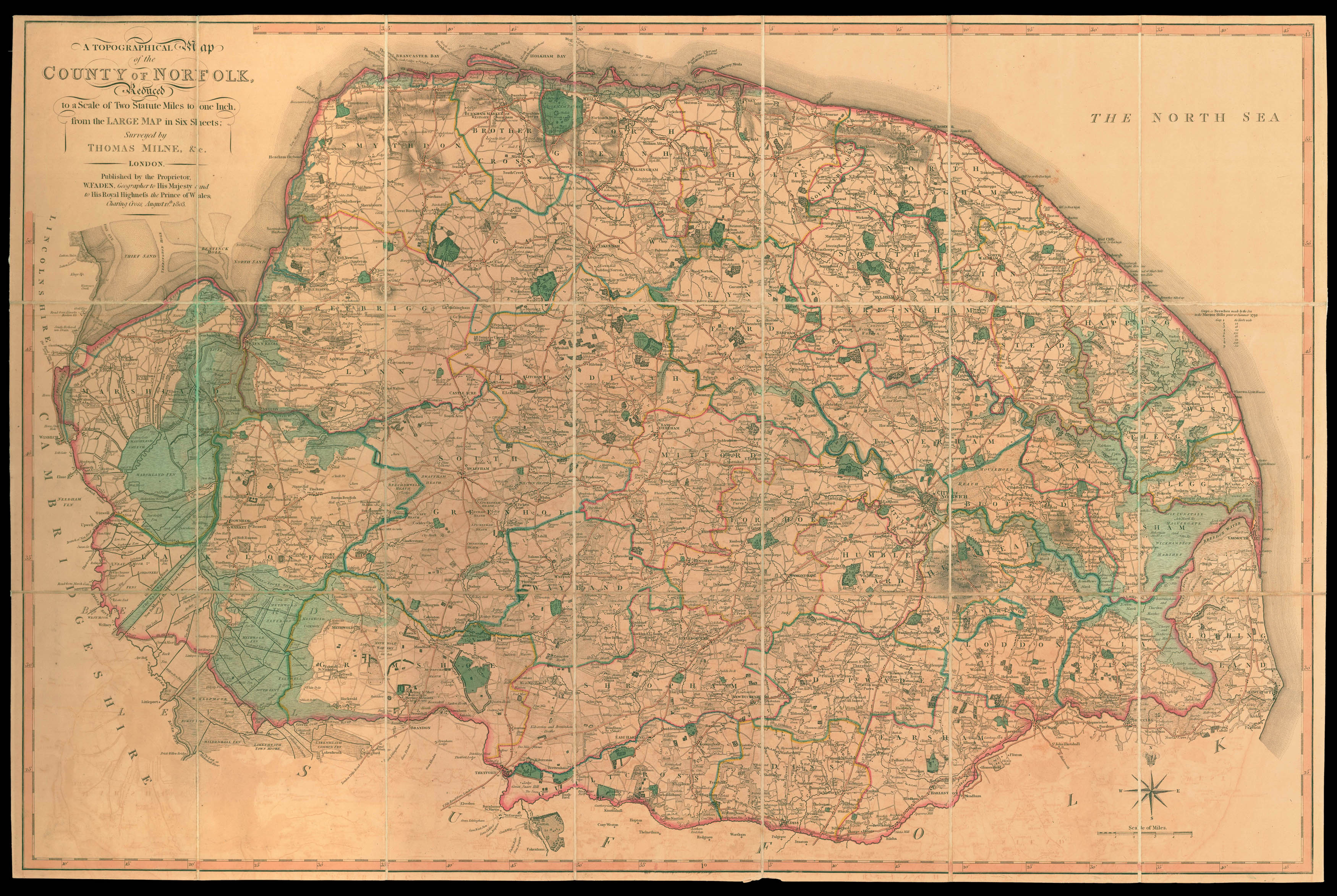
Engraved map dissected and mounted on linen, fine original outline hand-colour, folding into original green marbled paper slipcase, with publisher's label.
Rare reduction of the first large-scale map of the county.
William Faden was a prolific publisher of atlases, maps and plans who started his career working for Thomas Jefferys around 1770. Following the latter's death in 1771 he took over the business, which traded as Jeffery's and Faden until 1783, after which it traded under Faden's own name. The stock acquired from Jefferys was considerable, but it did not include a one inch to one mile of Norfolk; indeed the ...
Rare reduction of the first large-scale map of the county.
William Faden was a prolific publisher of atlases, maps and plans who started his career working for Thomas Jefferys around 1770. Following the latter's death in 1771 he took over the business, which traded as Jeffery's and Faden until 1783, after which it traded under Faden's own name. The stock acquired from Jefferys was considerable, but it did not include a one inch to one mile of Norfolk; indeed the only large-scale surveys of the county up to this time were a number of maps published in the first half of the eighteenth century on a scale of 2/3 inch to one mile.
Andrew Armstrong's son, Mostyn John, who had been involved with his father in the 1769 survey of Northumberland had moved to Norfolk a few years later. There he issued "Proposals" for large-scale maps of Norfolk, and Cambridgeshire, neither of which came to fruition. It was therefore left to William Faden to produce his own map as he had done with Hampshire and he again engaged the services of the surveyor of that map, Thomas Milne. The latter was joined by Thomas Donald who had worked for Jefferys on several surveys and would therefore be well known to Faden.
The map took five years to complete and was the first survey of the county on this scale, finely engraved on six sheets. The single-sheet reduction present here was surprisingly never printed alongside editions of the large-scale survey; indeed it first appeared some six years after the publication of the six-sheet map. It is a true reduction of the latter and includes much of the information found on the larger map, including roads, rivers, fens, towns, villages, gentlemen's seats, forests and parks.
![[KHALIL, Muhammad and Abd AL-A'IMMA] [Brass Persian astrolabe]](https://omega.crouchrarebooks.com/wp-content/uploads/2025/03/23117_2H.jpg) Safavid astrolabe
1 × £550,000
Safavid astrolabe
1 × £550,000![[?MARKE, John] [Brass Astrolabe and Slide Rule]](https://omega.crouchrarebooks.com/wp-content/uploads/2025/03/22198_1H.jpg) The "Panchronologia"
1 × £500,000
The "Panchronologia"
1 × £500,000