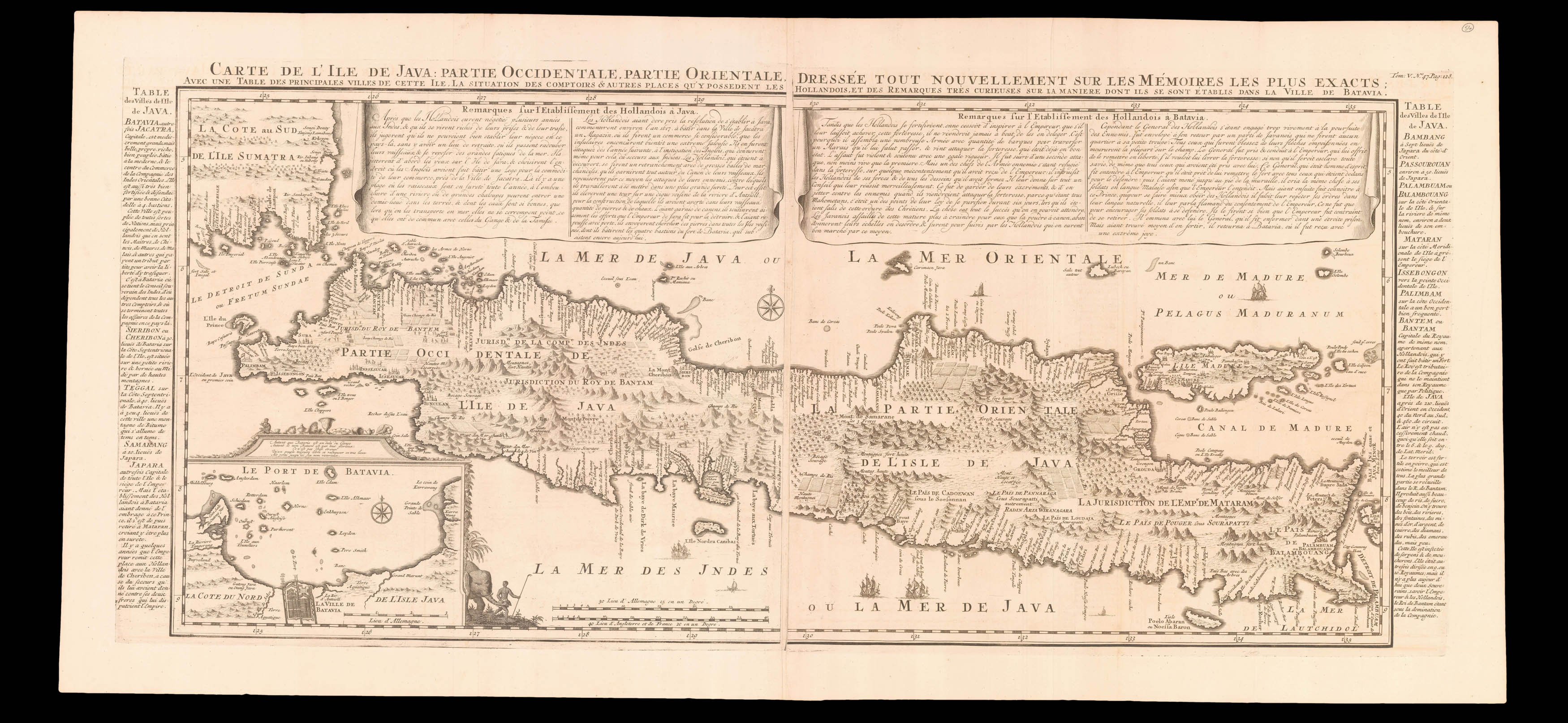
Partie Occidentale, Partie Orientale, dressee tout nouvellement sure les Memoires les plus exacts: avec une table des principles villes de cette Ile. La situation des comptoirs & autres places qu'y possedent les Hollandois, et remarques tres curieuses sur la maniere don't ils se sont etablis dans la Ville de Batavia.
The important VOC controlled island of Java, with extensive explanatory text in panels on either side and in banners along the top edge, an inset of Le Port de Batavia appears lower left.
The Chatelains based their maps on the work of contemporary and earlier cartographers and travel writers, and the current map is based on Hadriaan Reland's map, which was not published by the Dutch until Johannes van Keulen, issued it as 'Insulae Iavae pars Occidentalis edente Hadria...
The important VOC controlled island of Java, with extensive explanatory text in panels on either side and in banners along the top edge, an inset of Le Port de Batavia appears lower left.
The Chatelains based their maps on the work of contemporary and earlier cartographers and travel writers, and the current map is based on Hadriaan Reland's map, which was not published by the Dutch until Johannes van Keulen, issued it as 'Insulae Iavae pars Occidentalis edente Hadriano Relando' in 1728.
V