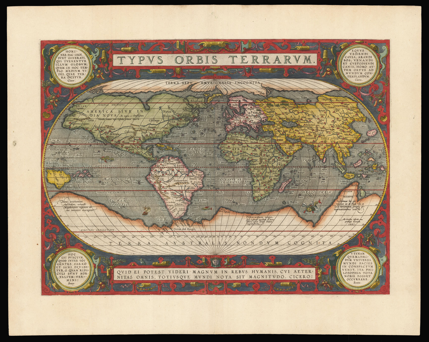
Ortelius's map is based upon Gerard Mercator's 1569 wall map of the world, Gastaldi's 1561 world map and Gutierrez' portolan map of the Atlantic. Although the date on the map is 1587, as shown on the right hand-side of the massive Terra Australis continent, the map was not used in the Theatrum until the Latin edition of 1592.
The map was first published in 1570 and it featured a border of clouds running around the oval of the map. Similarly to other plates in the...
Ortelius's map is based upon Gerard Mercator's 1569 wall map of the world, Gastaldi's 1561 world map and Gutierrez' portolan map of the Atlantic. Although the date on the map is 1587, as shown on the right hand-side of the massive Terra Australis continent, the map was not used in the Theatrum until the Latin edition of 1592.
The map was first published in 1570 and it featured a border of clouds running around the oval of the map. Similarly to other plates in the atlas, it was signed by the engraver Franciscus (Frans) Hogenberg. A second plate appeared in 1586, and possibly in two later states, all were smaller in size, and the third one had a corrected South American coastline without its westward bulge. Finally the present state, the third and last, with four medallions in the corners bearing Stoic quotes from Cicero and Seneca, a more intricate design to replace the clouds, and further geographical corrections, most importantly the appearance of the Solomon Isles.
Ortelius's Theatrum Orbis Terrarum is widely regarded as the first modern atlas. At the time of its publication, it was the most expensive book ever produced. Between 1570 and 1612, it was issued in 31 editions and seven languages.