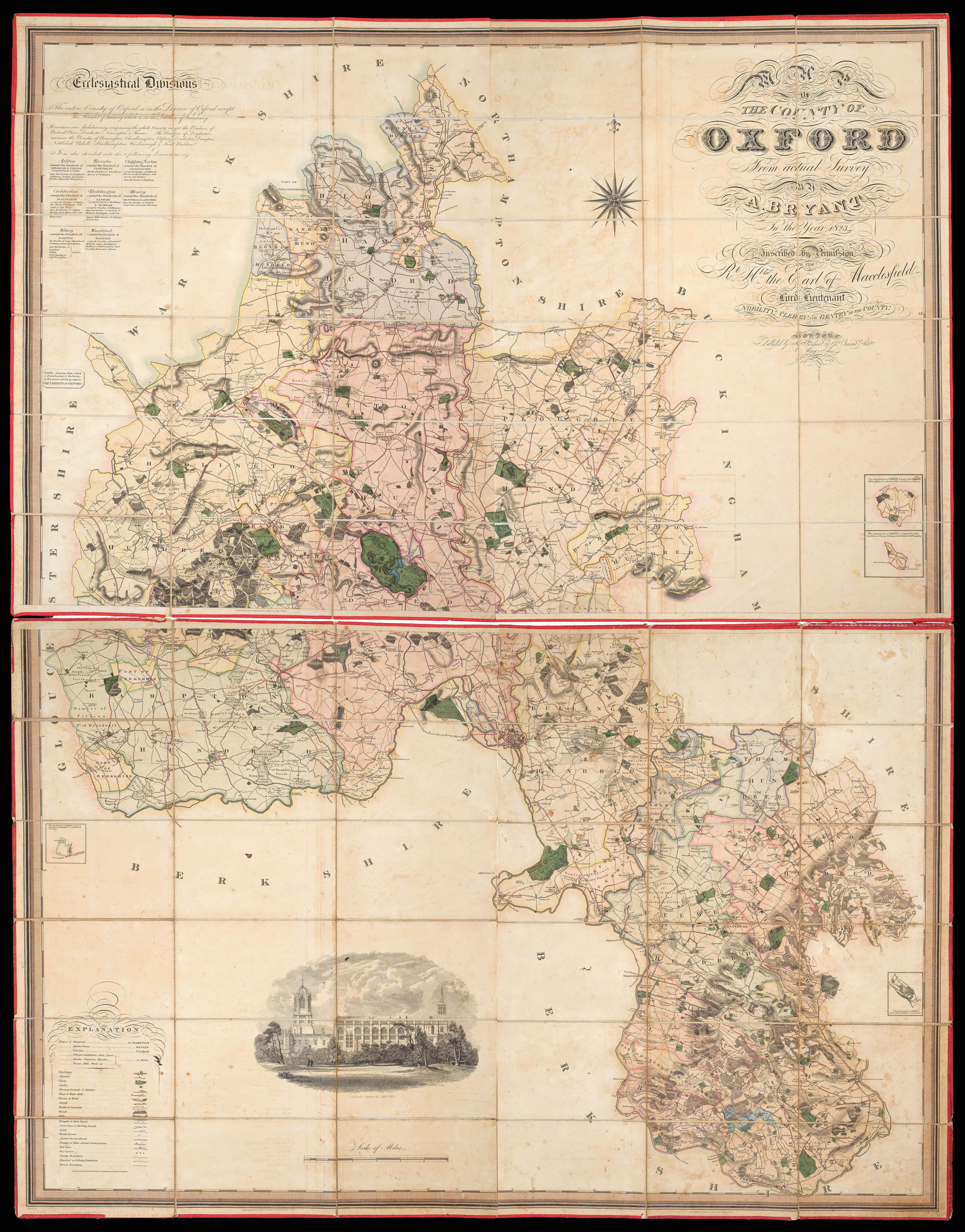
from actual survey by A. Bryant, in the Year 1823. Inscribed by Permission to Right Honourable the Earl of Macclesfield Lord Lieutenant, and to the Nobility, Clergy and Gentry of the County.
Large scale engraved map, dissected and mounted on linen and edged in red silk, in two sections, fine original full-wash colour, view of Christ Church Oxford, lower left, table of ecclesiastical divisions, upper left, some offsetting, insets of parts of the county outside Oxfordshire, housed in original full calf pull-off slipcase, gilt.
Between 1822 and 1835 Andrew Bryant surveyed thirteen English counties, much in the manner of the Greenwood brothers, though without the latters' extreme detail. With their swash lettering, vignette views and meticulous engraving there was a great similarity about their respective output. Of the six counties covered by both cartographers, in five instances they were both working in the field at the same time, even with the...
Bryant's large-scale map of Oxfordshire.
Between 1822 and 1835 Andrew Bryant surveyed thirteen English counties, much in the manner of the Greenwood brothers, though without the latters' extreme detail. With their swash lettering, vignette views and meticulous engraving there was a great similarity about their respective output. Of the six counties covered by both cartographers, in five instances they were both working in the field at the same time, even with the much talked about animosity between the Greenwoods and Bryant, it is most likely that they shared information. The map, like the Greenwoods', is very detailed, and shows boundaries of the counties, hundreds and parishes, churches and chapels, castles and quarries, farmhouses and gentlemen's seats, heaths and common land, woods, parliamentary representatives, and distances between towns. The map is on a scale of 1 1/2 inches to the mile. The maps by Bryant are appreciably scarcer than those of the Greenwoods.
![[WILLDEY, George] [Composite atlas].](https://omega.crouchrarebooks.com/wp-content/uploads/2025/03/12621_1H.jpg) Willdey's rare composite atlas
1 × £75,000
Willdey's rare composite atlas
1 × £75,000