Novitur impressum per Bernadinu Venetu de Vitalibus. Expensis Evagelista Tossino Brixiano Bibliopola. Impante Iulio II. Pont. Max Anno. III. Potificatus sui Die VIII. Septebr M.D.VII.
1507].
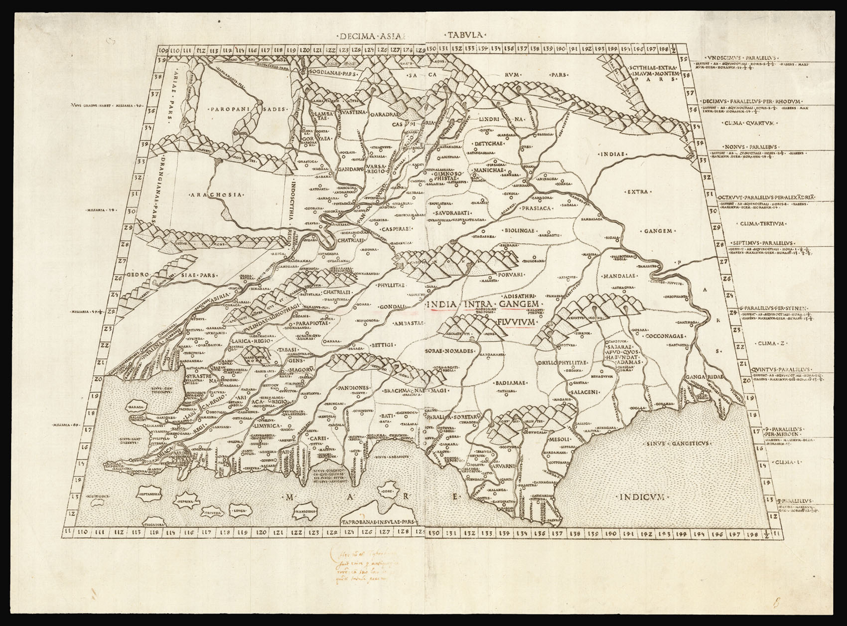
Double-page engraved map, on two sheets joined, on laid paper, with a watermark of a crossbow within and circle and a T within a circle, a few words underlined in red ink, together with later marginalia, two tears to upper and lower right hand margin skilfully repaired.
Detailed map of showing the whole of Northern India including a severely truncated peninsula.
Map from the beautiful third Rome edition of Ptolemy's Geographia. "This handsome edition is a reprinting of the copper-plate maps of the 1478 [and 1490] Ptolemy [the first Rome edition by Conrad Sweynheym and Arnold Buckinck, whose] maps are considered the finest Ptolemaic ones produced up to the time that the great Mercator engraved his Ptolemy of 1578... It is believe...
Detailed map of showing the whole of Northern India including a severely truncated peninsula.
Map from the beautiful third Rome edition of Ptolemy's Geographia. "This handsome edition is a reprinting of the copper-plate maps of the 1478 [and 1490] Ptolemy [the first Rome edition by Conrad Sweynheym and Arnold Buckinck, whose] maps are considered the finest Ptolemaic ones produced up to the time that the great Mercator engraved his Ptolemy of 1578... It is believed that Sweynheym was the one who first thought of applying the very new art of copper-engraving to the printing of maps, and he might have taken a hand in the actual engraving of them himself" (World Encompassed). While the Bologna edition of 1477 was the first atlas to use copperplate maps, the present series is generally regarded as superior for its clear captions, accurate projections and overall design. Also, there are indications the Bologna edition was hurried through the press: the captions were not engraved but stamped into the plates. The early Italian Ptolemys, particularly the Rome editions, are "superb testimonials of Italian craftsmanship without the picturesque but unscientific monsters of the medieval maps or the addition of the adventitious decoration of later work, relying for their beauty solely on the delicacy of their execution and the fineness of the material employed" (Tooley).