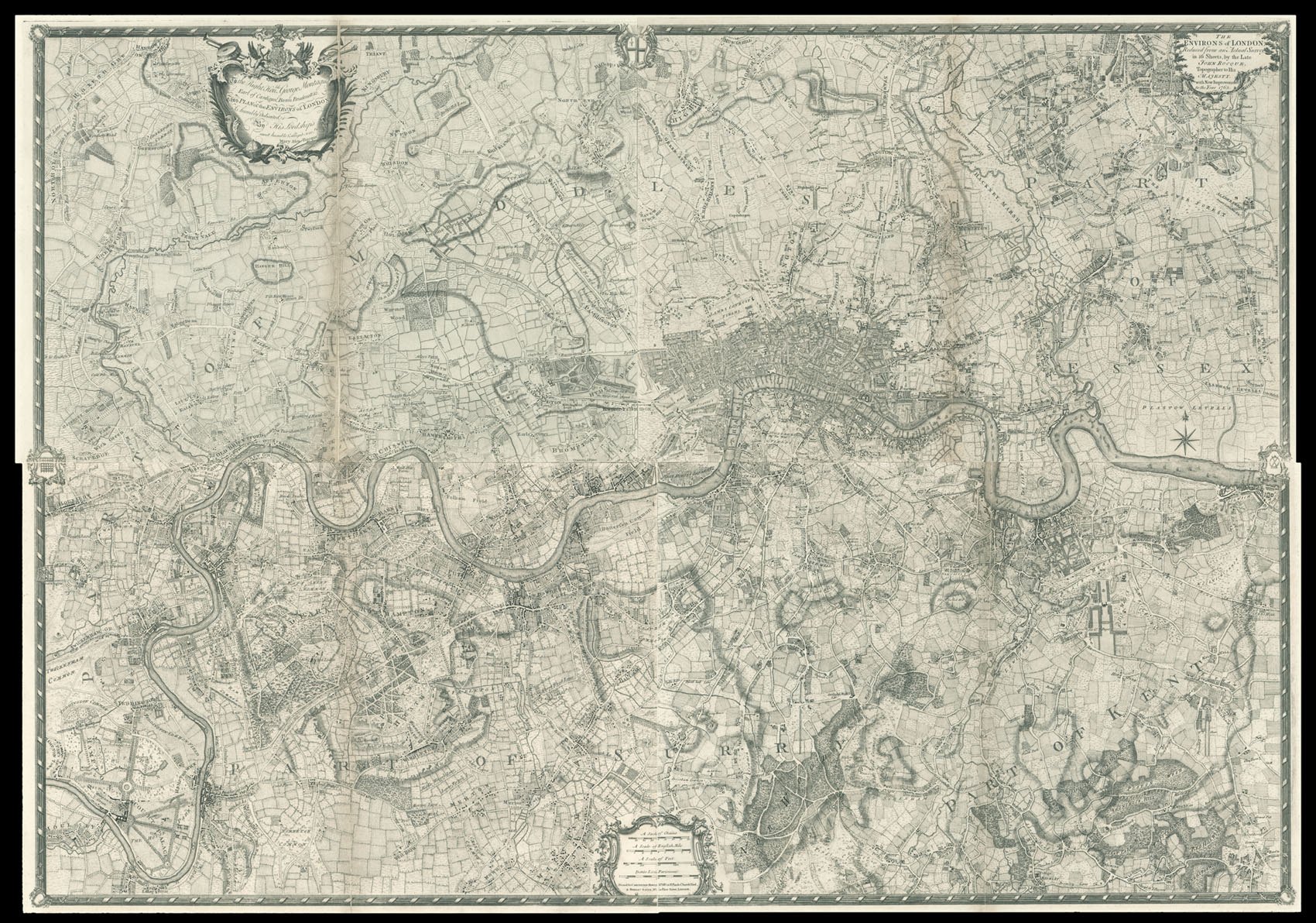
Reduced from an Actual Survey in 16 Sheets, by the Late John Rocque, topographer to His Majesty with New Improvements to the Year 1763. To the Right Honorable George Montague Earl of Cardigan, Baron Brudenell &c. This Plan of the Environs of London Is humbly dedicated By His Lordship's most humble & obliged servant, Mary Ann Rocque.
This fine survey is a reduction of John Rocque's monumental survey of London upon 16 sheets. The map bears the name of Rocque's widow, Mary Ann, who continued his map publishing business. The plan also bears the imprint of Carington Bowles, to whom Mary would transfer much of the business at some time around 1769.
Scale: 2 1/2 inches to 1 statute mile.
...
This fine survey is a reduction of John Rocque's monumental survey of London upon 16 sheets. The map bears the name of Rocque's widow, Mary Ann, who continued his map publishing business. The plan also bears the imprint of Carington Bowles, to whom Mary would transfer much of the business at some time around 1769.