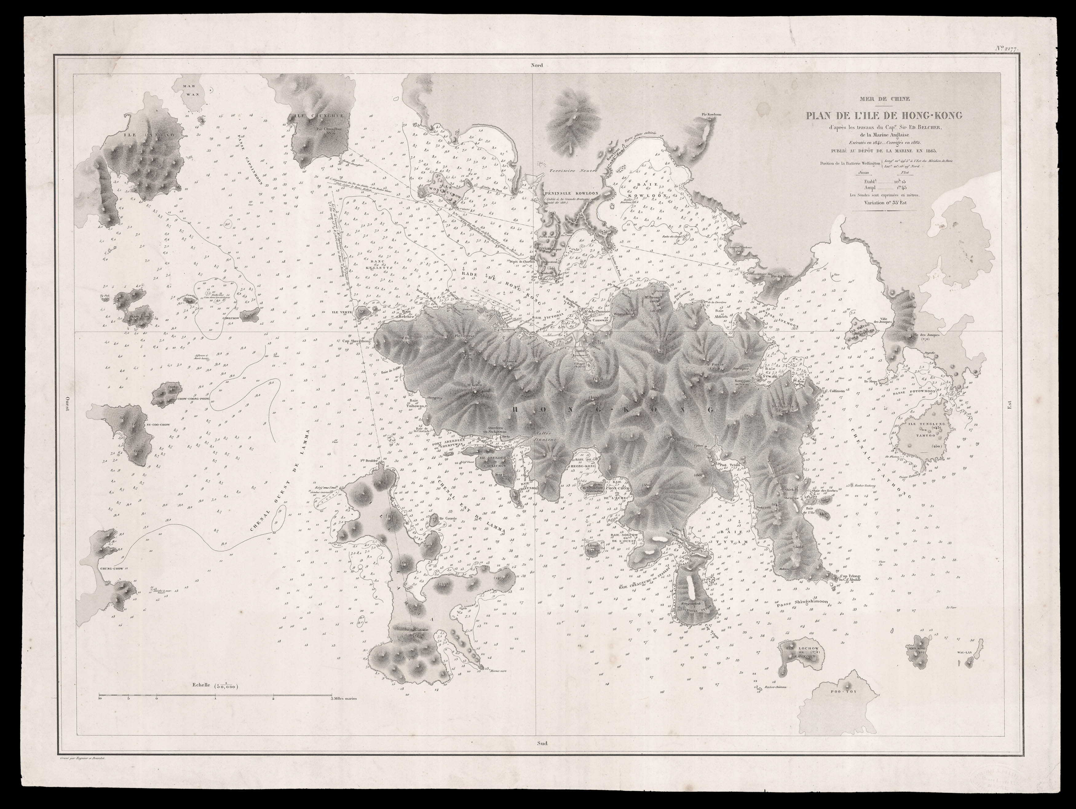
A French chart of Hong Kong drawn after Captain Sir Edward Belcher's seminal survey of 1841, the first systematic survey of Hong Kong harbour.
The present French chart is based on the Admiralty's 1864 edition, which has been updated with the latest surveys carried out between 1857 to 1861. The most striking additions are to the Kowloon Peninsular, where the area is marked as 'Cedee a la Grande Bretagne par le traite de 1860' (ie The Convention of Peking). The la...
A French chart of Hong Kong drawn after Captain Sir Edward Belcher's seminal survey of 1841, the first systematic survey of Hong Kong harbour.
The present French chart is based on the Admiralty's 1864 edition, which has been updated with the latest surveys carried out between 1857 to 1861. The most striking additions are to the Kowloon Peninsular, where the area is marked as 'Cedee a la Grande Bretagne par le traite de 1860' (ie The Convention of Peking). The latest constructions are marked, including a coal depot to the western coast; signalling the British Navy's increasing dependence on coal to power their fleet.
Although the chart is somewhat reduced from Belcher's original, it does cover a slightly wider area, with more of the Chinese coast and surrounding islands marked. The final amendment to Belcher's chart is the use of metres for marking soundings and heights of mountains, rather than the British fathoms and feet.
It would appear that the 1865 edition was the only one published by the Depot de la Marine, as we are unable to locate any subsequent or earlier editions housed in institutions.
Rare: we are only able to trace two institutional examples of the present work: The British Library; and the Berlin State Library.