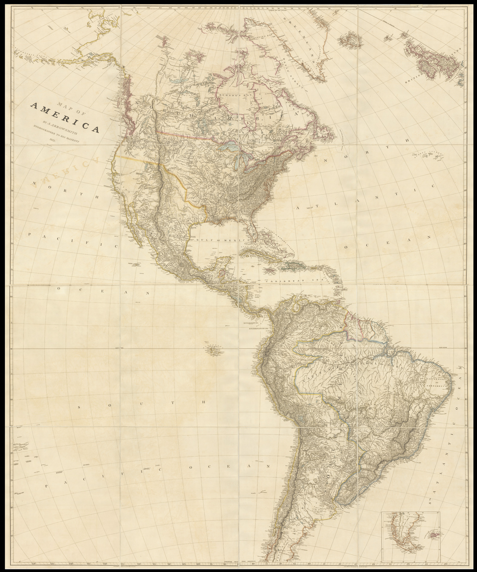
Large engraved map on four sheets, dissected and mounted on linen, in two sections, fine original outline hand-colour, inset of Cape Horn, folding into original blue paper slipcase, with manuscript label.
The map displays detailed information of the Hudson Bay Company's discoveries on the Columbia River and the Upper Missouri Regions. The coastal details along the Northwest coast of America are significantly better than the prior edition of Arrowsmith's map of North America.
The Fairbanks example of the map was used in the International Boundary Tribunal for the Alaskan Boundary and there is reference to the map in the US Supreme Court arbitration of a seal fur d...
The map displays detailed information of the Hudson Bay Company's discoveries on the Columbia River and the Upper Missouri Regions. The coastal details along the Northwest coast of America are significantly better than the prior edition of Arrowsmith's map of North America.
The Fairbanks example of the map was used in the International Boundary Tribunal for the Alaskan Boundary and there is reference to the map in the US Supreme Court arbitration of a seal fur dispute (Fur seal arbitration, Volume 15, by the Bering Sea Tribunal of Arbitration, United States. 53d Congress, 2d session, Senate).
Aaron Arrowsmith (1750-1823), "easily the foremost cartographer of his time" (R.V. Tooley), was the founder of the Arrowsmith dynasty of cartographers. Born in County Durham, he was in London by 1777 when he witnessed the will of Andrew Dury, a mapseller and publisher, and was probably training with him; he may have trained with William Faden, Geographer to the King, but was certainly employed by John Cary in 1782, as he is credited with the survey work for 'Cary's Actual Survey, of the Great Post Roads between London and Falmouth', published in 1784; he is frequently credited with some of the survey work for Cary's county atlas, 'Cary's New and Correct English Atlas: being a set of county maps from actual surveys' (1787), but the sources are silent on this and by this time Arrowsmith had established his own business.
Arrowmsith's maps set a new standard; he was assiduous in analysing and verifying his sources, discarding not only the fictional but also the uncertain, going to printed and manuscript sources for his information, and engraved in a clear and highly legible style. Arrowsmith was also diligent in revising and improving his maps to keep them current, and served as an inspiration for the next generation of (particularly American) surveyors.
Not in OCLC. The only example of this map that we have been able to locate is in the University of Alaska, Fairbanks.