A rare map of Persia (now Iran) and central Asia. The map uses the Iranian unit of measurement, the parasang or farsakh, roughly equivalent to a league. It reflects the provisions made by the Treaty of Paris, which concluded the Anglo-Persian War.
Persia at the time was ruled by Nasser al-Din Shah Qajar. The Shah attempted to take Herat to increase Persian influence in the region and regain territory lost to Russia at the end of the Russo-Persian Wars. The Briti...
A rare map of Persia (now Iran) and central Asia. The map uses the Iranian unit of measurement, the parasang or farsakh, roughly equivalent to a league. It reflects the provisions made by the Treaty of Paris, which concluded the Anglo-Persian War.
Persia at the time was ruled by Nasser al-Din Shah Qajar. The Shah attempted to take Herat to increase Persian influence in the region and regain territory lost to Russia at the end of the Russo-Persian Wars. The British, mistakenly thinking that Persia was influenced by Russia, and keen to maintain Persia as a buffer between Russian territory and India, declared war in retaliation. The war culminated in Persia abandoning its claims to Herat, and the British making concessions to the Persian government.
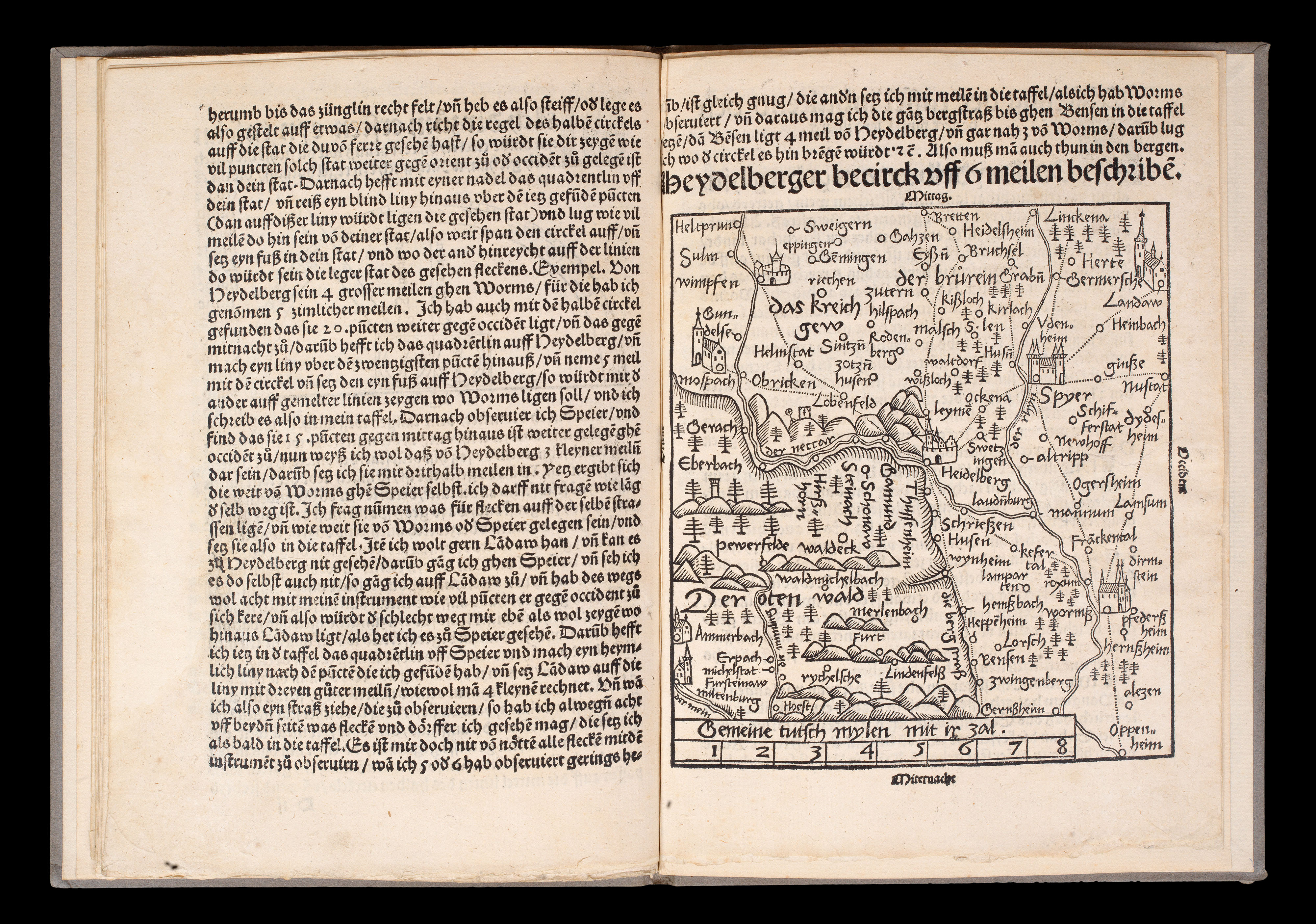 The seminal standardization of cartography
1 × £18,000
The seminal standardization of cartography
1 × £18,000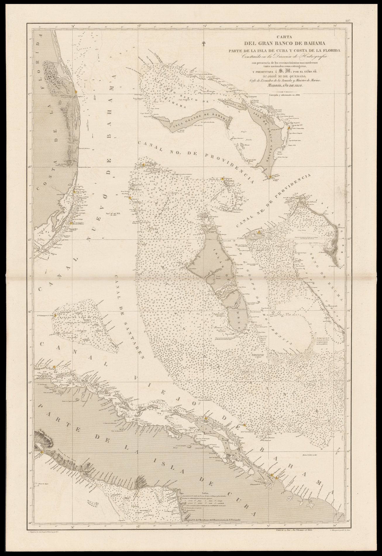 A chart of the Bahamas
1 × £4,000
A chart of the Bahamas
1 × £4,000![Աստուածատուր Վ. Աւագեան [AVAKIAN, Astvatsatur V.]. Ատլաս կամ աշխարհացոյց տախտակք Ի պէտս ազգային դպրոցաց [Atlas or World Map for the National Schools].](https://omega.crouchrarebooks.com/wp-content/uploads/2025/03/20717_1H.jpg) The most important nineteenth-century Armenian atlas
1 × £15,000
The most important nineteenth-century Armenian atlas
1 × £15,000


![QARAJADAGHI, Ashraf Ali [Iran].](https://omega.crouchrarebooks.com/wp-content/uploads/2025/03/2873_1H.jpg)