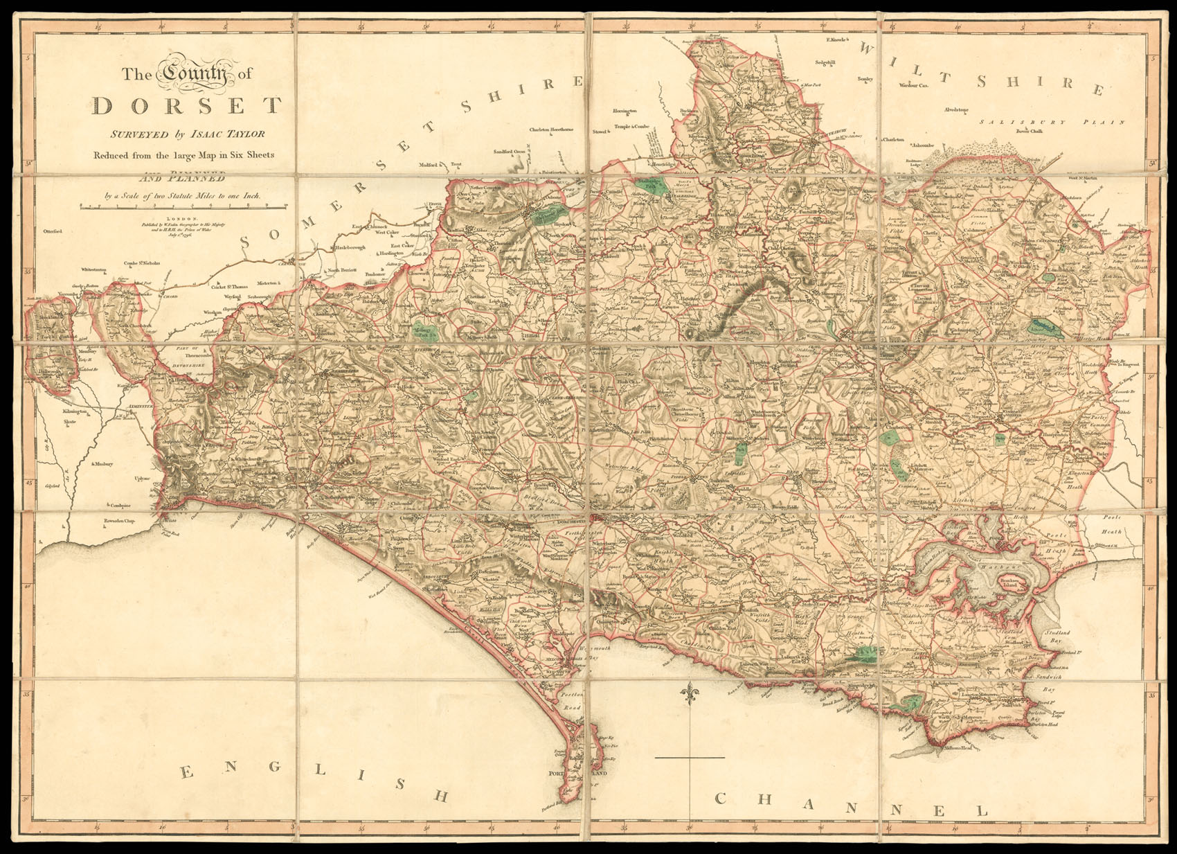
The map shows towns, villages, farms, gentleman's seats, churches, woodland, parks, parish boundaries, rivers, roads, distances between towns; relief is shown by hachures.
Though lacking the clarity of of some of the other large-scale surveys, Taylor's Dorset was ackowledged as a fine piece of work, and was the first to be submitted for the prestigious Society of Arts Award, just ahead of the Donn's Devon. However, due to the slight inaccuracy of its place names,...
The map shows towns, villages, farms, gentleman's seats, churches, woodland, parks, parish boundaries, rivers, roads, distances between towns; relief is shown by hachures.
Though lacking the clarity of of some of the other large-scale surveys, Taylor's Dorset was ackowledged as a fine piece of work, and was the first to be submitted for the prestigious Society of Arts Award, just ahead of the Donn's Devon. However, due to the slight inaccuracy of its place names, Taylor failed to win the prize for the first person to accurately map an English county on a scale of 1 inch to 1 mile. The £100 prize would instead be awarded to Donn and his map of Devon.
Isaac Taylor was born in Worcester in 1730 and earned an early reputation as a surveyor of both county maps and city plans. This style was easily recognisable and gave particular emphasis to the hills on his county maps; Herefordshire 1754, Hamphire 1759, Dorset 1765, Worcestershire 1772, and Cloucestershire 1777. It is surprising that Taylor, like Rocque and Jefferys, was not successful in gaining the approval of the Society of Arts who appeared to favour the amateur surveyors rather than the professional map-makers. Nearly all the awards went to appliacants who produced just one or two maps rather than men loike Taylor or Jefferys who between them published fifteen fine large-scale maps, accurately surveyed and well engraved and in some instances more competant than most of those that were recognised by the Society.