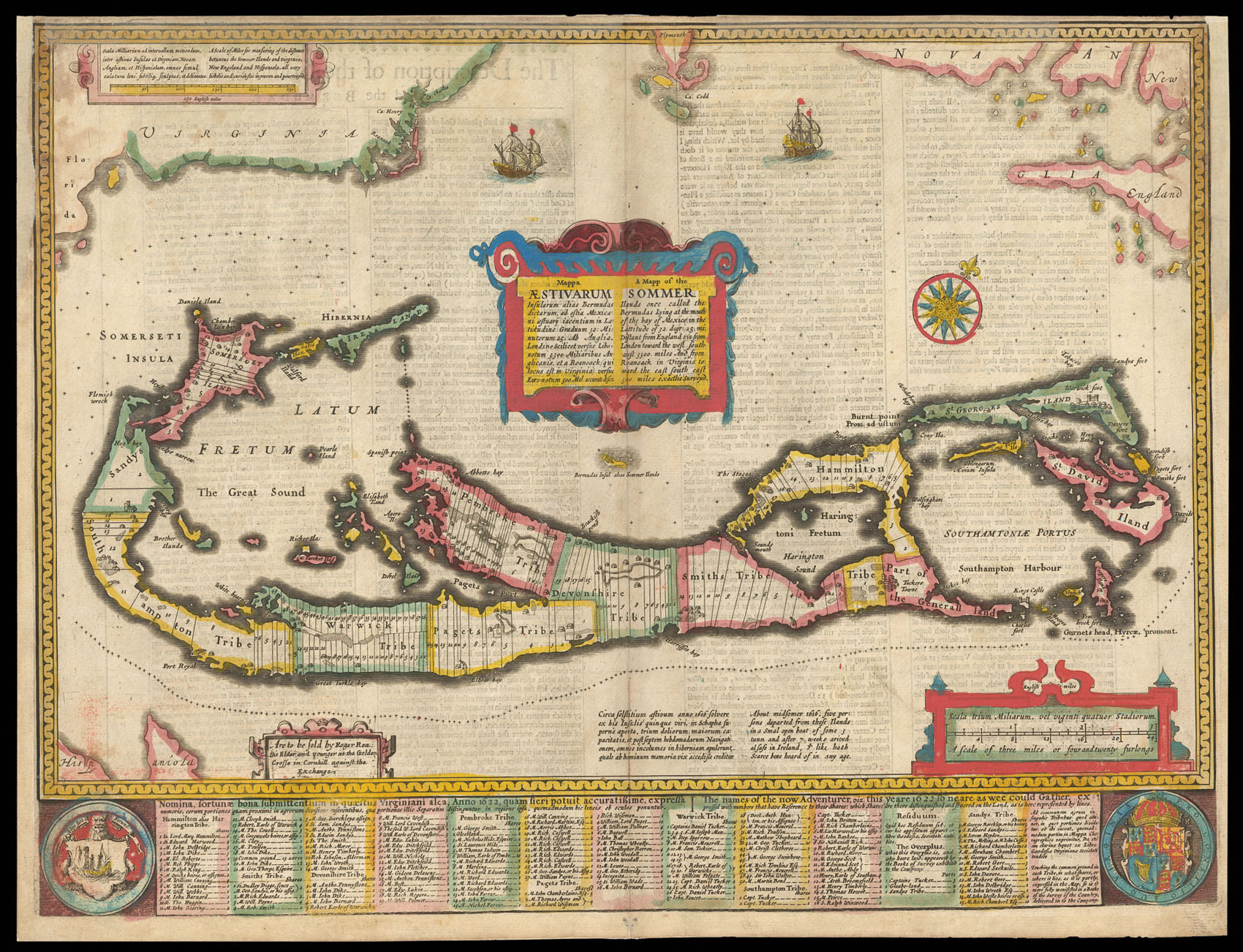
A Mapp of the Sommer Ilands once called the Bermudas
Lying at the mout of the bay of Mexico in the Lattitude of 32 degr: 25 mi: Distant from England viz from London toward the west southwest 3300 miles And from Roanoack in Virginia toward the east south east 500 miles exactlie surveyed.
The map bears the imprint of Roger Rea the Elder and Younger. The Reas had purchased the rights to Speed's work from William Garrett in 1659, who had previously purchased them from the widow of William Humble in the same year. Skelton suggests that the father and son intended a new edition of the atlas for the Restoration of 1660. However, the atlas would appear not to have been published until 1665. This is borne out by an advertisement in the Term Catalogue by the subsequ...
The map bears the imprint of Roger Rea the Elder and Younger. The Reas had purchased the rights to Speed's work from William Garrett in 1659, who had previously purchased them from the widow of William Humble in the same year. Skelton suggests that the father and son intended a new edition of the atlas for the Restoration of 1660. However, the atlas would appear not to have been published until 1665. This is borne out by an advertisement in the Term Catalogue by the subsequent owners of the plates, Thomas Bassett and Richard Chiswell, in 1675:
"Mr John Speed's... Geography of the Kingdoms of England, Scotland, and Ireland... together with his Prospect... all in one entire Volume, hath been, for seven Years past, out of Print, the greatest part of an Impression, then newly Printed, being destroyed by the late dreadful Fire, 1666". This is borne out by the rarity of the Rea edition of the atlas. There is evidence that they planned an edition of 1666, as there are impressions of Sussex, Buckingham and Derby, with Rea's imprint, which bear that date. Rea would later sell the plates to Bassett and Chiswell, who would publish a new edition in 1676.