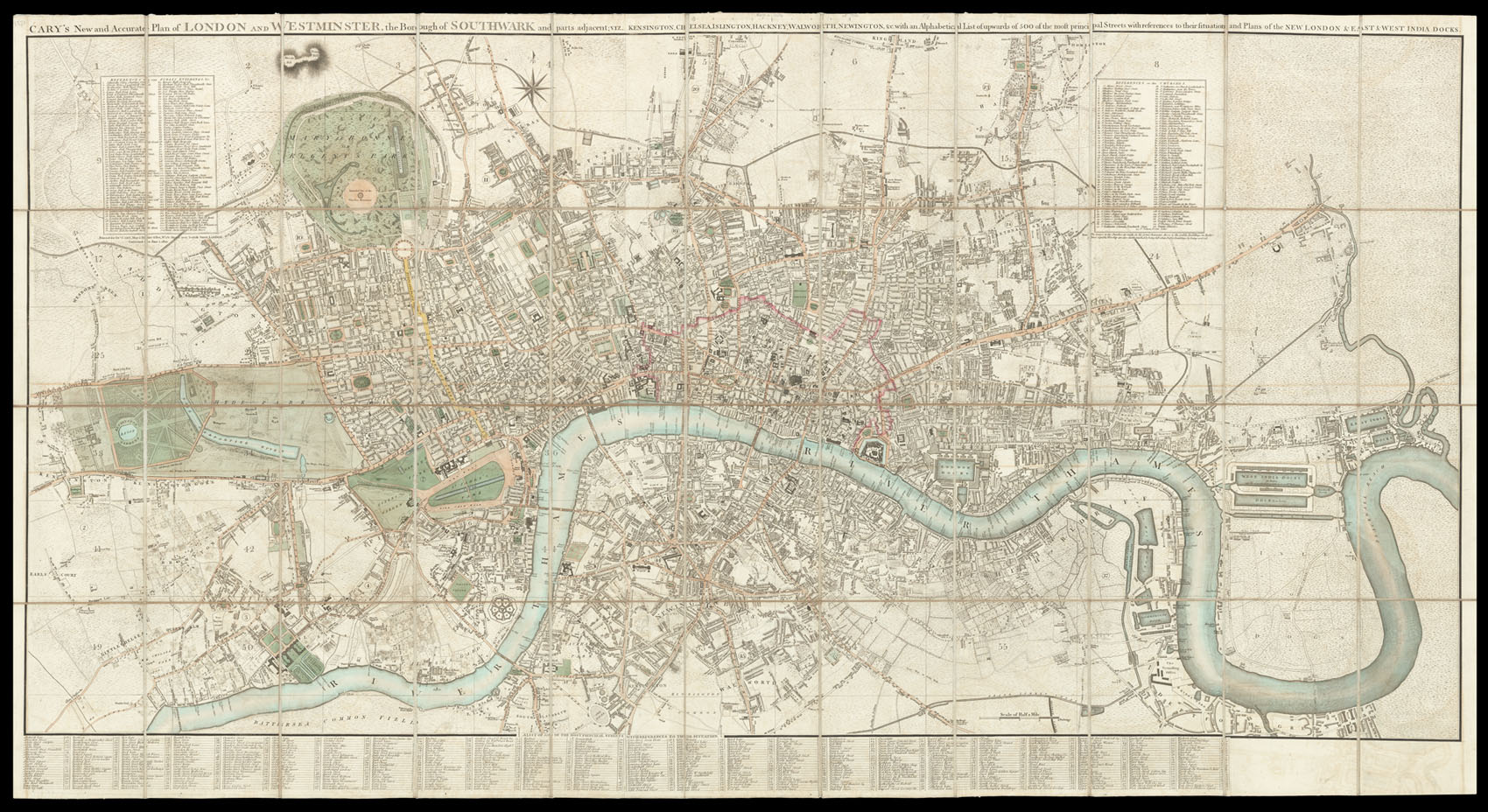
Cary's New and Accurate Plan of London and Westminster
the Borough of Southwark and parts adjacent; viz. Kensington, Chelsea Islington, Hackney, Walworth, Newington, &c. on a Scale of Six inches and a half to a Mile; with the Alphabetical list of upwards of 500 of the most considerable Streets, with the reference to the Situation and Plans of the New London & East & West India Docks.
printed for Jn. Cary, Engraver, and Map-seller No 181 near Norfolk Street, Strand,
Corrected to June 1st, 1820.
Large folding engraved map, hand-coloured in outline, dissected and mounted on linen, folding into original green marbled paper slipcase, with publisher's label.
A fine example of Cary's map showing London at the end of the Regency Period. The map was extended in 1811 to accommodate the development of the docks on the Isle of Dogs, and Howgego makes particular note of the map:
"The best of the London maps published by the firm was the 'New and Accurate Plan' to a scale of 6 1/2 inches to the mile. First published in 1787, of which at least twenty editions were issued between then and 1825. Unlike many other map-makers Ca...
A fine example of Cary's map showing London at the end of the Regency Period. The map was extended in 1811 to accommodate the development of the docks on the Isle of Dogs, and Howgego makes particular note of the map:
"The best of the London maps published by the firm was the 'New and Accurate Plan' to a scale of 6 1/2 inches to the mile. First published in 1787, of which at least twenty editions were issued between then and 1825. Unlike many other map-makers Cary was at considerable pains to bring each edition up to date" (Howgego p.21)