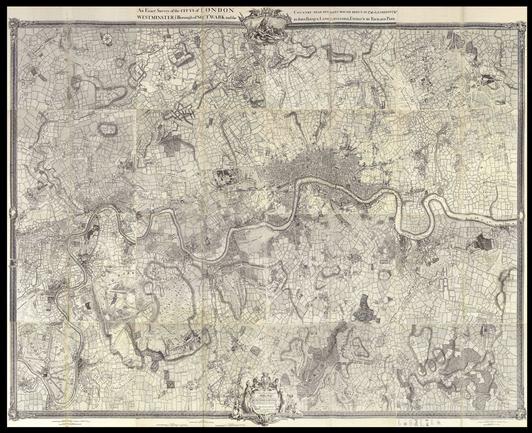
An exact Survey of the Cities of London and Westminster,
the Borough of Southwark, The Country near ten Miles round; begun in 1741, finished in 1745, and publish'd in 1746, according to Act of Parliament, By John Rocque Land-Surveyor: Engrav'd by Richard Parr, and Printed by W. Pratt.
sold by the Proprietor John Rocque, next th Duke of Gaston's Head, in Hyde-Park Road, the Bottom of Picadilly, and at the Print Shops in London and Westminster,
[1746].
Large engraved wall map on 16 sheets, joined, and mounted on linen.
One of the finest maps of - what is now - Greater London ever produced. It would appear that John Rocque, a French Huguenot, emigrated with the rest of his family to London in the 1730s, where he began to ply his trade as a surveyor of gentleman's estates, and with plans of Kensington Gardens, and Hampton Court. However, in 1737 he applied his surveying skills to a much greater task, that of surveying the entire built-up area of London, the survey that would make his name. ...
One of the finest maps of - what is now - Greater London ever produced. It would appear that John Rocque, a French Huguenot, emigrated with the rest of his family to London in the 1730s, where he began to ply his trade as a surveyor of gentleman's estates, and with plans of Kensington Gardens, and Hampton Court. However, in 1737 he applied his surveying skills to a much greater task, that of surveying the entire built-up area of London, the survey that would make his name. Begun in March of 1737, the map would take nine years to produce, eventually being engraved upon 24 sheets of copper and published in 1746. Whilst engaged upon this project Rocque was also working on the present map of the "Country ten miles round London", on a scale of 5 1/2 inches to the mile, or one quarter of the scale of the large survey. The completed map was published in 1746.