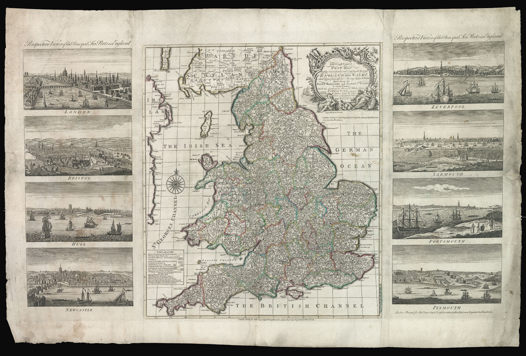
A New and Correct Post Map of the Great Roads and Cross Roads through England and Wales.
Laid down from all the surveys hitherto made. Describing the Citys Boroughs, and Market Towns in each County. With the distance in Measur'd Miles from Town to Town. Likewise the distance of all the citys, county towns, and great towns from London.
Printed for Robt. Sayer, Map & Print seller at the Golden Buck near Serjeants Inn, Fleet Street,
[c1760].
Engraved map, fine original outline hand colour, 'Perspective Views of the Principal Seaports in England' consisting of Liverpool, Yarmouth, Portsmouth, Plymouth, London, Bristol, Hull and Newcastle, pasted to left right margins, some light soiling to views, and a few tears to margins skilfully repaired and not effecting image.
Robert Sayer's rare one sheet reduction of Adam's distance map of England and Wales, with views of England's principal sea ports.
The map is derived from, and a reduction of, John Adam's seminal distance map of 1677, one of the earliest economic maps. A key to the lower left of the plan provides information on: post roads marked with dotted lines, principal cross roads solid line; the names of cities are contained within a double ruled box together with their dis...
Robert Sayer's rare one sheet reduction of Adam's distance map of England and Wales, with views of England's principal sea ports.
The map is derived from, and a reduction of, John Adam's seminal distance map of 1677, one of the earliest economic maps. A key to the lower left of the plan provides information on: post roads marked with dotted lines, principal cross roads solid line; the names of cities are contained within a double ruled box together with their distance from London, county towns in a single line box together with distance from London, and market town are denoted by an oval. To either side of the map are eight views of the principal ports of England, from left: London, Bristol, Hull, Newcastle; right, Liverpool, Yarmouth, Portsmouth, and Plymouth.
Rare Copac records only two institutional exmaples: The British Library; and the University of Cambridge Library. OCLC records a further dissected example at Harvard but without the views of the ports.