This map of South Africa is distinguished from Stanford's standard map of the region by the bold pink colour in which the British South Africa Company's territories are highlighted. Presented as part of its fourth annual report in 1894, this map displays the vast swathes of land controlled by the company. The small inset map of England in the lower left corner offers some perspective on the extent of colonial expansion in Africa. The British South Africa Company had been es...
This map of South Africa is distinguished from Stanford's standard map of the region by the bold pink colour in which the British South Africa Company's territories are highlighted. Presented as part of its fourth annual report in 1894, this map displays the vast swathes of land controlled by the company. The small inset map of England in the lower left corner offers some perspective on the extent of colonial expansion in Africa. The British South Africa Company had been established by Cecil Rhodes in 1889 to exploit the expected mineral wealth of Africa, hoping to benefit from the miles of goldfields that were reported to lying untapped in Mashonaland. When the anticipated gold failed to materialise, the company found itself in financial difficulties, and many of their enterprises, such as railway expansion, slowly ground to a halt. Nonetheless, the company remained in charge of Rhodesia, as the region was named in 1895, until 1924, when administrative power and control of the land was given over to colonial Governors.
This map records information about the politics, industry and geography of the company's territories. For instance, the land boundaries agreed upon between the British governors and native chiefs are distinguished by colour. A key beneath the title shows that the network of solid and dotted lines that span the map correspond to the communications systems that expanded throughout southern Africa under colonial control, namely the railway network and the telegraph grid, both operational and under construction. Rivers and roads are also represented, and the relief of the land is shown by hachures. An arrow bisecting the northern border points towards Cairo, alluding to Rhode's dream of British expansion 'from Cape to Cairo'.
This was published at Stanford's Geographical Establishment in London, founded and run by Edward Stanford. At this point in time, Stanford had already become the sole agent for Ordnance Survey Maps in England and Wales, and had received his royal warrant as Cartographer to the Queen. As well as the Ordnance Survey, he was an agent for the Admiralty, the Geological Survey, the India Office and the Society for the Diffusion of Useful Knowledge. Stanford continued to produce maps for the British South Africa Company, which gradually became larger and more detailed surveys of the company's territories. This particular map is rare: although there are six institutional examples of Stanford's standard map of British South Africa on which this is based, we have been unable to trace another copy of this specific example, with its focus on the company's affairs.
bibliography:
bibliography:
Blake, 'A History of Rhodesia', (New York: Knopf., 1977); The British South Africa Company, 'The Story of Rhodesia told in a series of historical pictures' (BSAC, 1936); Galbraith, 'Crown and Charter: The early Years of the British South Africa Company' (1974); Morris, 'An Environmental History of Southern Malawi: Land and People of the Shire Highlands', (Springer, 2016).
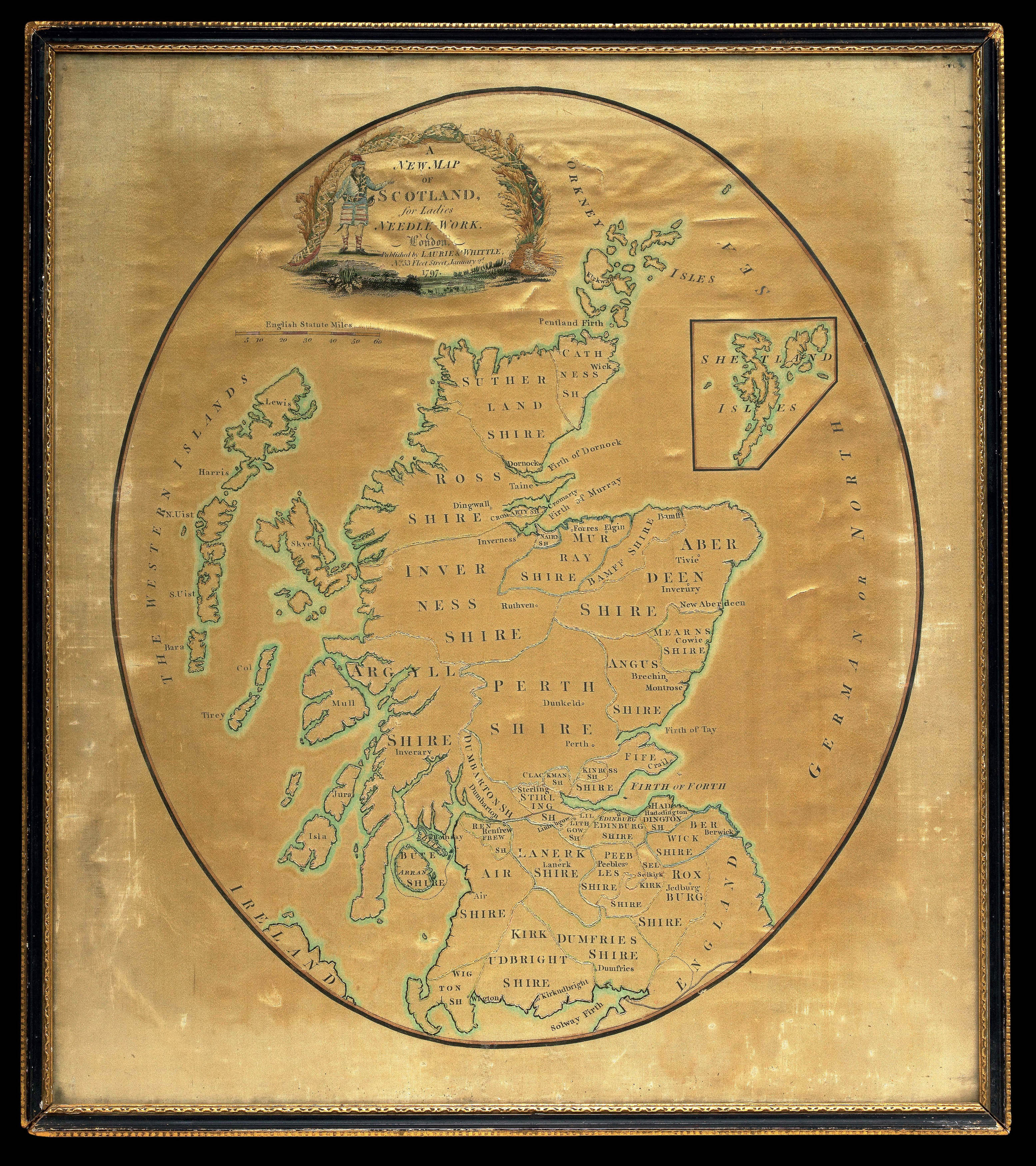 Needlework map of Scotland
1 × £750
Needlework map of Scotland
1 × £750![HAVELL, D[aniel] after HASELER, H[enry] A View of London, from near the Adelphi.](https://omega.crouchrarebooks.com/wp-content/uploads/2025/03/12329_1H.jpg) Waterloo sunset
1 × £2,000
Waterloo sunset
1 × £2,000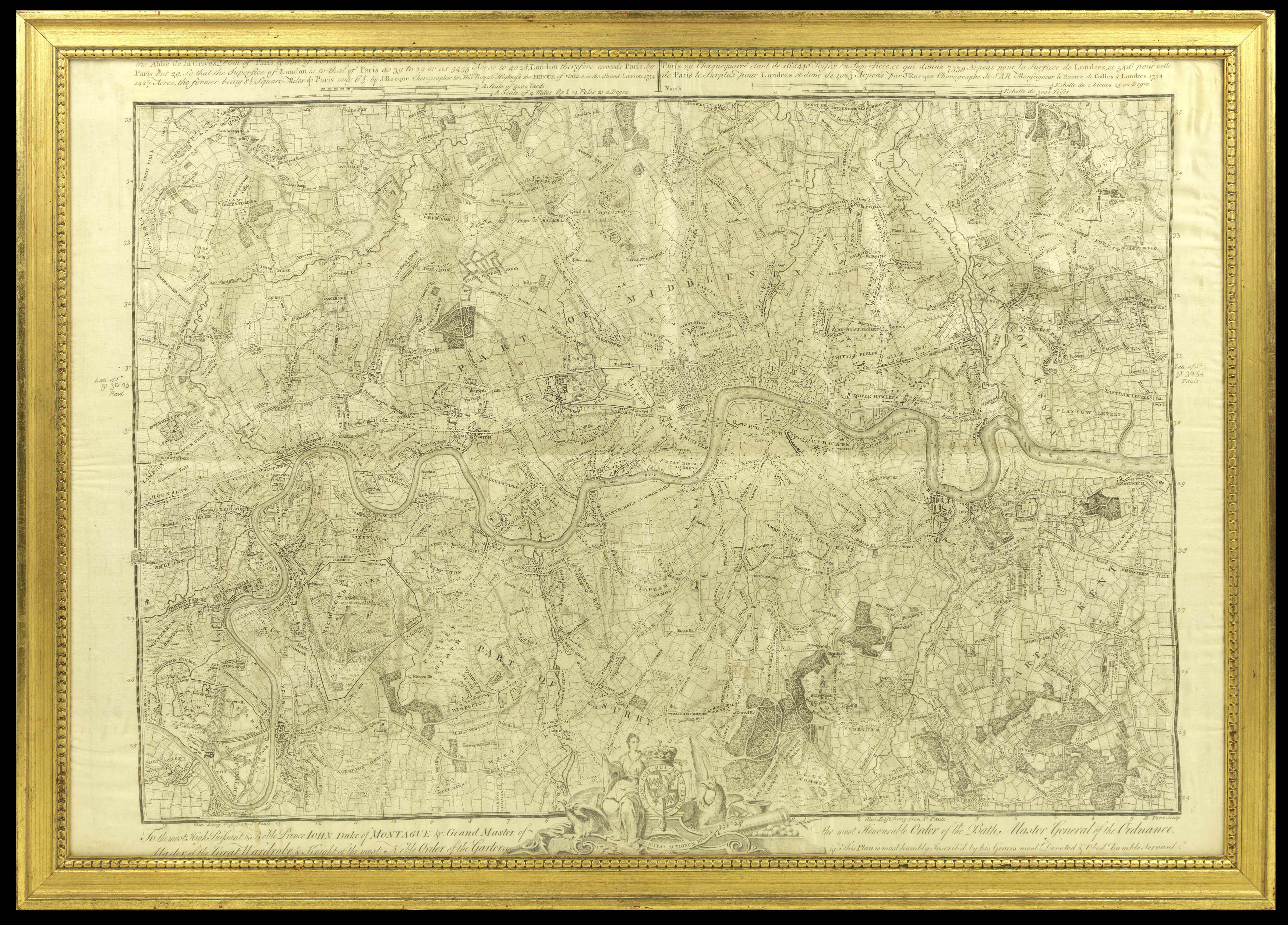 Printed on silk
1 × £6,000
Printed on silk
1 × £6,000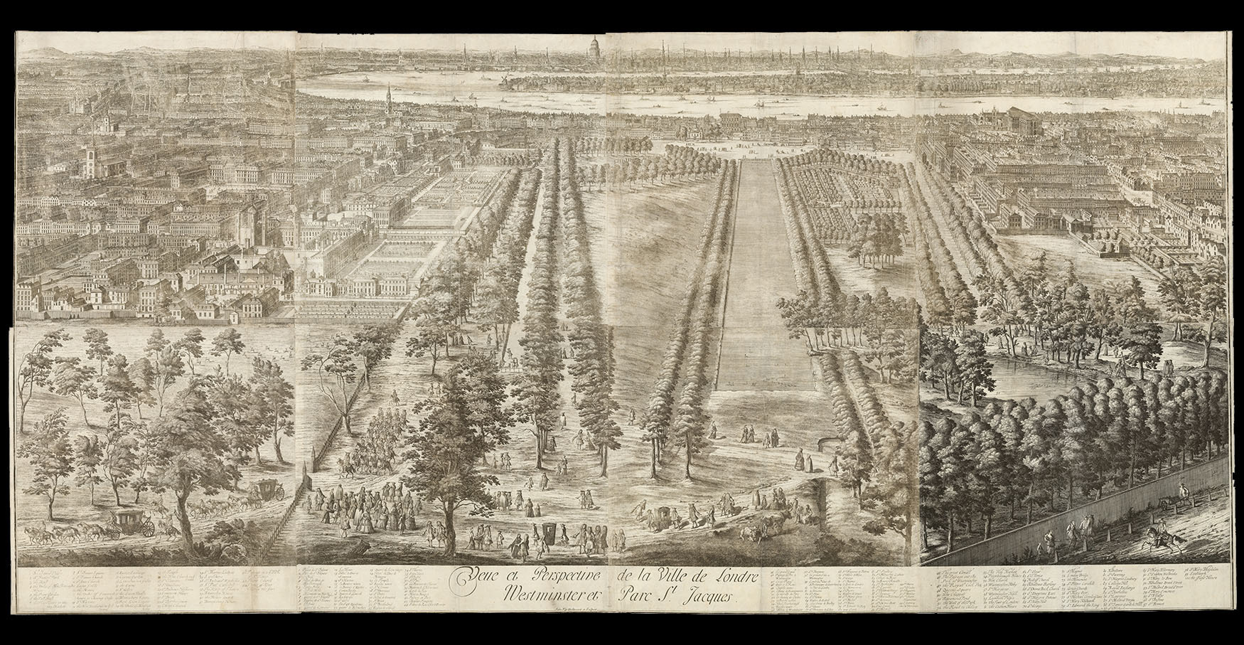 "The largest view of London ever to be published"
1 × £75,000
"The largest view of London ever to be published"
1 × £75,000 London Bridge
1 × £2,000
London Bridge
1 × £2,000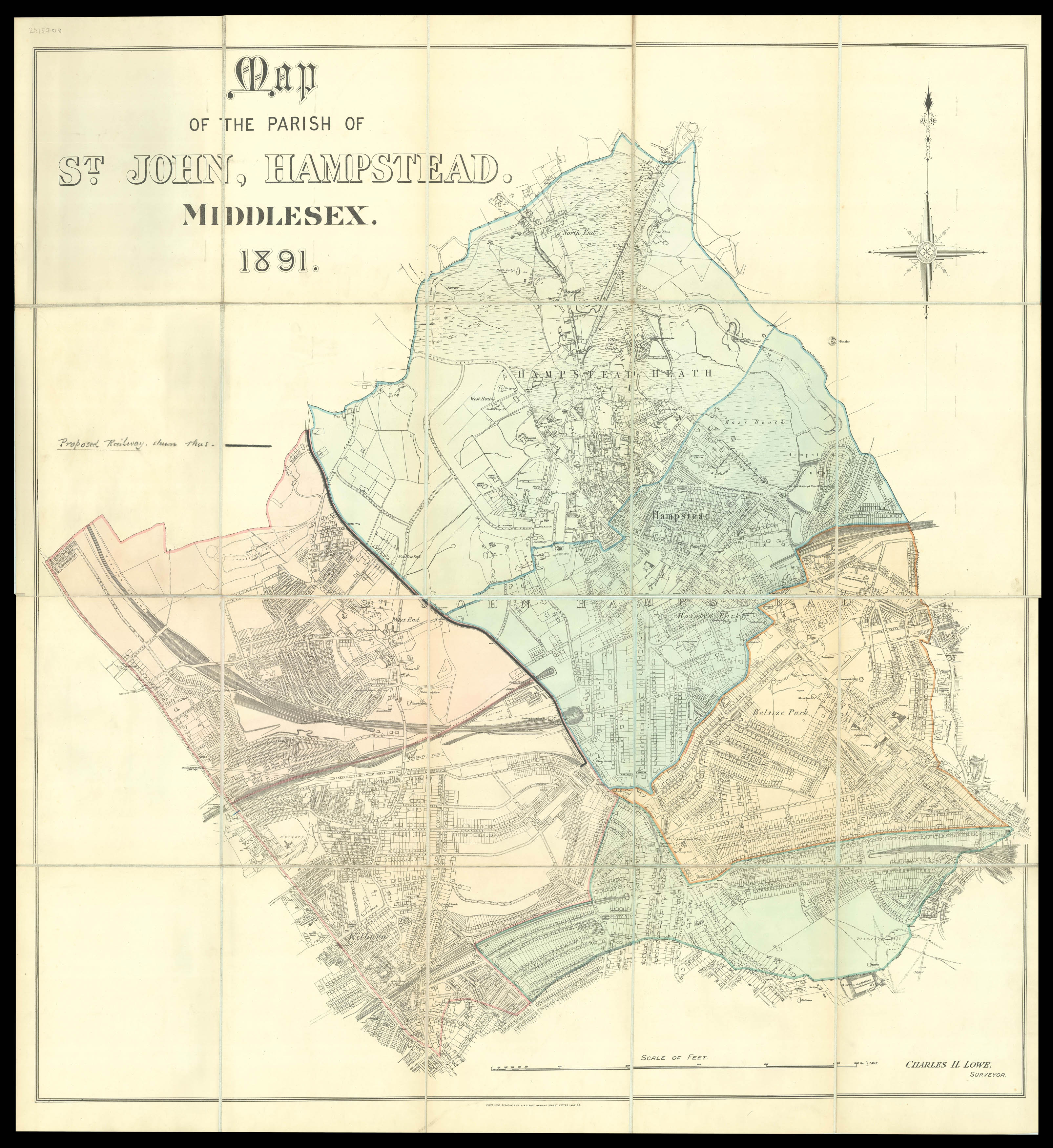 Hampstead
1 × £3,600
Hampstead
1 × £3,600 Superb facsimile of the Vatican's Ptolemy Cosmographia of 1472
1 × £6,000
Superb facsimile of the Vatican's Ptolemy Cosmographia of 1472
1 × £6,000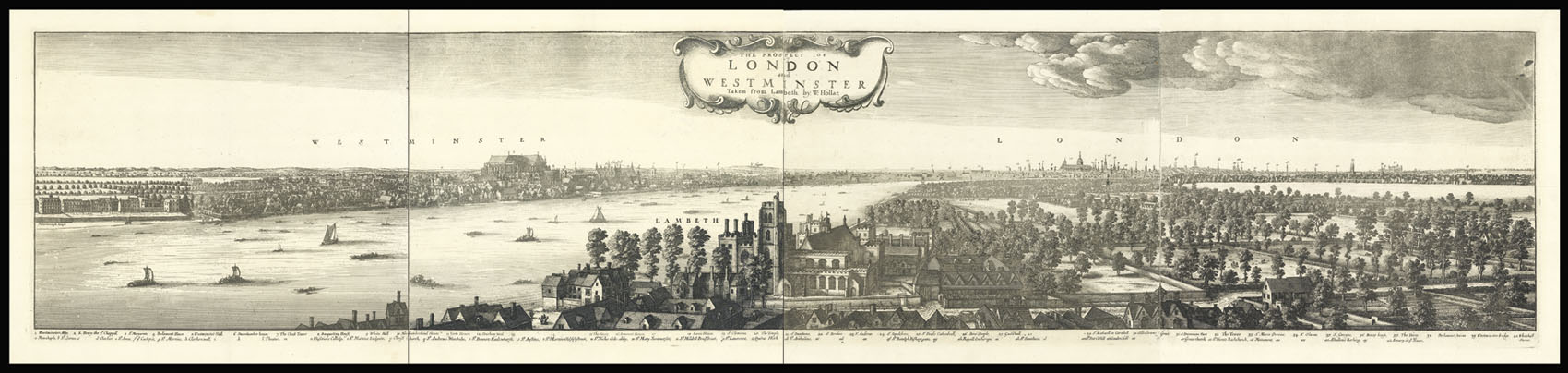 London after the fire
1 × £5,000
London after the fire
1 × £5,000 "Amidst the Arts which on the Thames appear...Printing claims prior place"
1 × £450
"Amidst the Arts which on the Thames appear...Printing claims prior place"
1 × £450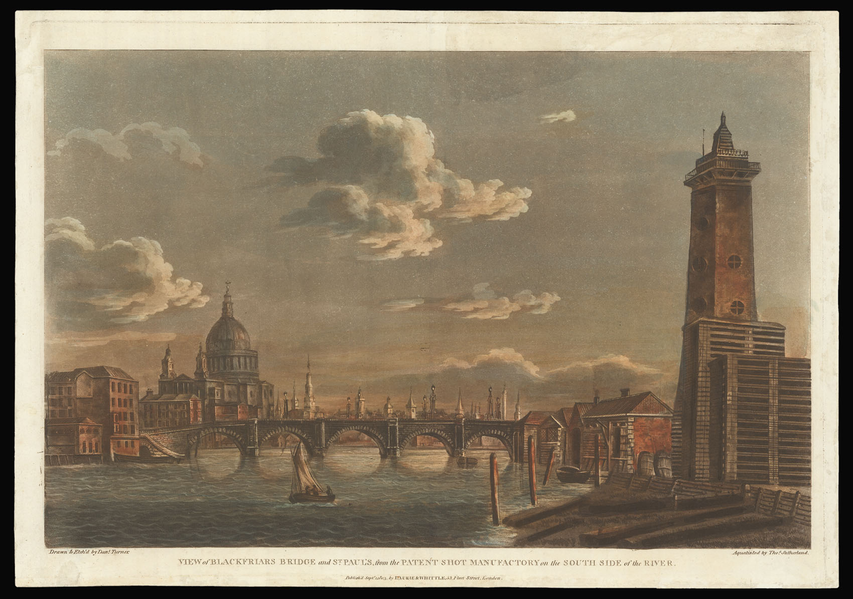 Blackfriars Bridge and St Pauls
1 × £500
Blackfriars Bridge and St Pauls
1 × £500![PARR, [Natheniel] after MAURER, J[ohn] Leicester Square](https://omega.crouchrarebooks.com/wp-content/uploads/2025/03/12424_1H.jpg) Leicester Square
1 × £500
Leicester Square
1 × £500![SIMONAU, Gustave [Westminster Abbey].](https://omega.crouchrarebooks.com/wp-content/uploads/2025/03/12364_1H.jpg) Westminster Abbey
1 × £350
Westminster Abbey
1 × £350![PTOLEMAEUS, Claudius [translated by ANGELUS, Jacobus, edited by GERMANUS, Nicolaus] [North Africa, Sardinia and Sicily] Secunda Affrice Tabula.](https://omega.crouchrarebooks.com/wp-content/uploads/2025/03/18400_1H.jpg) A striking map of North Africa, Sardinia and Sicily from the 1482 Ulm Ptolemy
1 × £7,500
A striking map of North Africa, Sardinia and Sicily from the 1482 Ulm Ptolemy
1 × £7,500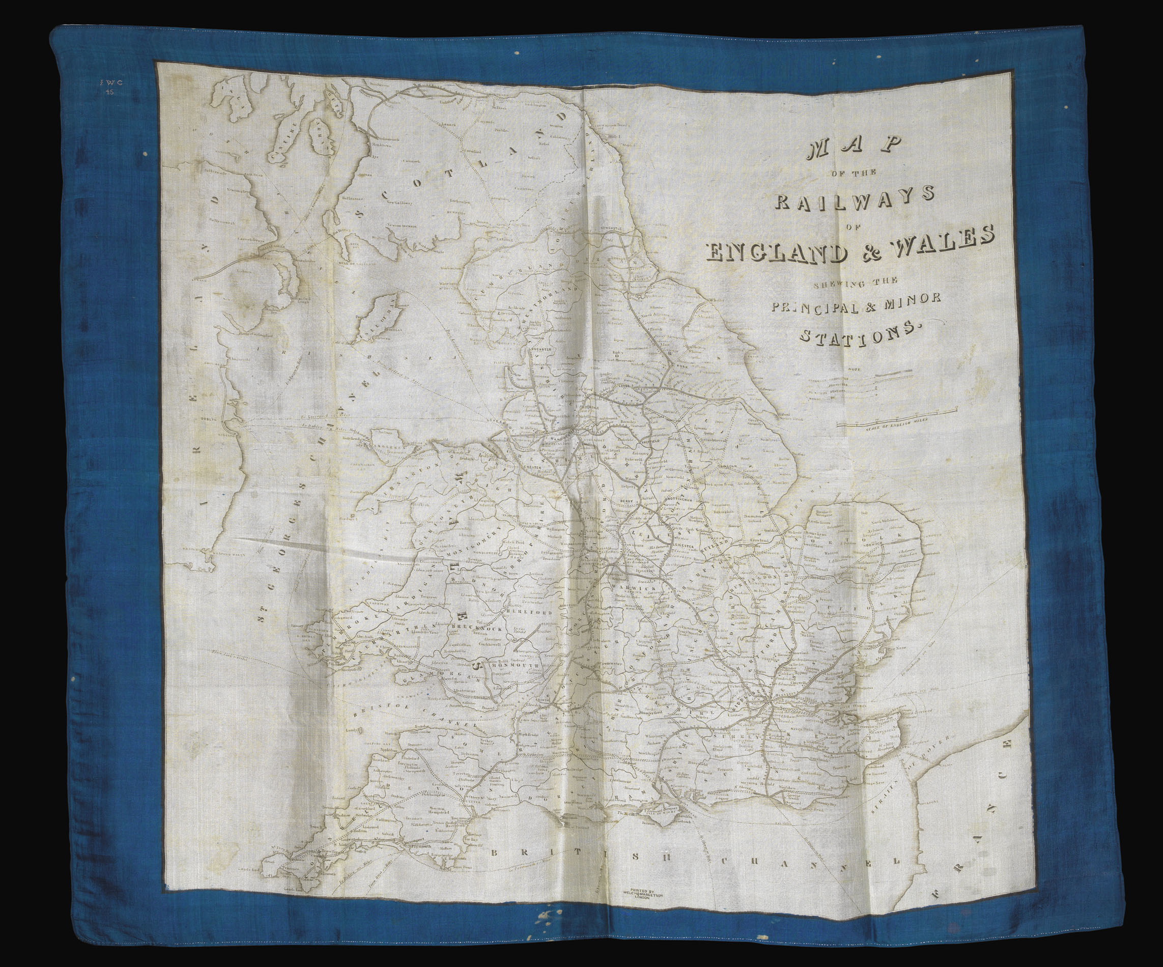 Rare railway map of England and Wales printed on silk
1 × £1,500
Rare railway map of England and Wales printed on silk
1 × £1,500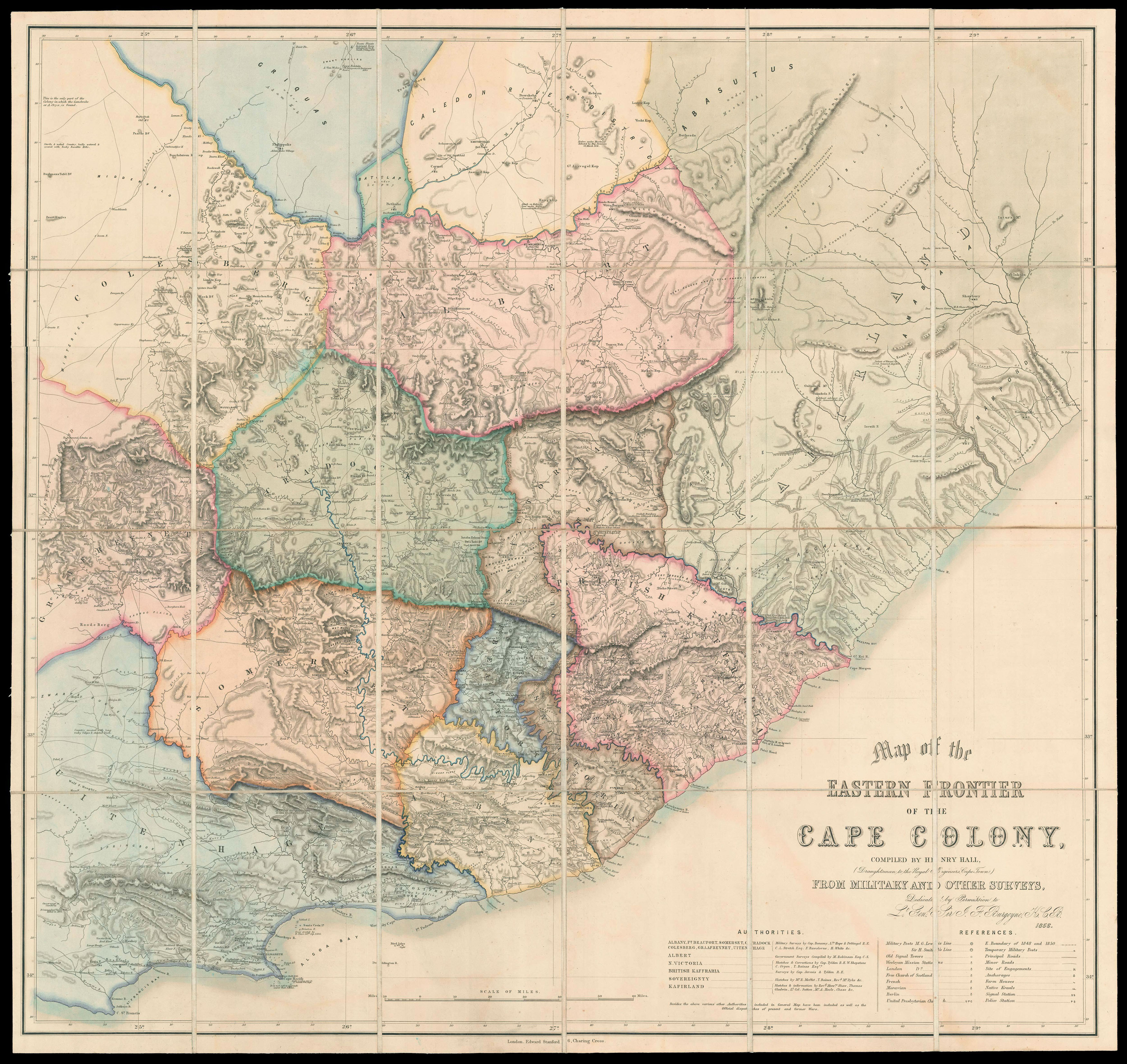 "Dr Livingstone, I presume?"
1 × £20,000
"Dr Livingstone, I presume?"
1 × £20,000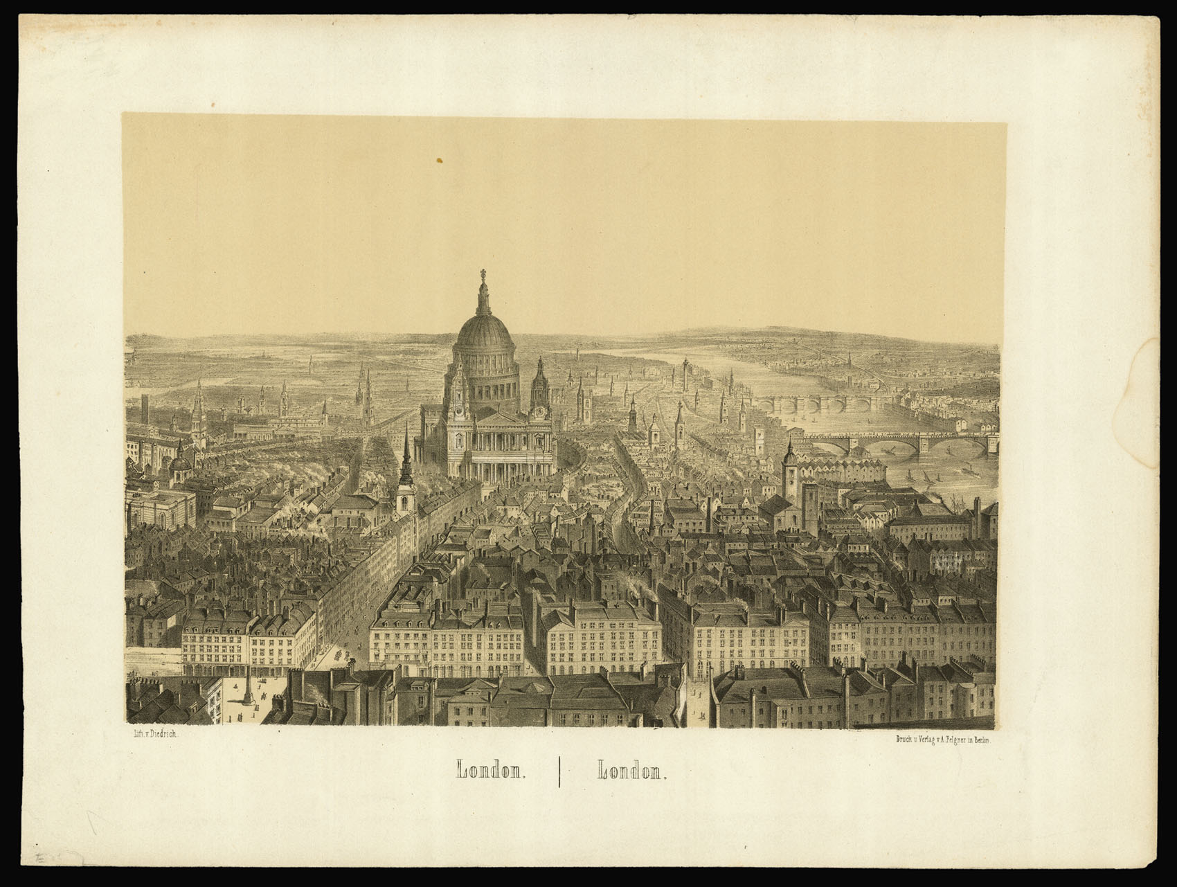 A London View
1 × £150
A London View
1 × £150 "Fine pasture country uninhabited and considered neutral ground"
1 × £1,200
"Fine pasture country uninhabited and considered neutral ground"
1 × £1,200![[LAYER, Christopher] [Seditious Souvenir Portrait from the Frost Fair of 1740].](https://omega.crouchrarebooks.com/wp-content/uploads/2025/03/18208_1H.jpg) Jacobite propaganda
1 × £1,750
Jacobite propaganda
1 × £1,750![HOLLAR, W[enceslaus] [Views of Tangiers]](https://omega.crouchrarebooks.com/wp-content/uploads/2025/03/18362_1H.jpg) Views of Tangiers
1 × £4,000
Views of Tangiers
1 × £4,000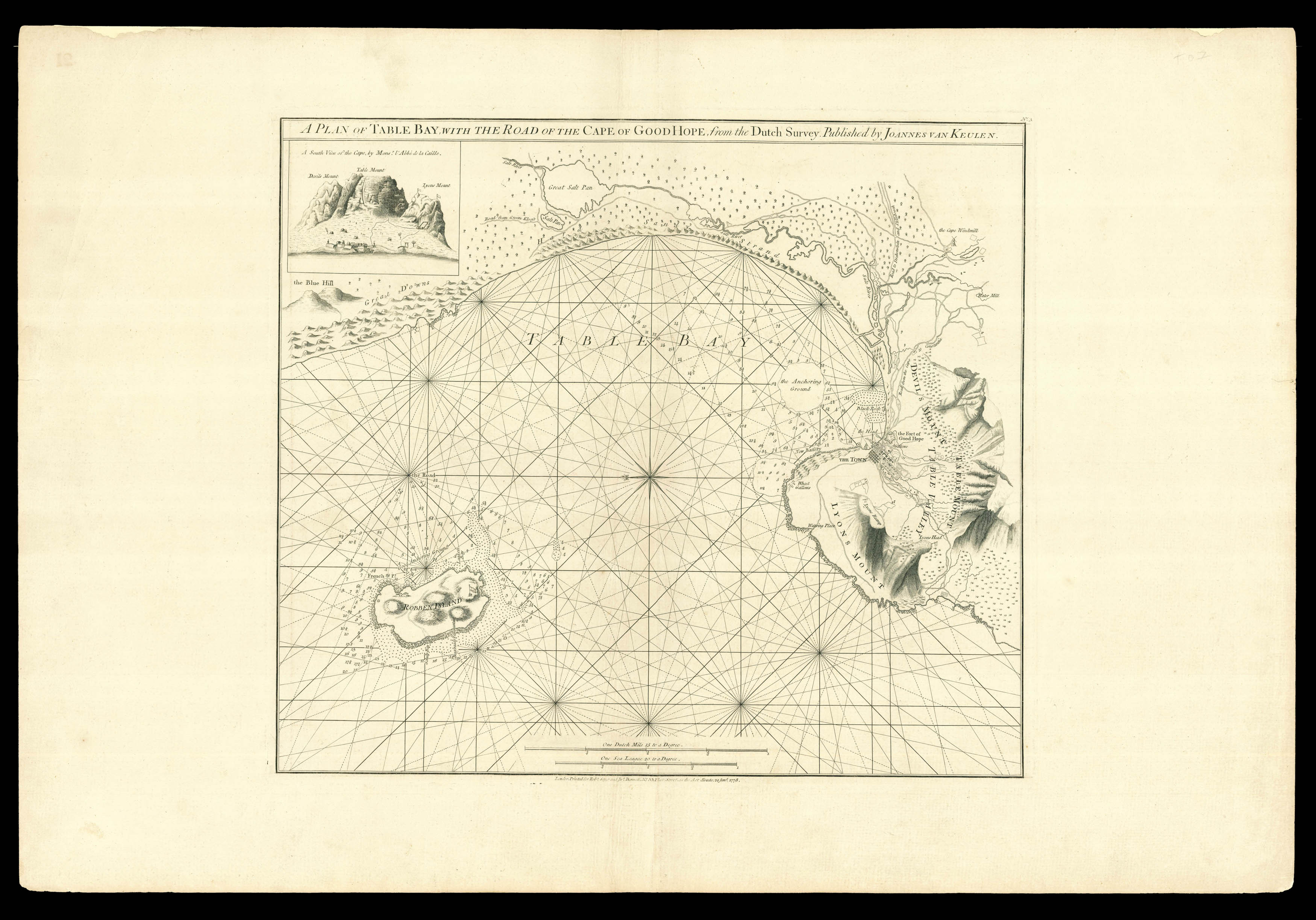 A rare sea chart of Cape Town
1 × £3,200
A rare sea chart of Cape Town
1 × £3,200![APPERT, Arnaud; [after] Nicolas Marie Joseph CHAPUY, as "Chapuis"; [and] Xavier GUESNU; [printed by] Alfred CHARDON. Aspect General de Londres](https://omega.crouchrarebooks.com/wp-content/uploads/2025/03/12481_1H.jpg) H.P. Source
1 × £3,500
H.P. Source
1 × £3,500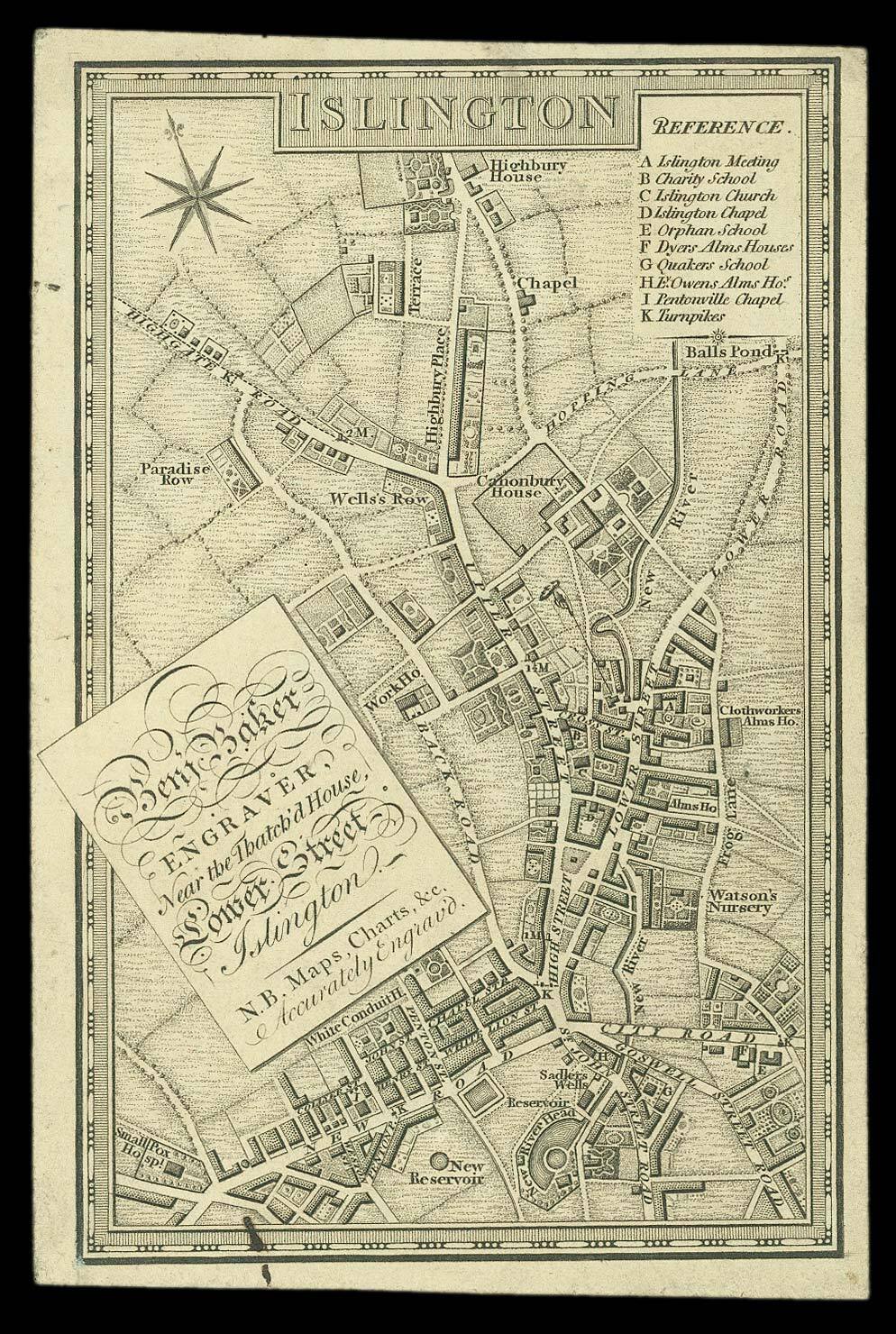 Trade card with a miniature map of Georgian Islington
1 × £2,000
Trade card with a miniature map of Georgian Islington
1 × £2,000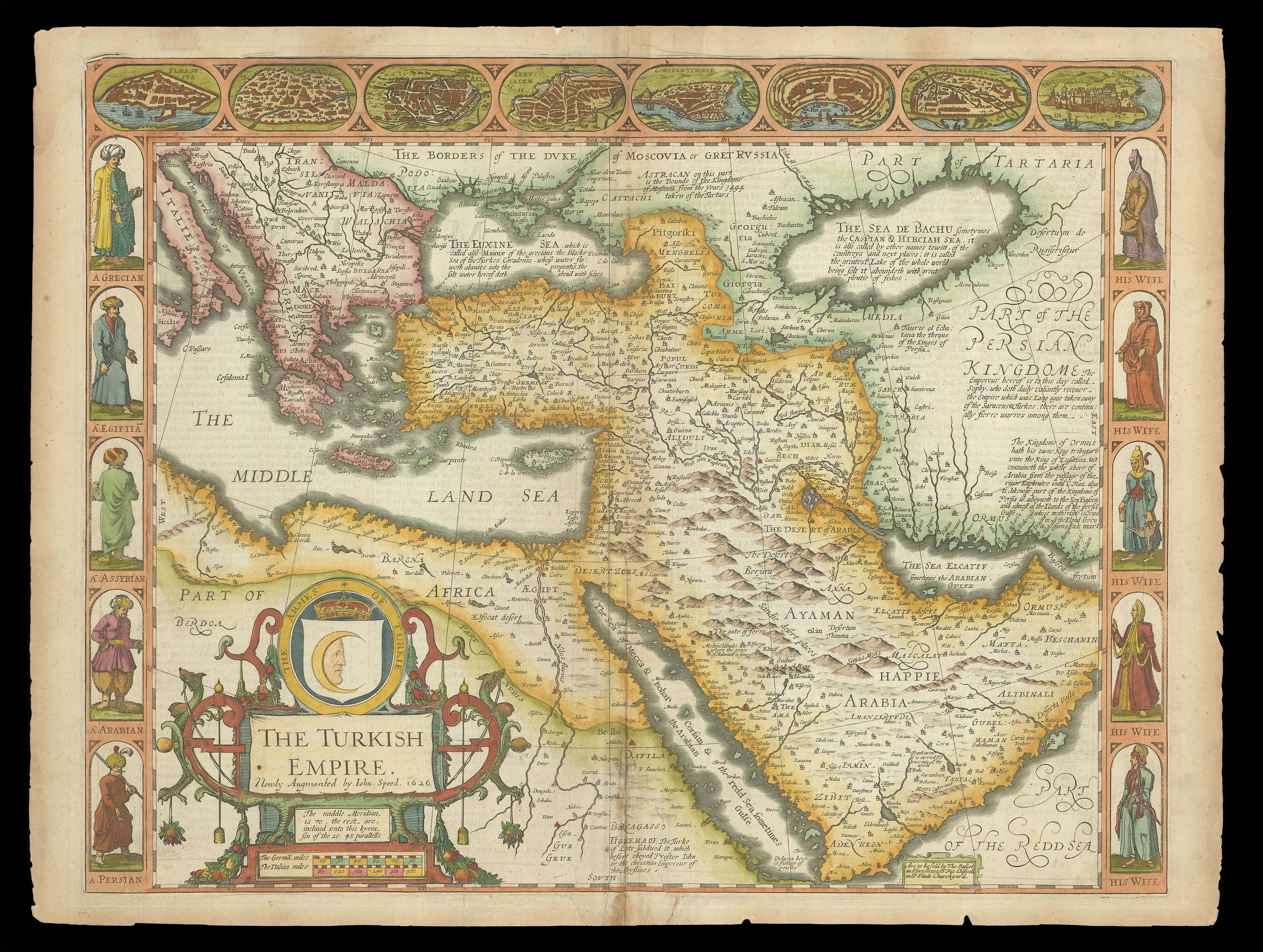 Speed's map of the Ottoman Empire
1 × £2,000
Speed's map of the Ottoman Empire
1 × £2,000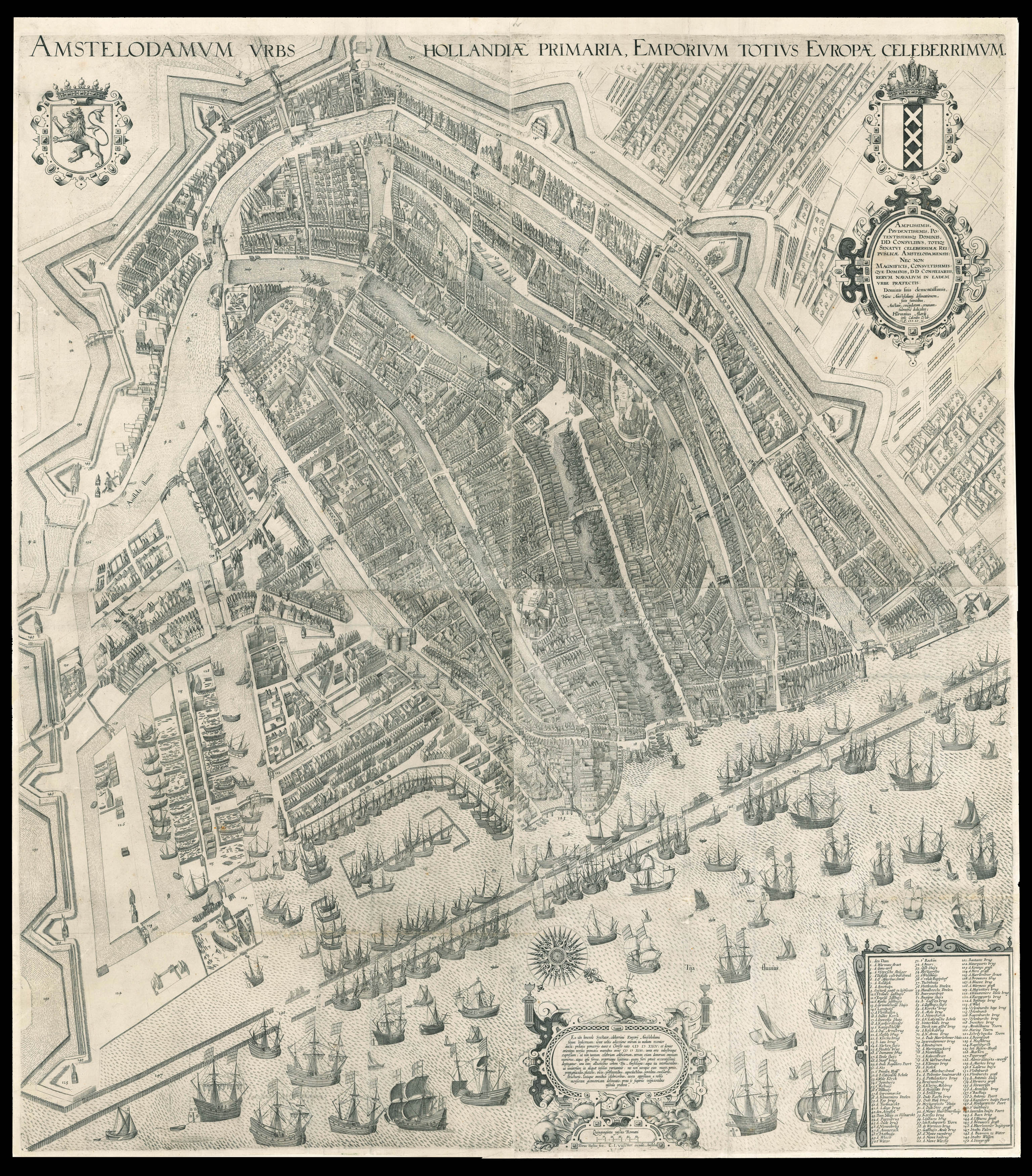 One of the most influential maps of Amsterdam
1 × £60,000
One of the most influential maps of Amsterdam
1 × £60,000![SLY, R. E[van] A Stiff old File from Waterloo.](https://omega.crouchrarebooks.com/wp-content/uploads/2025/03/20715_1H.jpg) A Rare Sly Moveable
1 × £4,000
A Rare Sly Moveable
1 × £4,000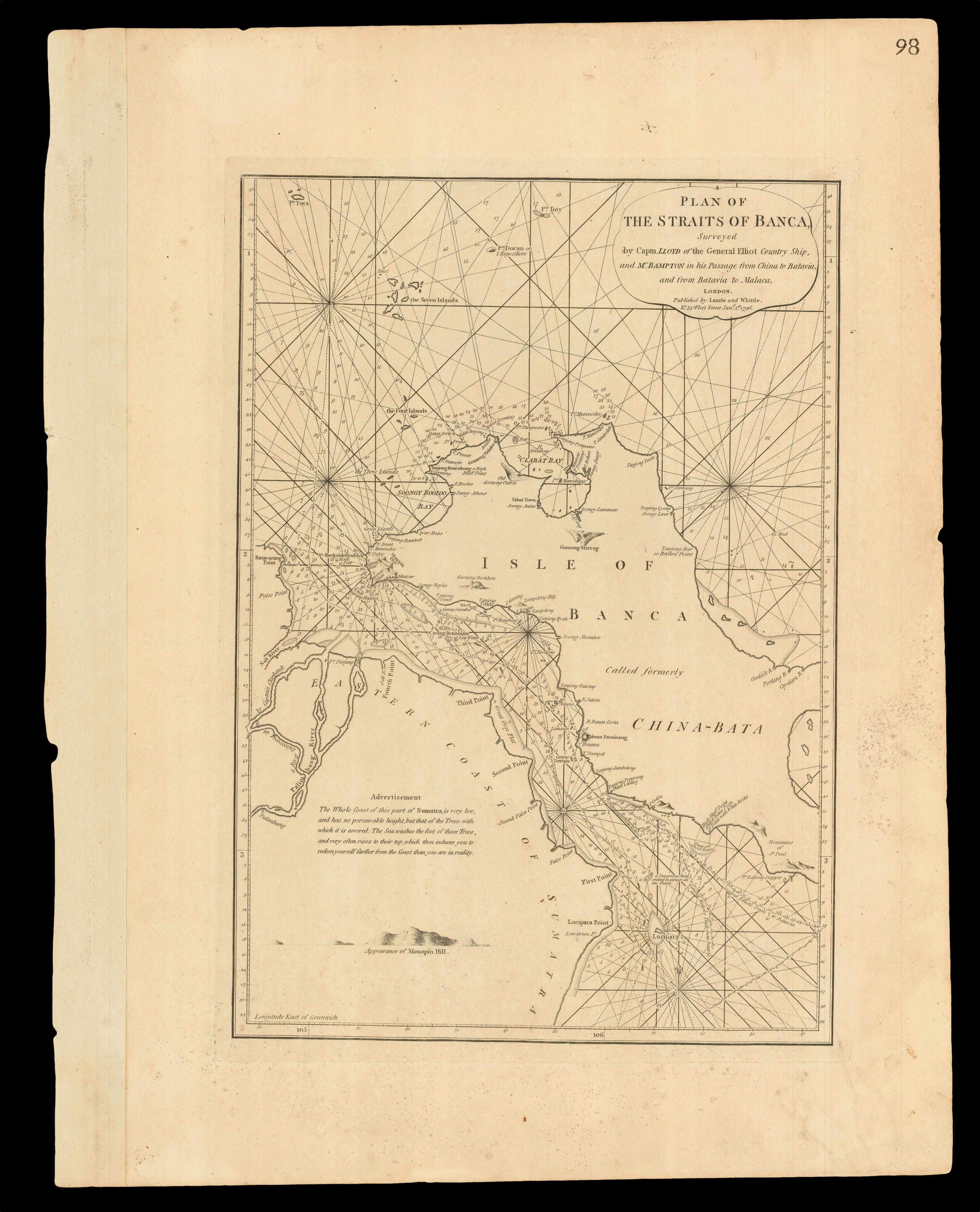 Navigating the Bangka Strait
1 × £550
Navigating the Bangka Strait
1 × £550![LUFFMAN, John A Map of the Western Pyrenees Mount[ai]ns](https://omega.crouchrarebooks.com/wp-content/uploads/2025/03/11348_1H.jpg) The final phase of the Peninsular War
1 × £1,200
The final phase of the Peninsular War
1 × £1,200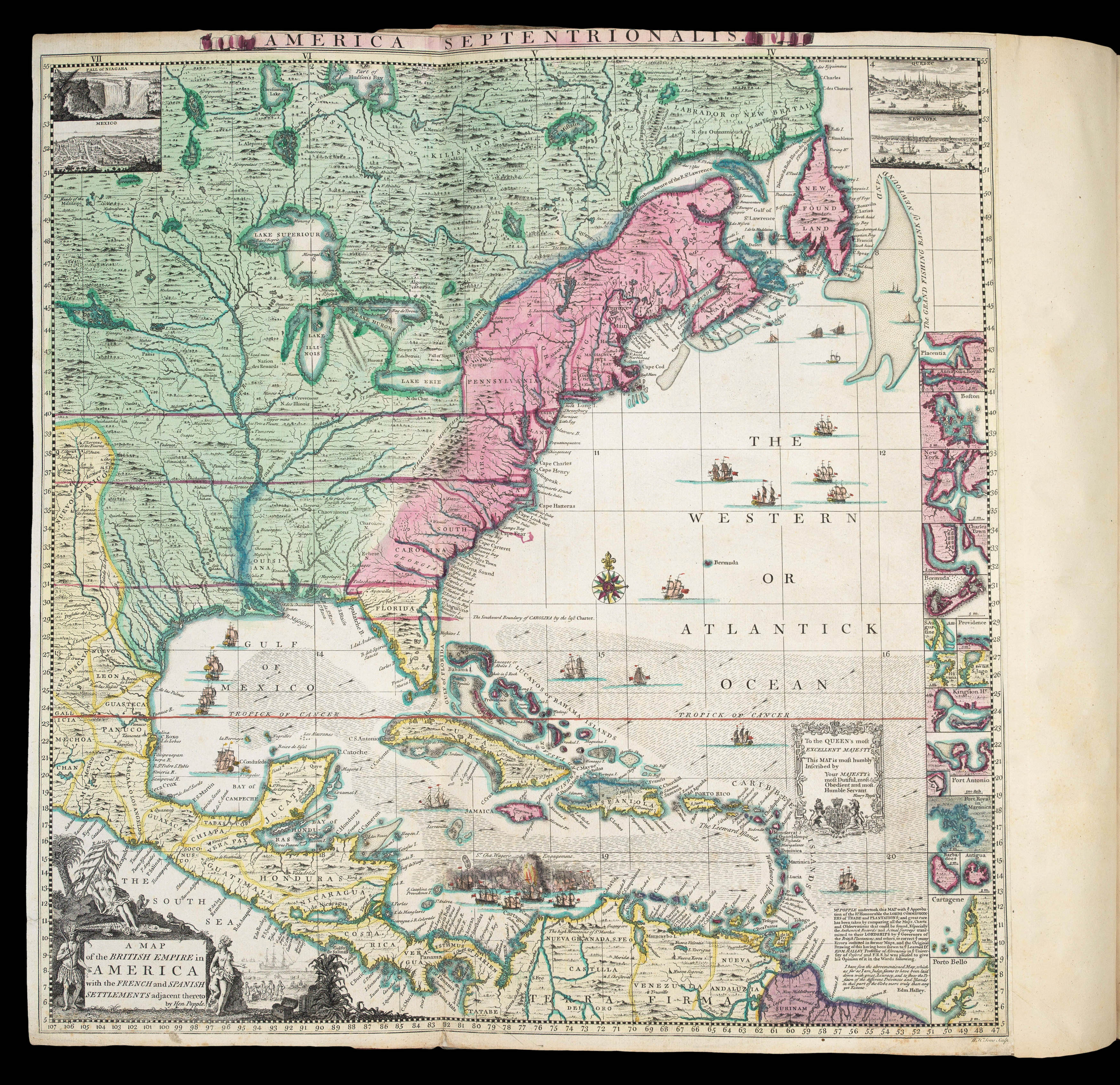 A profound statement of England's designs for dominance of the North American continent; at a time when colonial control of North America was by no means certain
1 × £180,000
A profound statement of England's designs for dominance of the North American continent; at a time when colonial control of North America was by no means certain
1 × £180,000![[Anonymous] L'Attaque et la Riposte](https://omega.crouchrarebooks.com/wp-content/uploads/2025/03/1735_1H.jpg) French Caricature cards of the Outbreak of the First World War
1 × £1,200
French Caricature cards of the Outbreak of the First World War
1 × £1,200


![STANFORD, [Edward] A map of South Africa to accompany the fourth annual report of the British South Africa Company 1894.](https://omega.crouchrarebooks.com/wp-content/uploads/2025/03/15455_1H.jpg)