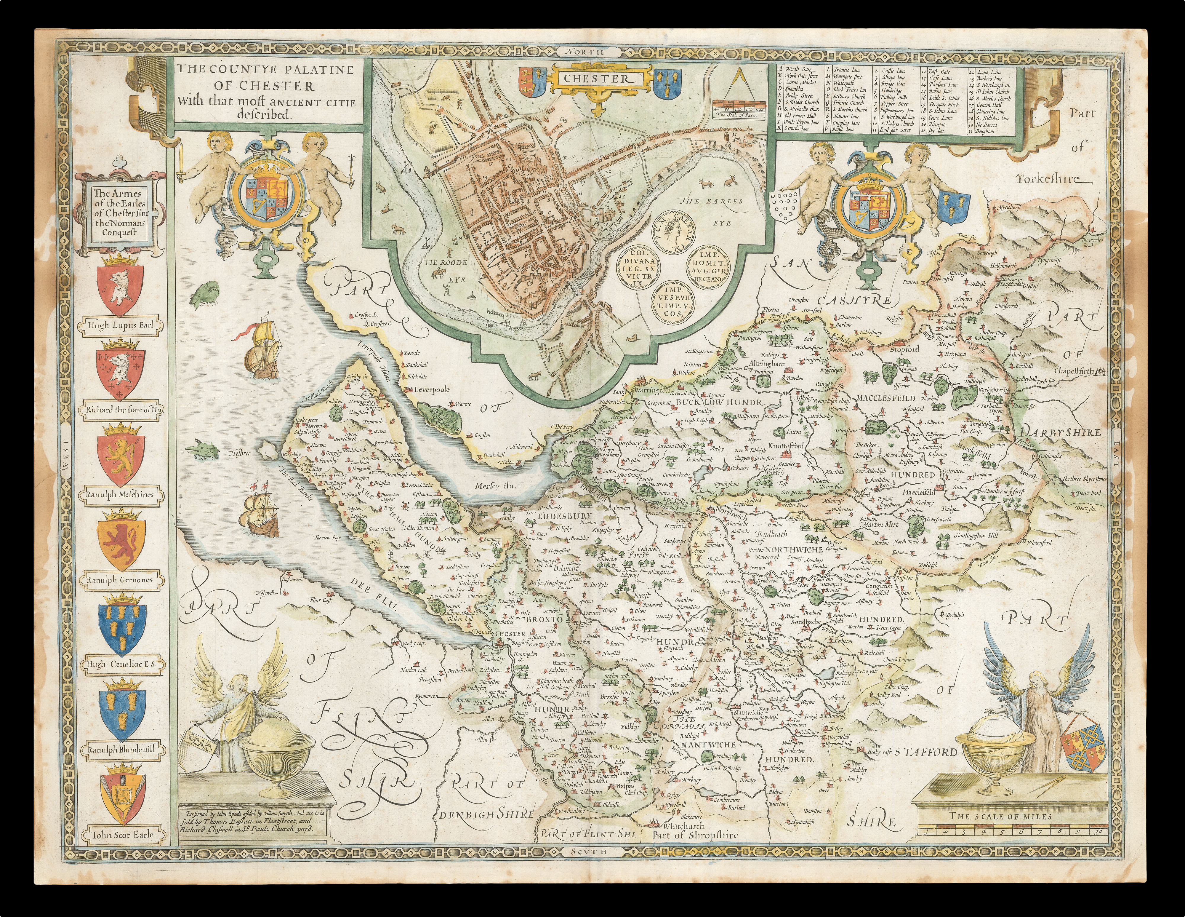
A map of Cheshire from the 1676 edition of the first large-scale atlas of the British Isles, Speed's 'Theatre'. In the top-centre of the map is an inset town-plan of Chester, with four coin medallions, possibly showing: Julius Caesar, the emperor Vespasian, the emperor Domitian, and the 20th Legion (which was among those to invade Britain with Claudius in 43CE). Along the left-hand side of the map are depicted the arms of the Earls of Chester since the Norman Conquest, amon...
A map of Cheshire from the 1676 edition of the first large-scale atlas of the British Isles, Speed's 'Theatre'. In the top-centre of the map is an inset town-plan of Chester, with four coin medallions, possibly showing: Julius Caesar, the emperor Vespasian, the emperor Domitian, and the 20th Legion (which was among those to invade Britain with Claudius in 43CE). Along the left-hand side of the map are depicted the arms of the Earls of Chester since the Norman Conquest, among them 'Ranulph Blundeuill' and 'Ranulph Gernones'.
John Speed (1552-1629) was the outstanding cartographer of his age. By trade a merchant tailor, but by proclivity a historian, it was the patronage of Sir Fulke Greville, poet and statesman, that allowed him to pursue this interest in earnest. His 'Theatre of Great Britain', from which the present work is drawn, was first published in 1611 or 1612 and is 'the earliest English attempt at atlas-production on a grand scale' (Skelton). Drawing heavily on the work of Saxton and Norden, little of Speed's cartography is original (he acknowledges, 'I have put my sickle into other mens corne'), instead it is his blend of cartography and history, incorporating town-plans, vignettes, and genealogy, that makes Speed an innovator.
This map is from the 1676 edition of the 'Theatre', published by Thomas Bassett and Richard Chiswell. Interestingly, this map lacks the text in English that is usually printed on the verso.