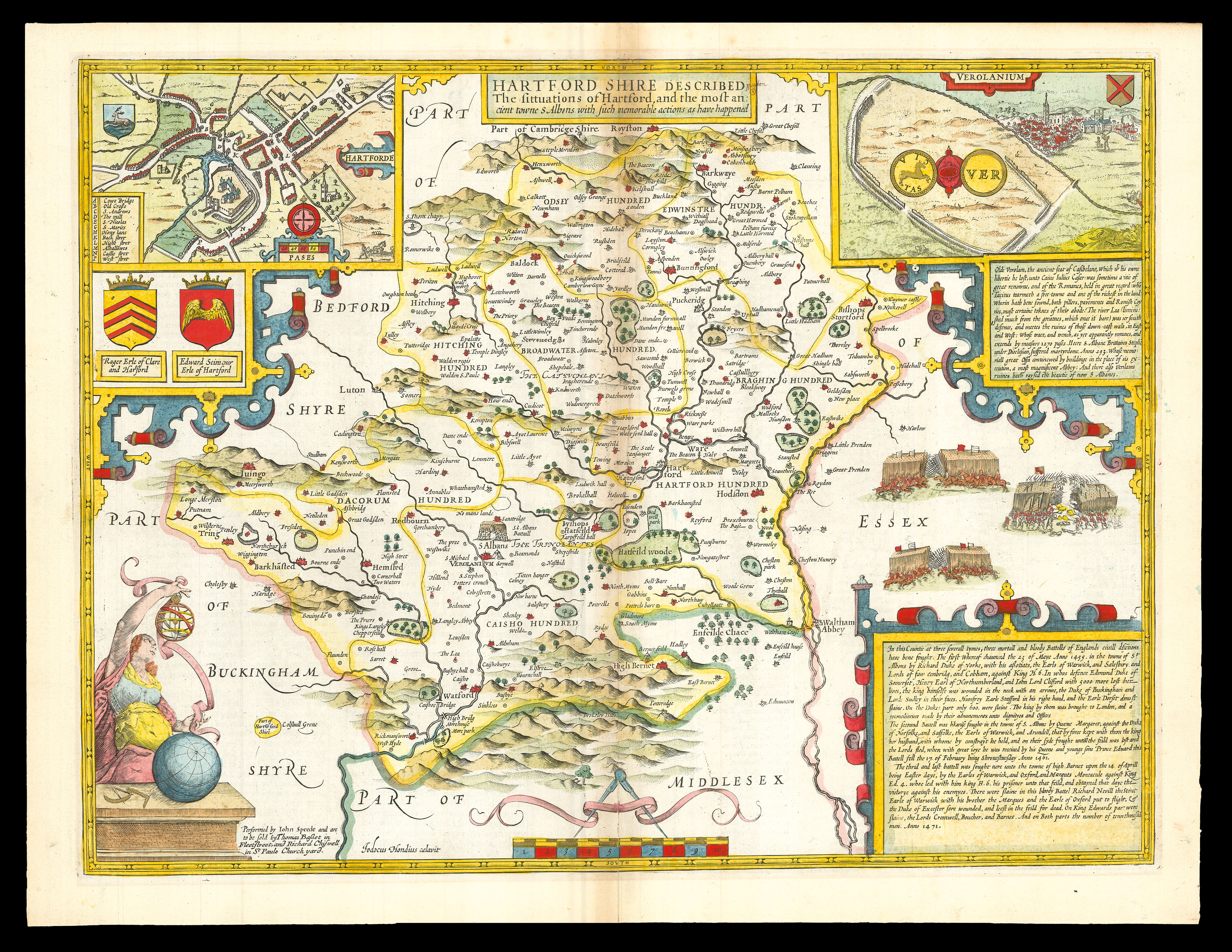
A map of Hertfordshire from the 1676 edition of the first large-scale atlas of the British Isles, Speed's 'Theatre'. In the top left-hand corner is an inset town-plan of Hertford, with points of interest including 'Hony lane' and 'Back stret' marked using an alphabetical key. In the top right-hand corner is an inset showing 'Verolanium', presumably a mis-spelling of 'Verulamium', modern-day St. Albans, one of the most significant cities in Roman Britain. In the bottom ri...
A map of Hertfordshire from the 1676 edition of the first large-scale atlas of the British Isles, Speed's 'Theatre'. In the top left-hand corner is an inset town-plan of Hertford, with points of interest including 'Hony lane' and 'Back stret' marked using an alphabetical key. In the top right-hand corner is an inset showing 'Verolanium', presumably a mis-spelling of 'Verulamium', modern-day St. Albans, one of the most significant cities in Roman Britain. In the bottom right-hand corner is a cartouche, in which are described the 'three mortall and bloody Battells of Englands civill disections' fought in Hertfordshire: the first battle of St. Albans (1451), the second battle of St. Albans (1461), and the battle of Barnet (1471).
Accompanying text in English, 'Hundreds in Hertford-shire' and 'Hertford-shire' is printed on the verso.
John Speed (1552-1629) was the outstanding cartographer of his age. By trade a merchant tailor, but by proclivity a historian, it was the patronage of Sir Fulke Greville, poet and statesman, that allowed him to pursue this interest in earnest. His 'Theatre of Great Britain', from which the present work is drawn, was first published in 1611 or 1612 and is 'the earliest English attempt at atlas-production on a grand scale' (Skelton). Drawing heavily on the work of Saxton and Norden, little of Speed's cartography is original (he acknowledges, 'I have put my sickle into other mens corne'), instead it is his blend of cartography and history, incorporating town-plans, vignettes, and genealogy, that makes Speed an innovator.
This map is from the 1676 edition of the 'Theatre', published by Thomas Bassett and Richard Chiswell.