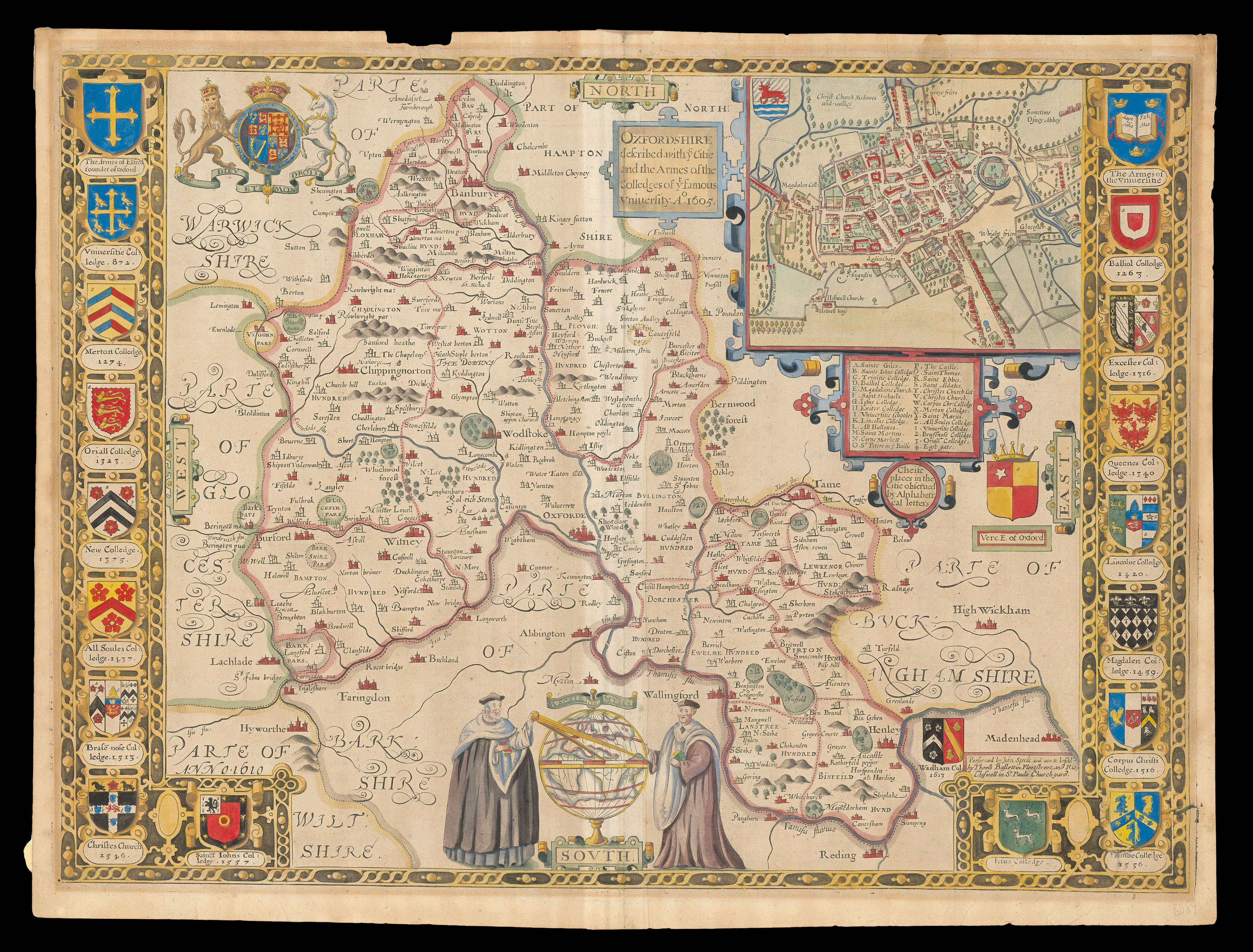
A map of Oxfordshire from the 1676 edition of the first large-scale atlas of the British Isles, Speed's 'Theatre'. In the top right-hand corner is an inset town-plan of Oxford, with points of interest including 'The Castle' and 'All Soules Colledge' marked using an alphabetical key. Along both the left and right-hand side of the map are depicted the arms of the university colleges. At the bottom of the map, a globe has been drawn around the scale bar, with a scholar stan...
A map of Oxfordshire from the 1676 edition of the first large-scale atlas of the British Isles, Speed's 'Theatre'. In the top right-hand corner is an inset town-plan of Oxford, with points of interest including 'The Castle' and 'All Soules Colledge' marked using an alphabetical key. Along both the left and right-hand side of the map are depicted the arms of the university colleges. At the bottom of the map, a globe has been drawn around the scale bar, with a scholar standing on each side, one of whom is measuring the scale bar with a compass.
Accompanying text in English, 'Hundreds in 'Oxford-shire' and 'Oxford-shire' is printed on the verso.
John Speed (1552-1629) was the outstanding cartographer of his age. By trade a merchant tailor, but by proclivity a historian, it was the patronage of Sir Fulke Greville, poet and statesman, that allowed him to pursue this interest in earnest. His 'Theatre of Great Britain', from which the present work is drawn, was first published in 1611 or 1612 and is 'the earliest English attempt at atlas-production on a grand scale' (Skelton). Drawing heavily on the work of Saxton and Norden, little of Speed's cartography is original (he acknowledges, 'I have put my sickle into other mens corne'), instead it is his blend of cartography and history, incorporating town-plans, vignettes, and genealogy, that makes Speed an innovator.
This map is from the 1676 edition of the 'Theatre', published by Thomas Bassett and Richard Chiswell.