Described by Christopher Saxton, augmented and published by John Speed servant to his Majesty, and are to be sold in popes head alley by John Sudbury and George Humbell,
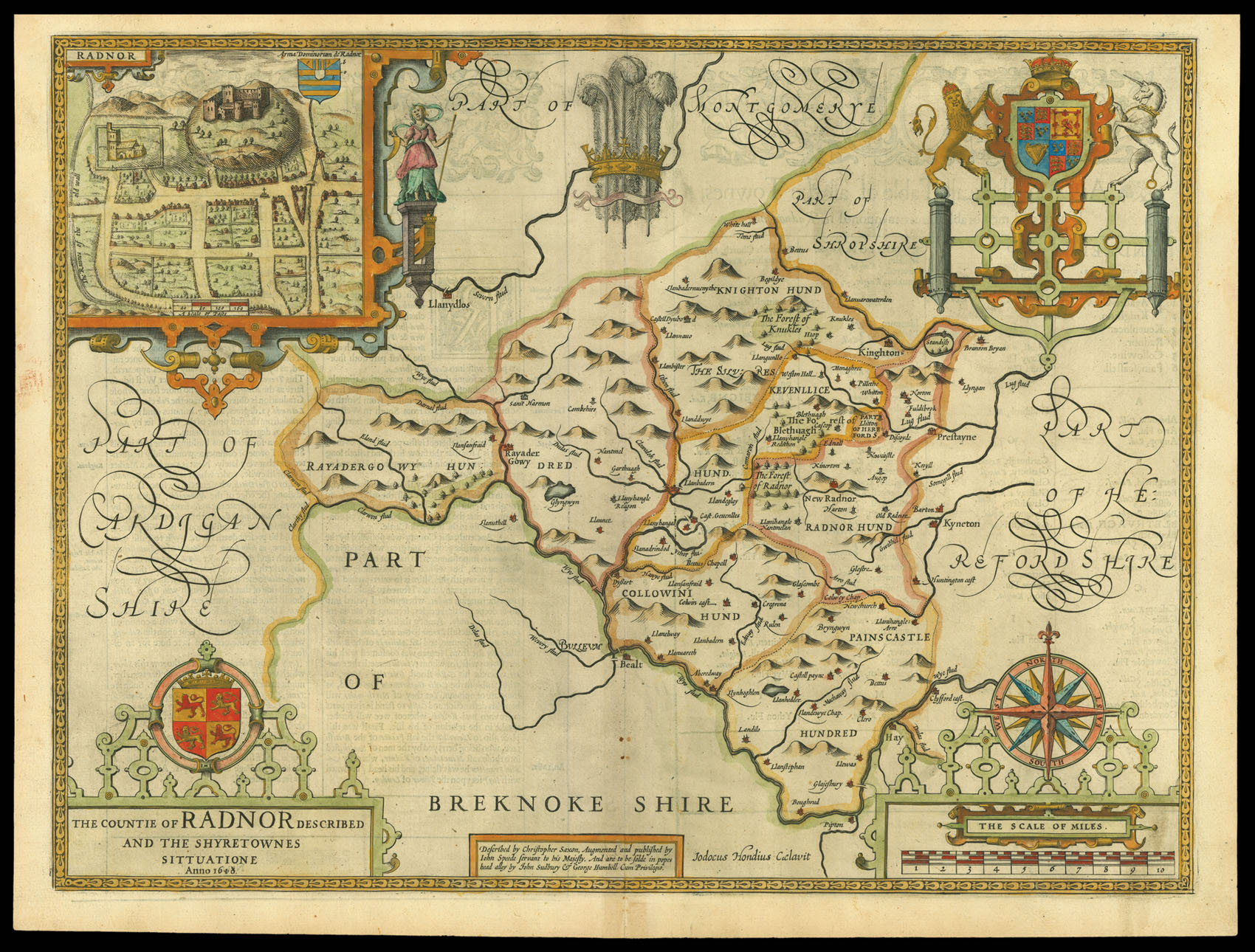
A beautifully coloured map of the historic county of Radnorshire, now Powys, with an inset map of Radnor.
John Speed (1552-1629) was the outstanding cartographer of his age. His 'Theatre of Great Britain' was the first atlas of the British Isles: Speed prepared the maps himself about two years before they were published. His maps and books dominated the seventeenth-century English market. The present map is taken from the 1627 English edition published by George...
A beautifully coloured map of the historic county of Radnorshire, now Powys, with an inset map of Radnor.
John Speed (1552-1629) was the outstanding cartographer of his age. His 'Theatre of Great Britain' was the first atlas of the British Isles: Speed prepared the maps himself about two years before they were published. His maps and books dominated the seventeenth-century English market. The present map is taken from the 1627 English edition published by George Humble.