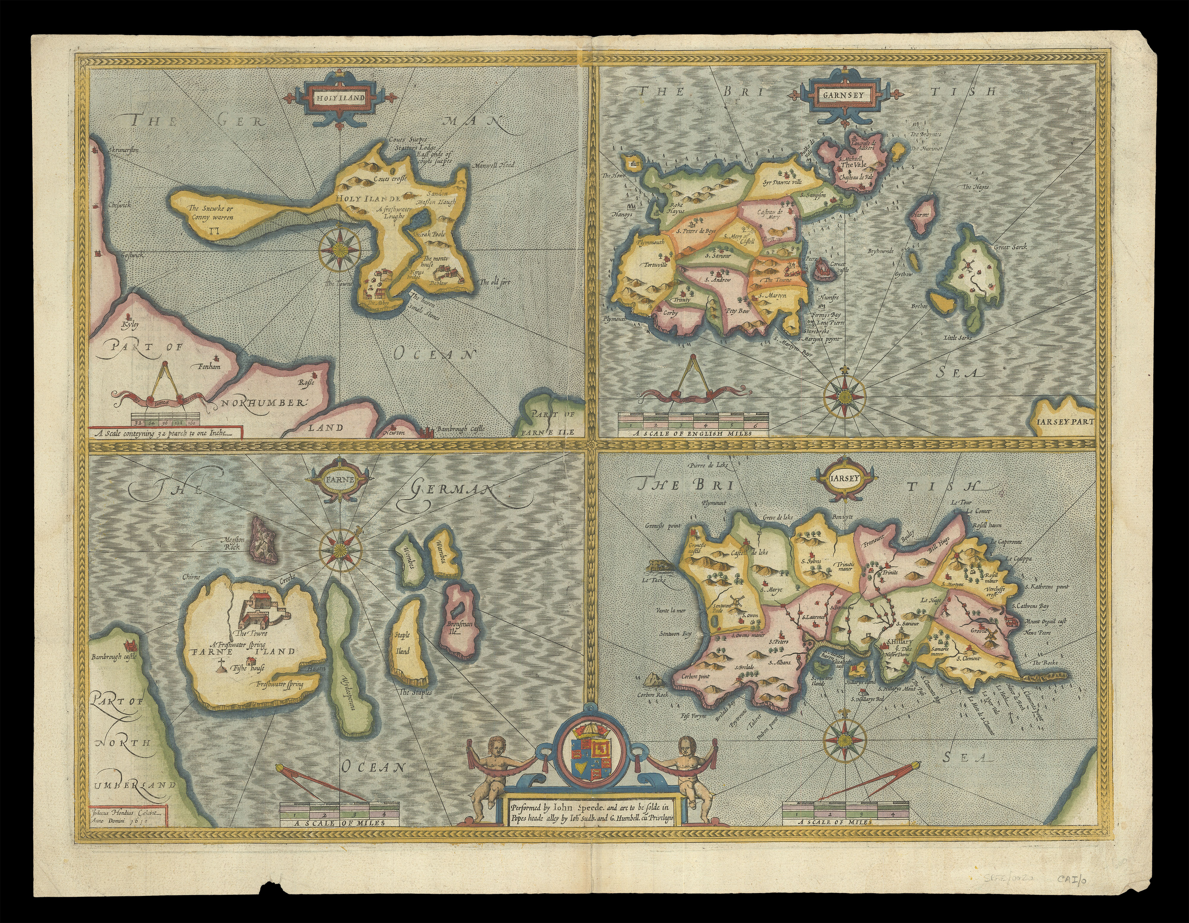
A map of islands off the coast of Britain from the first printed atlas of the British Isles, Speed's 'Theatre'. Unusually, this map is not in the carte-à-figure style that so characterizes Speed's work. Instead, the map is divided into four quarters, depicting 'Holy Iland' (Lindisfarne) and the Farne Islands, off the coast of Northumberland, and Guernsey and Jersey, two of the Channel Islands.
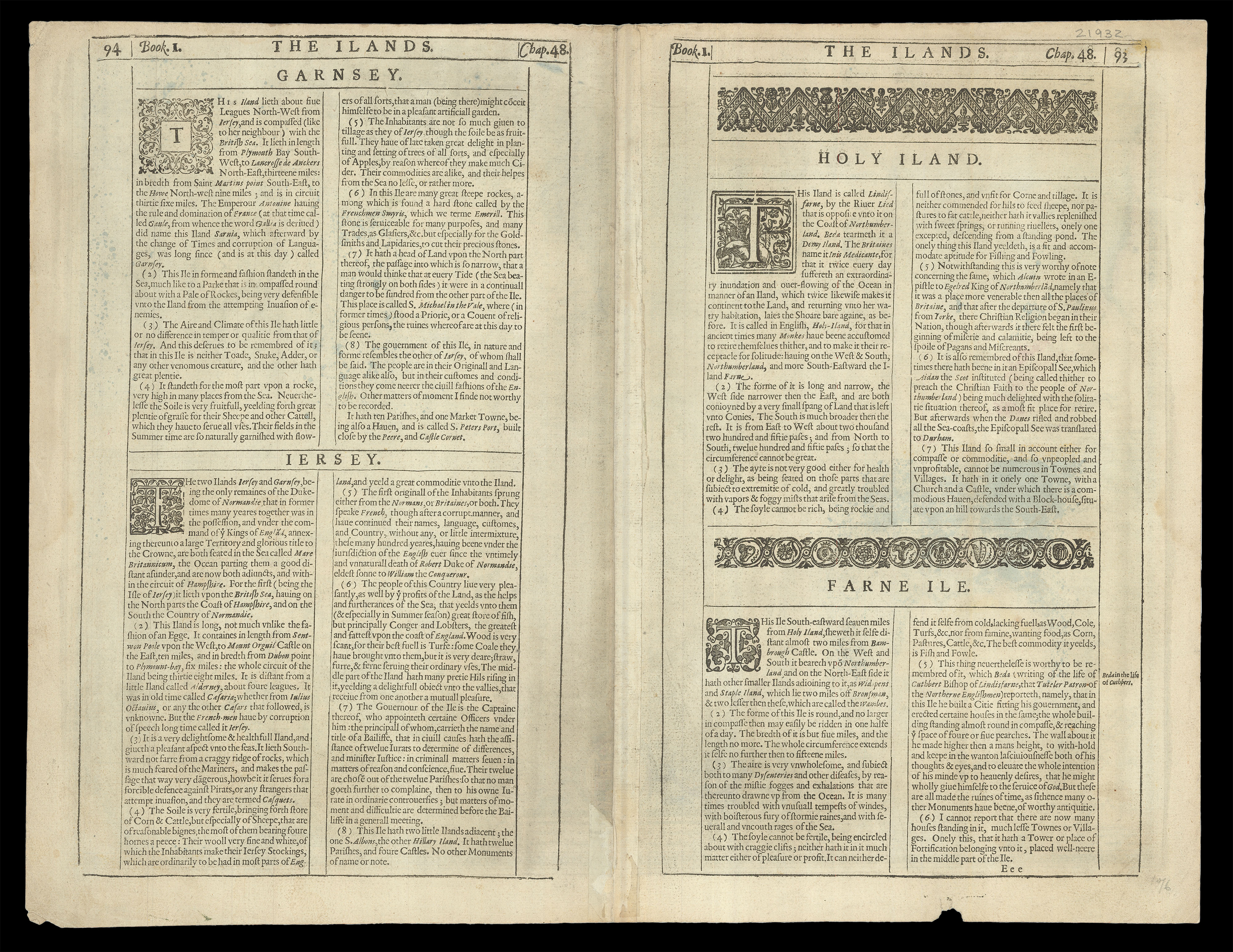
Accompanying text in English, 'The Ilands', is printed on the rever...
A map of islands off the coast of Britain from the first printed atlas of the British Isles, Speed's 'Theatre'. Unusually, this map is not in the carte-à-figure style that so characterizes Speed's work. Instead, the map is divided into four quarters, depicting 'Holy Iland' (Lindisfarne) and the Farne Islands, off the coast of Northumberland, and Guernsey and Jersey, two of the Channel Islands.
Accompanying text in English, 'The Ilands', is printed on the reverse.
John Speed (1552-1629) was the outstanding cartographer of his age. By trade a merchant tailor, but by proclivity a historian, it was the patronage of Sir Fulke Greville, poet and statesman, that allowed him to pursue this interest in earnest. His 'Theatre of Great Britain', first published in 1611 or 1612, was the first large-scale printed atlas of the British Isles. The 'Prospect of the Most Famous Parts of the World', from which the present work is drawn, appeared in 1627, bound with the 'Theatre', and is the first world atlas compiled by an Englishman to be published in England. Engraved in Amsterdam, many of the maps are anglicized versions of works by Dutch makers in distinctive carte-à-figure style, featuring borders with figures in local costume and city views.