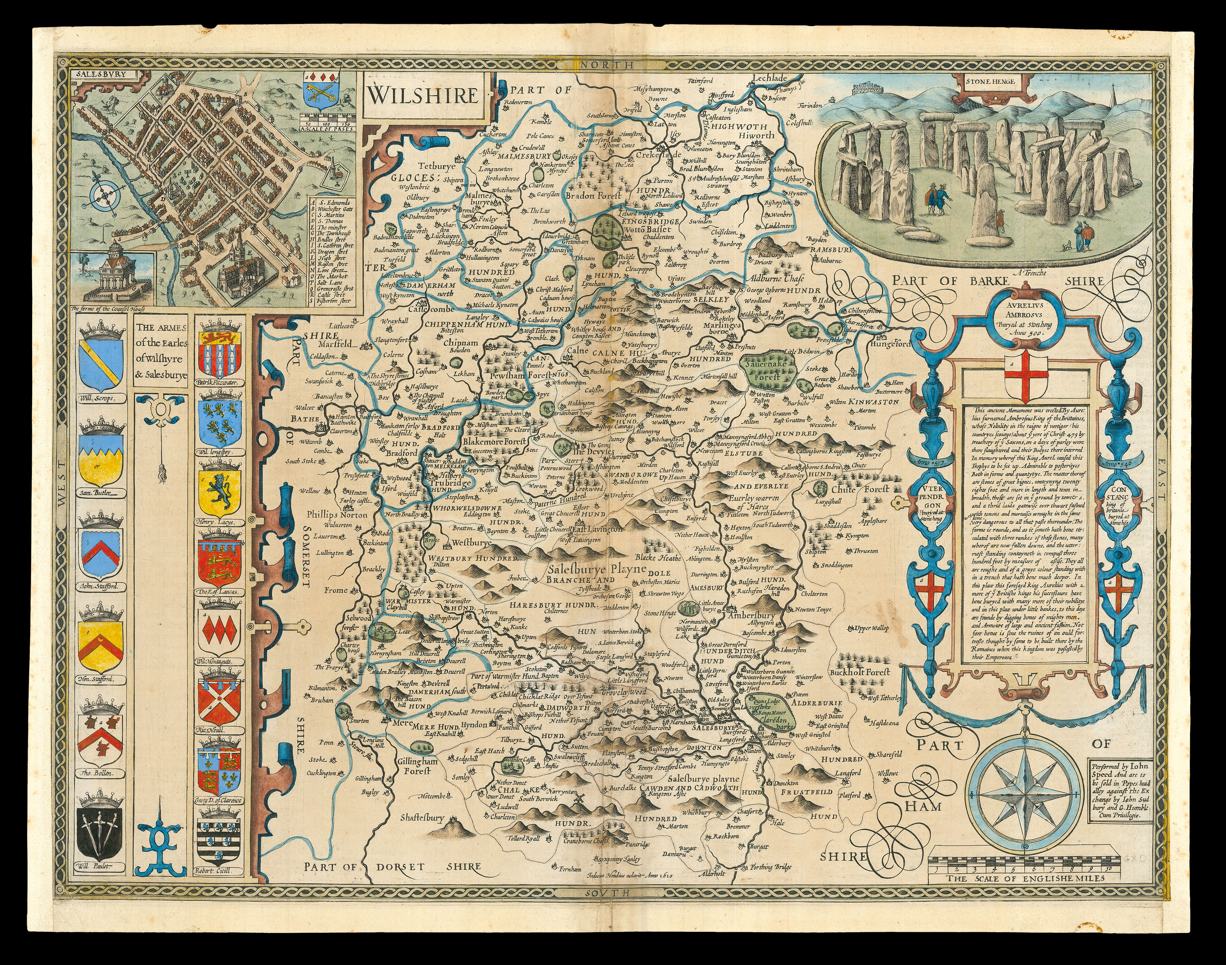
A map of Wiltshire from the first large-scale atlas of the British Isles, Speed's 'Theatre'. In the top left-hand corner of the map is an inset plan of 'Salesbury', with points of interest including 'Dragon Stret' and 'Love Strete' marked using an alphabetical key. In the top right-hand corner, Stonehenge is illustrated, with a history of the monument set out in an elaborate cartouche below, describing how it was 'erected By Aure:ius surnamed Ambrosius King of the Britta...
A map of Wiltshire from the first large-scale atlas of the British Isles, Speed's 'Theatre'. In the top left-hand corner of the map is an inset plan of 'Salesbury', with points of interest including 'Dragon Stret' and 'Love Strete' marked using an alphabetical key. In the top right-hand corner, Stonehenge is illustrated, with a history of the monument set out in an elaborate cartouche below, describing how it was 'erected By Aure:ius surnamed Ambrosius King of the Brittaines'. Along the left-hand side are illustrated the arms of the Earls of Wiltshire and Salisbury.
Accompanying text in English, 'Hundreds in Wilt-shire' and 'Wilt-shire' is printed on the reverse.
John Speed (1552-1629) was the outstanding cartographer of his age. By trade a merchant tailor, but by proclivity a historian, it was the patronage of Sir Fulke Greville, poet and statesman, that allowed him to pursue this interest in earnest. His 'Theatre of Great Britain', from which the present work is drawn, was first published in 1611 or 1612 and is 'the earliest English attempt at atlas-production on a grand scale' (Skelton). Drawing heavily on the work of Saxton and Norden, little of Speed's cartography is original (he acknowledges, 'I have put my sickle into other mens corne'), instead it is his blend of cartography and history, incorporating town-plans, vignettes, and genealogy, that makes Speed an innovator.