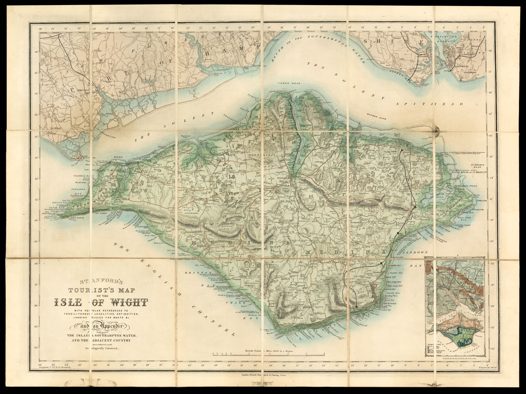
with the popular references to fossiliferous localities, antiquities, landing places for boats &c. and an Appendir shewing the Island, Southampton Water, and the adjacent Country on a reduced scale Geologically Coloured.
Engraved map, original hand-colour, inset of the Isle of Wight and part of Hampshire geologically coloured, dissected and mounted on linen, folding into original brown cloth boards, with publisher's label, upper cover detached.