Large and detailed plan of Shanghai, and surroundings.
The map stretches west to east from modern day Tongling to Shanghai, and north to south from Nanjing to Hangzhou. The major districts and provinces are marked in English and Chinese. Also marked upon the plan are cities, towns, villages, marshes, swamps, bridges, pagodas, hills, boundary provinces, canals, and the sea wall. To the upper left are profiles of the stone bridge and the city walls of Soochow (Suz...
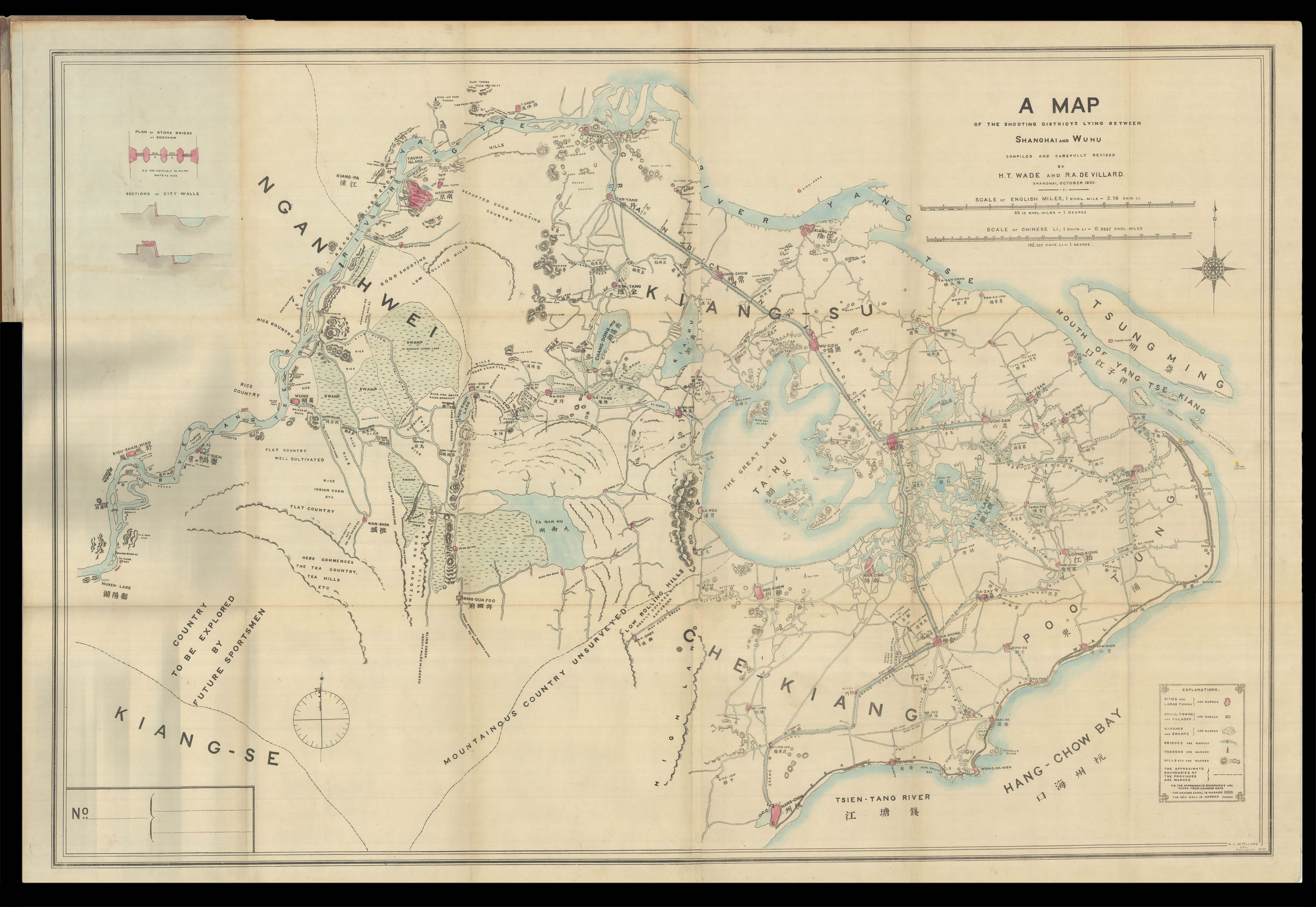
Large and detailed plan of Shanghai, and surroundings.
The map stretches west to east from modern day Tongling to Shanghai, and north to south from Nanjing to Hangzhou. The major districts and provinces are marked in English and Chinese. Also marked upon the plan are cities, towns, villages, marshes, swamps, bridges, pagodas, hills, boundary provinces, canals, and the sea wall. To the upper left are profiles of the stone bridge and the city walls of Soochow (Suzhou).
The map was produced to aid the consumate gentleman to find suitable areas around Shanghai to shoot game. Hence, as well as the labelling of geographical and man-made features, the map is replete with phrases such as "good shoot low rolling hills", "reported good shooting country", and to the far left of the map, "country to be explored by future sportsmen". Pasted onto the inside cover is a 13 page distance table, giving distances in English miles and Chinese Li.
The map was made by Robert Alexis de Villard, an artist and customs official who spent the majority of his career in the foreign concessions of Shangai, and Henling Thomas Wade, who was born in the city and was an extremely well-known member of the international community there. In a box in the lower left-hand corner the number of the map is given, in this case 462, and it is signed by both Wade and Villard. It is likely that the map had a print run of 500, with examples given out by the makers to hunting enthusiasts within tight-knit expatriate community in Shanghai.
Scale: 7.5 statute miles to 1 inch.
bibliography:
bibliography:
provenance:
provenance:
Provenance:
Robert Alexis de Villard, signature to title page.