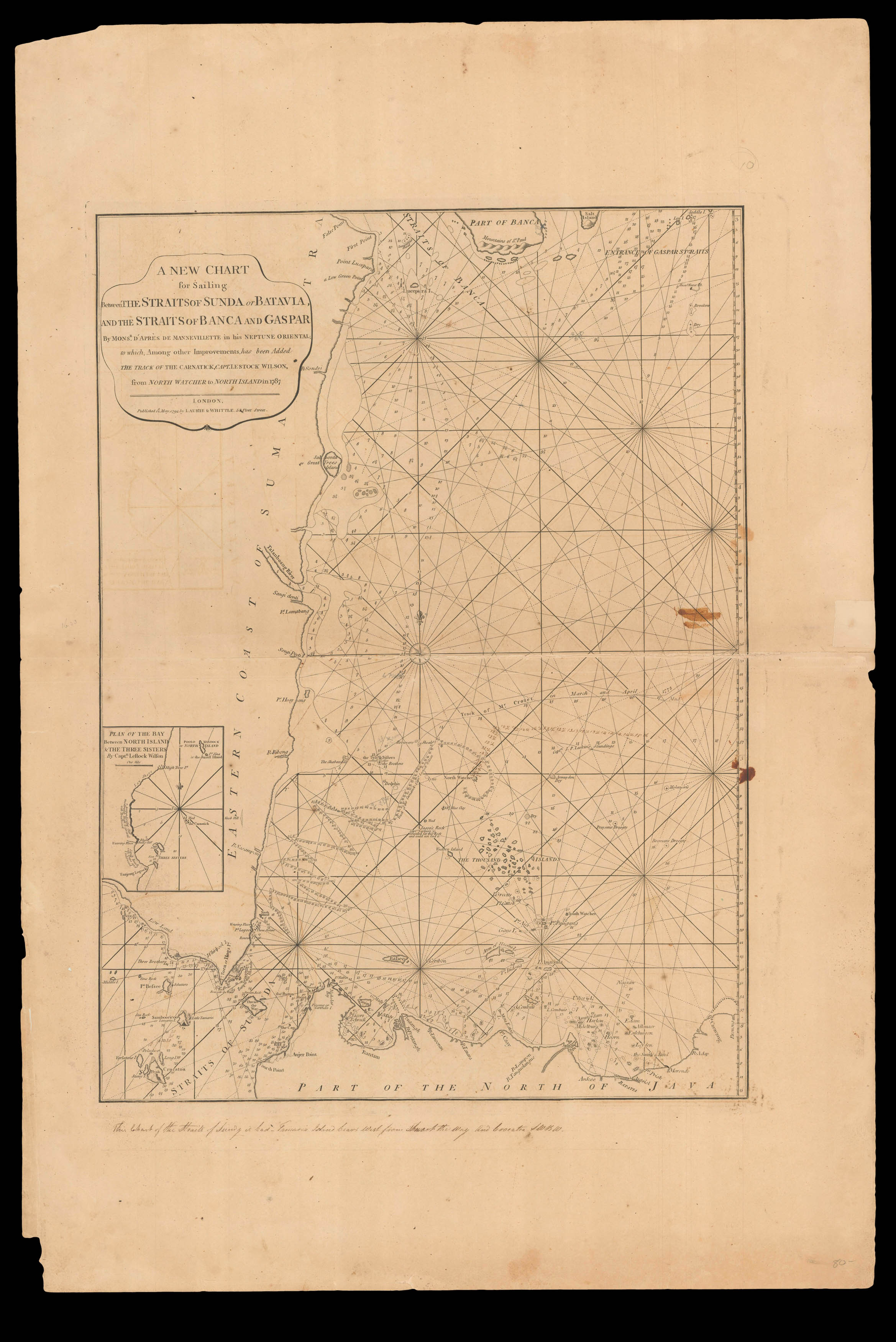
A New Chart for Sailing Between the Straits of Sunda or Batavia and the Straits of Banca and Gaspar
by Mons.r D'Apres de Mannevillette in his Neptune Oriental; to which, Among other Improvements, has been Added the Track of the Carnatick, Capt. LeStock Wilson, from North Watcher to North Island in 1787.
Based on D'Apres Mannevillette's 'Carte pour Aller du Detroit de la Sonde ou de Batavia au Detroit de Banca' (1775), the chart has been updated and is more detailed. An inset, 'Plan of the Bay between North Island & the Three Sisters by Capt.n LeStock Wilson', lower left. The explosive island of "Cracatoa" is given prominence in the Sunda Strait. From an early edition of Laurie & Whittle's rare 'East India Pilot', and one of the first charts published after their purchase o...
Based on D'Apres Mannevillette's 'Carte pour Aller du Detroit de la Sonde ou de Batavia au Detroit de Banca' (1775), the chart has been updated and is more detailed. An inset, 'Plan of the Bay between North Island & the Three Sisters by Capt.n LeStock Wilson', lower left. The explosive island of "Cracatoa" is given prominence in the Sunda Strait. From an early edition of Laurie & Whittle's rare 'East India Pilot', and one of the first charts published after their purchase of Robert's Sayer's business.
Laurie & Whittle's 'East India Pilot' was published as a practical guide to navigators aboard ships of the Royal Navy and East Indiamen, and often taken to sea, and this chart appears to be no exception. All variants of Laurie and Whittle's 'Oriental' pilots of eastern waters are scarce, and were published under several titles, each with a different complement of charts. Variants include: 'The Country Trade East-India Pilot, for the Navigation of the East-Indies and Oriental Seas, within the limits of the East-India Company', 'The Complete East-India Pilot, or Oriental Navigator', 'The East-India Pilot, or Oriental Navigator', and 'The Oriental Pilot; Or, East-India Directory' focusing on the most important charts used for the journey.
The foundation of the partnership of Robert Laurie (1755–1836) and James Whittle (1757–1818) was the existing stock of Robert Sayer's printing plates, both for maps and atlases and also decorative prints. Laurie had originally apprenticed to Robert Sayer in 1770, and made free in 1777. He was a skilled artist, who exhibited at the Society of Artists from 1770, winning a silver palette for a drawing in 1770, and he was also an accomplished engraver of mezzotint portraits and produced views and other decorative items. In about 1792 he returned to the Sayer business and took it over from the ailing Sayer in 1794. Whittle was apprenticed into the Needlemakers' Company, evidently made free by 1792, and joined with Laurie to take over the Sayer business in 1794.
Laurie retired in 1812. His son Richard Holmes Laurie replaced him in the partnership and, eventually, took over the firm after Whittle's death in 1818. Presumably under the influence of Richard Holmes Laurie, the partnership became noted as chartmakers and publishers, with the business existing to the current day as Imray, Laurie, Norie and Wilson.
bibliography:
bibliography:
provenance:
provenance:
Provenance: with contemporary marginal annotation complaining of the inaccuracy of the chart in relation to the position of Tamarin Island near Krakatoa