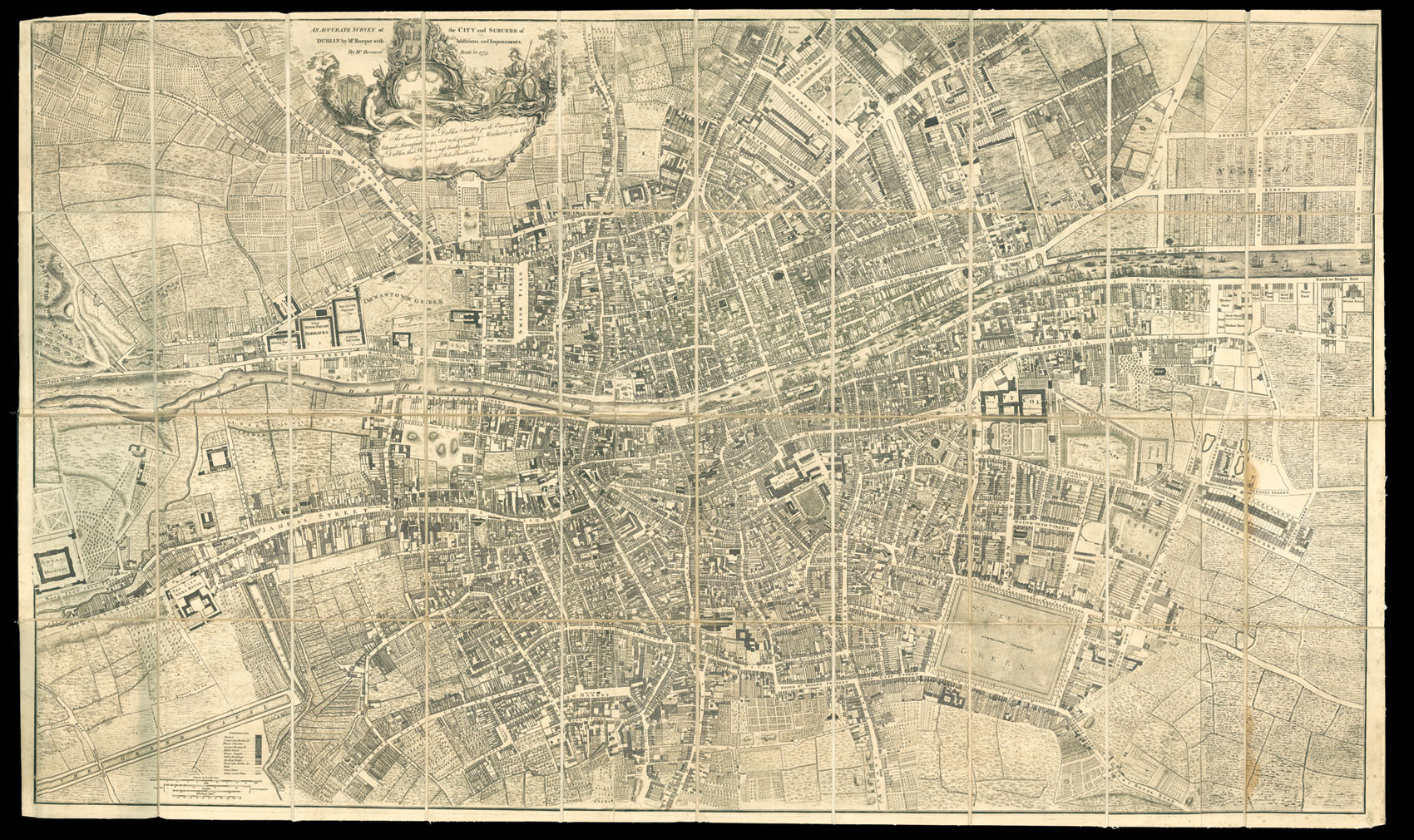
An Accurate Survey of the City and Suburbs of Dublin
By Mr Rocque with Additions and Improvements, By Mr Bernard Scale to 1773. To The Honourable the Dublin Society for the Encouragement of Arts and Manufactorys, And to the Committy of Merchants of the City of Dublin, this Plan is most humbly Inscribed by Their most Obedient Humble Servant Robert Sayer, [Together with] An Index Adapted to the Plan of the City and Suburbs of Dublin...
Engraved plan, dissected and mounted on linen, folding into nineteenth century half blue calf covers over blue cloth boards, title to spine lettered in gilt, rubbed.
Rocque's "Exact Survey of the City and Suburbs of Dublin" commenced in the autumn of 1754 and was published in four sheets just two years later. The map was drawn to a similar scale to his London plan upon 24 sheets, of two hundred feet to an inch, and portrayed "all publick buildings, dwelling houses, ware houses, stables, courts, yards &c'". Also depicted are numerous places of worship including Anglican churches, "Roman chappels", French churches, Presbyterian, and Quake...
Rocque's "Exact Survey of the City and Suburbs of Dublin" commenced in the autumn of 1754 and was published in four sheets just two years later. The map was drawn to a similar scale to his London plan upon 24 sheets, of two hundred feet to an inch, and portrayed "all publick buildings, dwelling houses, ware houses, stables, courts, yards &c'". Also depicted are numerous places of worship including Anglican churches, "Roman chappels", French churches, Presbyterian, and Quaker meeting houses, together with warehouses ad areas of manufacture.
At the time of printing Dublin's population was around 100,000; the city having greatly expanded from its mediaeval walls. Numerous churches and chapels crowd the medieval city, with the castle dominating to the right; not far to the south is St Patrick's cathedral, where Jonathan Swift was dean. To the right of the plan are Trinity College Dublin, Parliament House, and the fashionable St. Stephen's Green to the south. To the left the Barracks, Royal Hospital and the City work house are clearly marked.
Although first published in 1756, the Exact Survey was subsequently subject to various minor, piecemeal revisions, some of them corrections, others to take account of some of the new developments. These revisions continued after Rocque's death in 1762 until at least 1769. A second edition, with more extensive revisions by Rocque's brother-in-law Bernard Scalé, the present example, was issued by the London publisher, Robert Sayer, in 1773.
Rare we are only able to trace one institutional copy dated 1773: in the BNF in Paris.
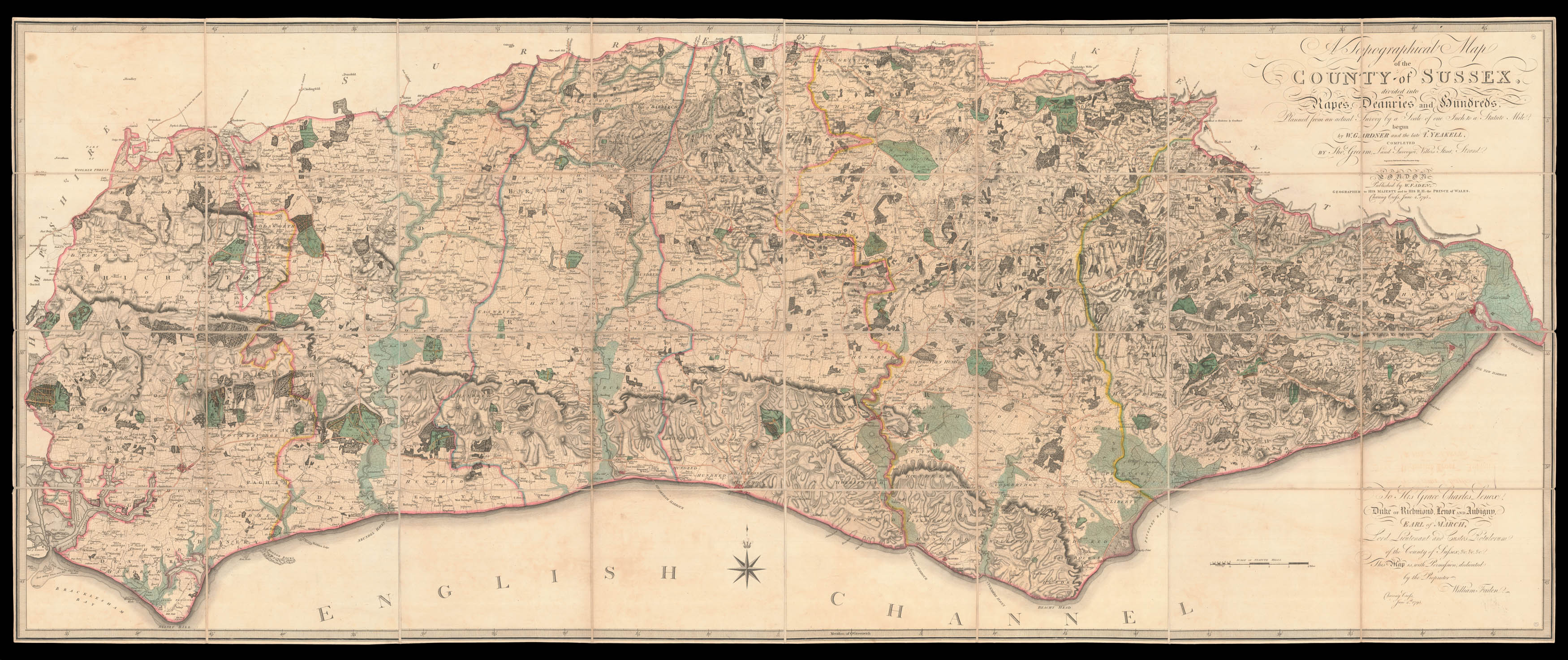 Yeakell and Gardner's landmark map of Sussex
 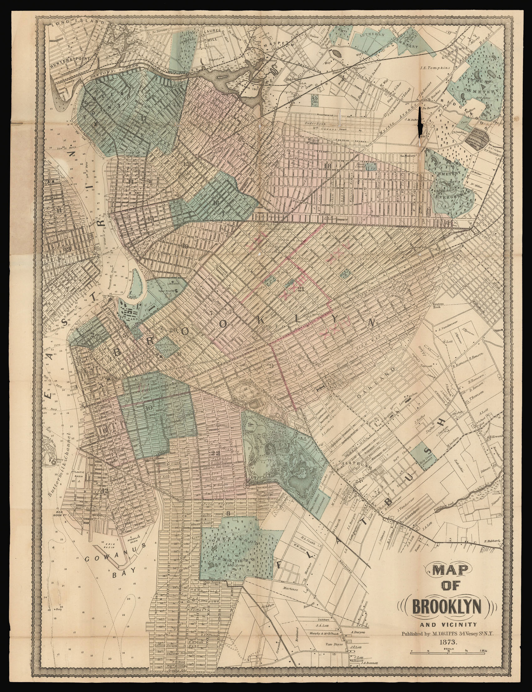 Brooklyn as the third largest city in the United States