Double-page engraved map, fine original colour in outline, some offsetting, contemporary annotation on verso in brown ink, some minor offsetting, some light marginal soiling.
This map of Cheshire, or "Cestria", is the tenth in the collection of county maps commissioned by the Queen's Privy Council in 1575, completed by Christopher Saxton within the following four years, and then published in his 'Atlas of England and Wales', the first ever national atlas. It is also the first map of the county itself ever to be created. The cartographer surveyed the landscape of the English and Welsh counties, and documented his findings with illustrations of r...
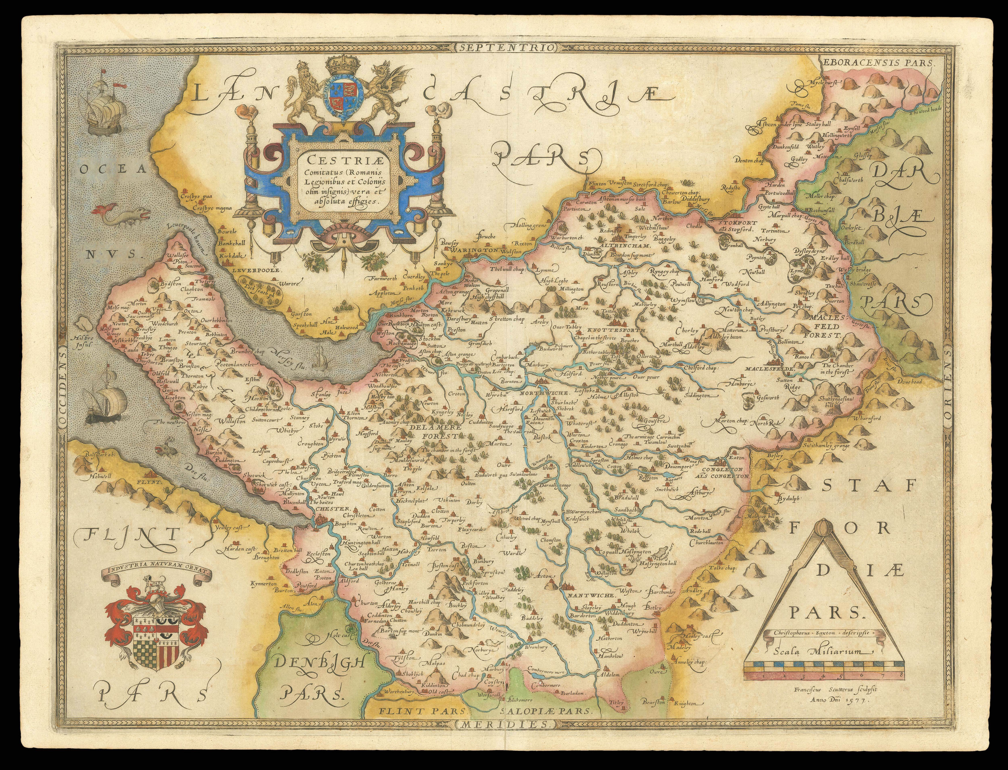
This map of Cheshire, or "Cestria", is the tenth in the collection of county maps commissioned by the Queen's Privy Council in 1575, completed by Christopher Saxton within the following four years, and then published in his 'Atlas of England and Wales', the first ever national atlas. It is also the first map of the county itself ever to be created. The cartographer surveyed the landscape of the English and Welsh counties, and documented his findings with illustrations of rivers, hills and settlements. Within Cheshire, these elements are labelled with their English names, while the surrounding counties are denoted in Latin. While small villages are represented by single buildings, larger towns and cities, such as Norwich, Chester and Macclesfield, are shown with more detailed depictions. The map is dominated by the Cheshire's three major rivers, the Weaver, Mersey and Dee, all of which flow into the sea on the Western side of the county. This 'oceanus' is illustrated with the Elizabethan ships, fish and sea monsters commonly found in Saxton's maps featuring coastal areas, attesting to the ornamental co-purpose of these pieces. However, attention was also paid to these regions for defensive purposes. Elizabeth's reign was haunted by the constant threat of naval invasion, meaning that Saxton's atlas was considered an important tool in the country's military arrangements. In fact, the Secretary of State, Lord Burghley, annotated his own personal proof copy with additional information, concentrated around Liverpool Haven, suggesting his concern about the possibility of enemy landings in the area.
An elaborate cartouche in bold blue colouring stands in the upper left section of the map, containing the Latin county name and surmounted by the royal coat-of-arms. Below it in the lower corner the Seckford crest appears, complete with its later Latin motto, in honour of Saxton's patron. Opposite this, the scale is found, enclosing a banner which identifies Saxton as the cartographer. The name of the engraver, in this case Francis Scatter, is included below without a banner. Additionally, like all the maps in Saxton's 'Atlas of England and Wales', this map bears his watermark, a bunch of grapes, to identify the work as original.
bibliography:
bibliography:
Bowd, 'John Dee and Christopher Saxton's Survey of Manchester (1596)', (Northern History, 2005); 'Cestiae Comitatus' (The British Library Online Gallery, 2009); Scanlan, 'Through Mountains to the Sea' (Places Journal, 2019).