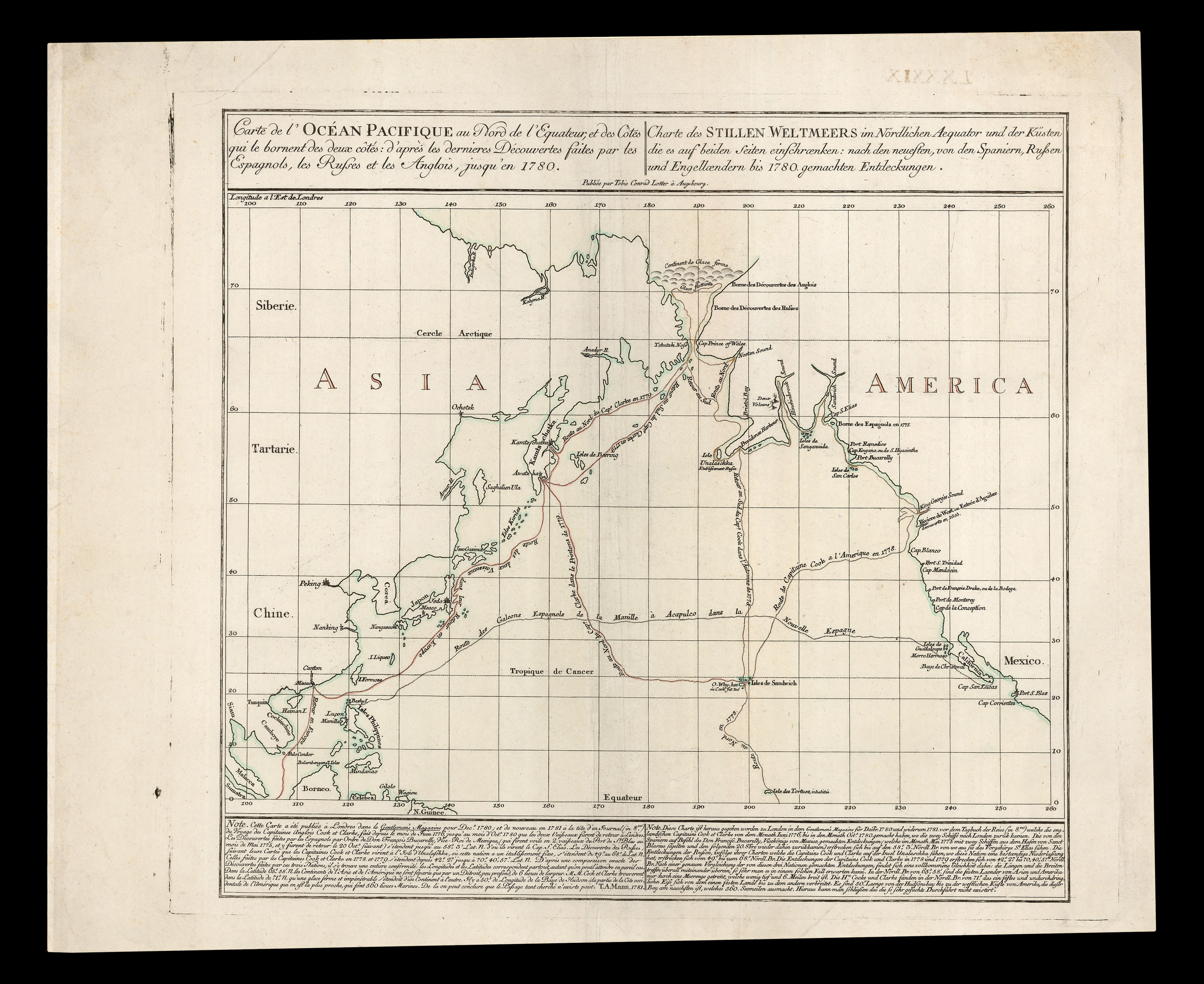
An extensive note beneath the map, in French and German, states that this chart is based on one first published in 'The Gentleman's Magazine' of December 1780, which published important notices on the progress of Cook's Third Voyage, his death, and interalia the existence of Hawaii. The map from the 'Gentleman's Magazine' by Thomas Kitchin, initially appeared in the July 1780 issue, without marking the tracks of the Cook's voyage. A revised version appeared in December, wit...
An extensive note beneath the map, in French and German, states that this chart is based on one first published in 'The Gentleman's Magazine' of December 1780, which published important notices on the progress of Cook's Third Voyage, his death, and interalia the existence of Hawaii. The map from the 'Gentleman's Magazine' by Thomas Kitchin, initially appeared in the July 1780 issue, without marking the tracks of the Cook's voyage. A revised version appeared in December, with the addition of Cook's route. Both Lotter's map, and Kitchin's, predate the first "official" map to show Hawaii, which appeared in the official account of Cook's final voyage published in 1784, as does a chart showing Cook's discoveries in Hawaii in John Rickman's unofficial account of 1781.
The Hawaiian Islands have been of great importance to the Grand Voyager of the Pacific Ocean since Captain James Cook first set foot on the island of Kauai in 1778. He named the islands after the Earl of Sandwich, and returned to a year later to meet his untimely death.
In 1820, the first Christian missionaries arrived. Shortly afterward, Western traders and whalers came to the islands, bringing with them diseases that devastated the native Hawaiian population.
The mapmaker Tobias Conrad Lotter (1717-1777) was just one of many engravers who advanced their careers by marrying into a prominent publishing family; the son of a baker, Lotter married the daughter of mapmaker Matthaus Seutter and began working at the Seutter firm in 1740. Over the next four years, he produced plates for Seutter's greatest work, the 'Atlas Minor, praecipua orbis terrarum imperia, regna et provincias'. Upon the deaths of his father- and brother-in-law, Lotter inherited the firm's plates, with which he built up his own business and soon became one of the most successful publishers of cartographic material in Germany.