John Thomson's separately published map of matrimony.
During the eighteenth and nineteenth century, a popular subject for spoof cartography was marriage, as shown in this fantasy 'map' made in a typical eighteenth century style.
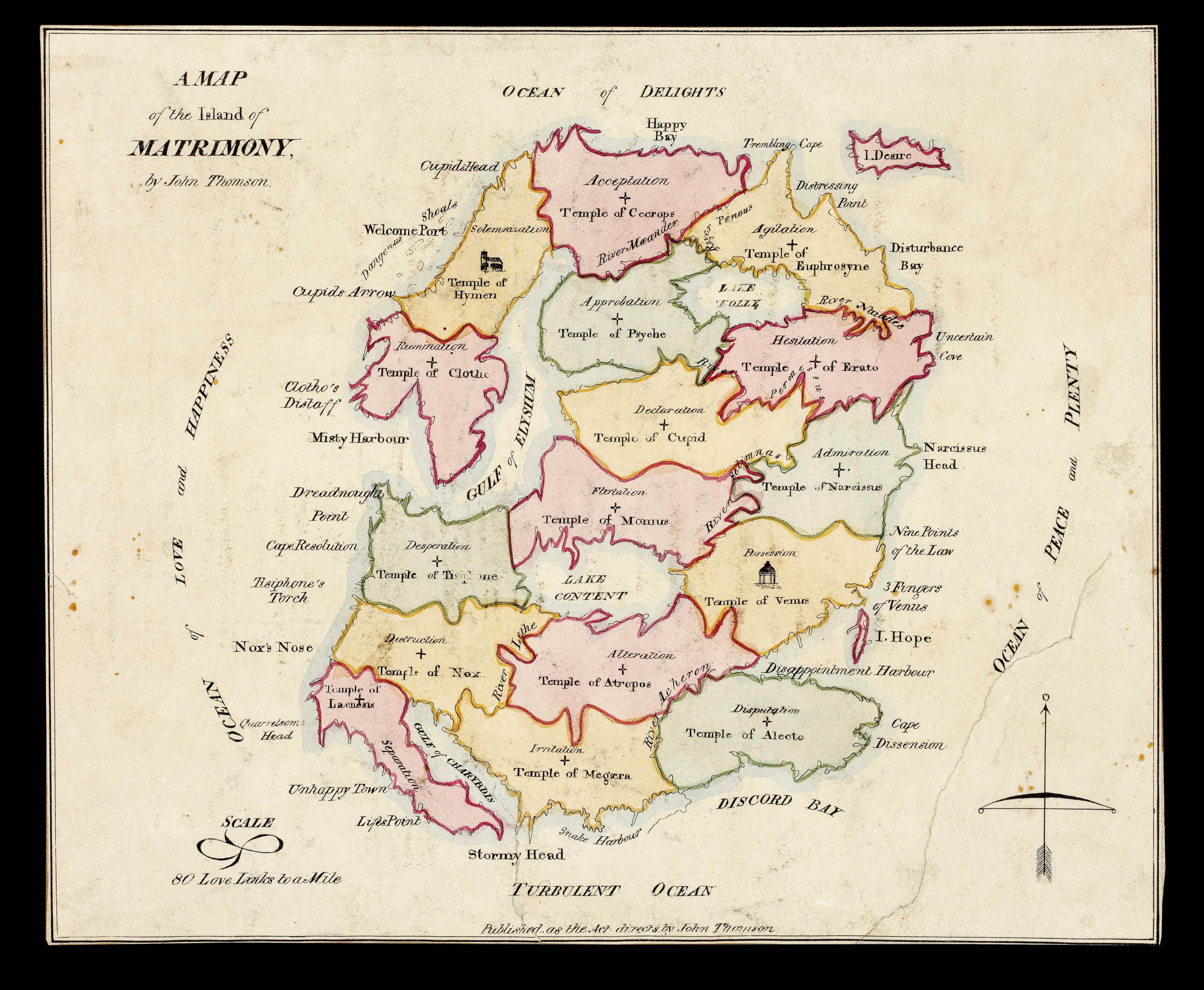
Marriage here is depicted as an Island surrounded by the 'Ocean of Lover and Happiness' to the west; 'Ocean of Delights' north; 'Ocean of Peace and Plenty' east; and the 'Turbulent Ocean' south. A scale bar to the lower left ma...
John Thomson's separately published map of matrimony.
During the eighteenth and nineteenth century, a popular subject for spoof cartography was marriage, as shown in this fantasy 'map' made in a typical eighteenth century style.
Marriage here is depicted as an Island surrounded by the 'Ocean of Lover and Happiness' to the west; 'Ocean of Delights' north; 'Ocean of Peace and Plenty' east; and the 'Turbulent Ocean' south. A scale bar to the lower left marks '80 love links to the Mile'.
The traveller begins his journey to the upper left, at 'Welcome Point', nestled between 'Cupids Arrow' and 'Cupids Head', in the province of 'Solemnisation'. Once reaching land he or she journeys to the 'Temple of Hymen' on the shores of the 'Gulf of Elysium', were the wedding ceremony takes place. The map then marks a further 15 regions each portraying a step along the road of a happy or disasterous union, and each bearing a classical Greek temple. The province of 'Possession' is home to the 'Temple of Venus' (goddess of erotic love); whereas the region of 'Irritation' contains the 'Temple of Magaer'a (jealousy), one of the three Furies of Greek; the province of Separation is watched over by the 'Temple of Laenesis', one of the three Fates who were in charge of the destiny of all living things.
One curious aspect of the map, and maybe a reflection of Thomson's own feelings regarding the state, is the placement of 'Desire' and 'Hope' as islands just off the marriage's east coast.
Rare. We are only able to trace two institutional examples of Thomson's work: the National Library of Scotland; and the New York Public Library.