dressée par Mr. C.A. Vincendon-Dumoulin, Ingénieur Hydrographe de la Marine; publiée sous le Ministère de Mr. Romain-Desfossés, Contre-Admiral, Secrétaire d'Etat au Département de la Marine et des Colonies au Dépôt-général de la Marine en 1851.
Separate issue, with price "Prix Deux Francs", lower right, first published in 1851.
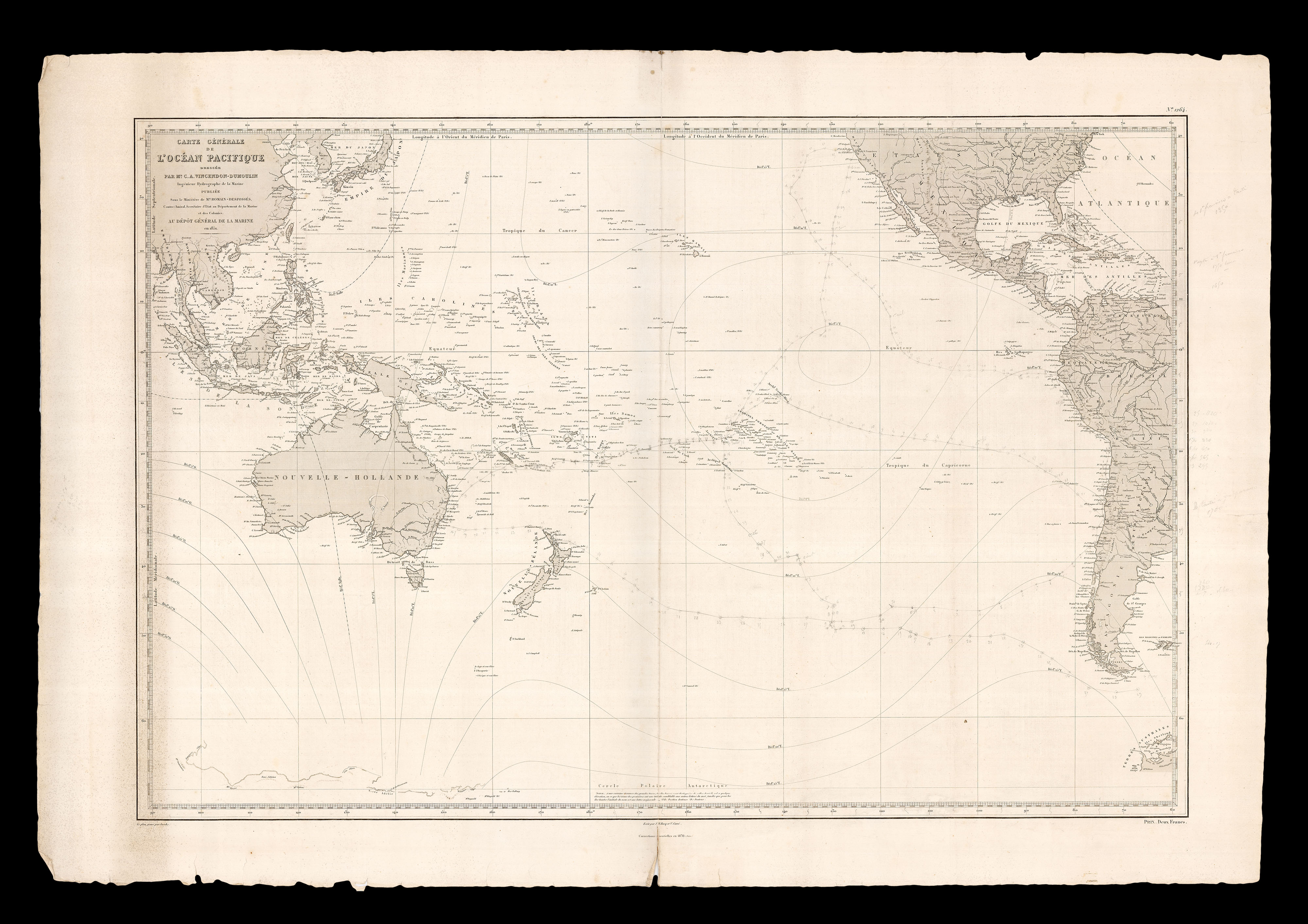
This large-scale chart, centred on the the Pacific Ocean, showing Southeast Asia, New Guinea, Australia, as "Nouvelle-Hollande", and the west coast of North and South America, with lines of magnetic declination, is annotated throughout with the route of an extensive voyage of a scion of the Freycinet family across the Pacific ocean during 1875 and 1876.
The voyage, in ...
Separate issue, with price "Prix Deux Francs", lower right, first published in 1851.
This large-scale chart, centred on the the Pacific Ocean, showing Southeast Asia, New Guinea, Australia, as "Nouvelle-Hollande", and the west coast of North and South America, with lines of magnetic declination, is annotated throughout with the route of an extensive voyage of a scion of the Freycinet family across the Pacific ocean during 1875 and 1876.
The voyage, in an unnamed vessel, begins in the major seaport of Valpairiso, Chile, on the 18th of January 1875. The first recorded landfall is Nouka-Hiva (Nuku Hiva), the largest of the Marquesas Islands in French Polynesia, which inspired both Herman Melville and Robert Louis Stevenson, on the 18th of January, remaining there until the 20th of February. On the 20th of March the vessel arrived in Tahiti, remaining only 24 hours before setting sail for the French territory of New Caldeonia on the 21st of March, where it remained for a month before heading for the eastern coast of Australia, and Port Jackson (Sydney). It arrived on the 6th of July. On the 17th of July the vessel left Port Jackson, arriving in Otea (Great Barrier Island), New Zealand ten days later. On the 12th of August the vessel left Otea and sailed to Concepcion, on the coast of Chile 12th August, staying one month, before heading back to Valpairiso on the 15th of September, a voyage of two days.
After a long sojourn in Valpariso, the vessel began a series of relatively short hops from port to port up the coast: firstly to Coquimbooula Serena 23rd - 25th December; then Coquimbooula to Copiaco, 27th December to 1st January; then Copiaco to Point Iqique, 2nd - 7th January 1876; then Pt. Iqique to Arica 8th - 9th January; Arica to Pisco, 10th-16th January; Pisco to Truxillo, 16th January to 28th February; Truxillo to Payta, 28th February to 6th March; and then Payta to San Francisco from the 9th of March to April the 27th.
At the end of May, the vessel begins its journey home, leaving San Francisco for Tahiti on the 25th May. Arriving in Tahiti on the 27th of June, the vessel stayed in port until the 17th of July before rounding Cape Horn on the 29th August, after which there is no record.
bibliography:
bibliography:
NLA Bib ID: 5664508.
provenance:
provenance:
Provenance 1. near contemporary pencilled annotations plotting an extensive voyage around the Pacific, and referencing distances and other charts in the margins; 2. Freycinet family archives