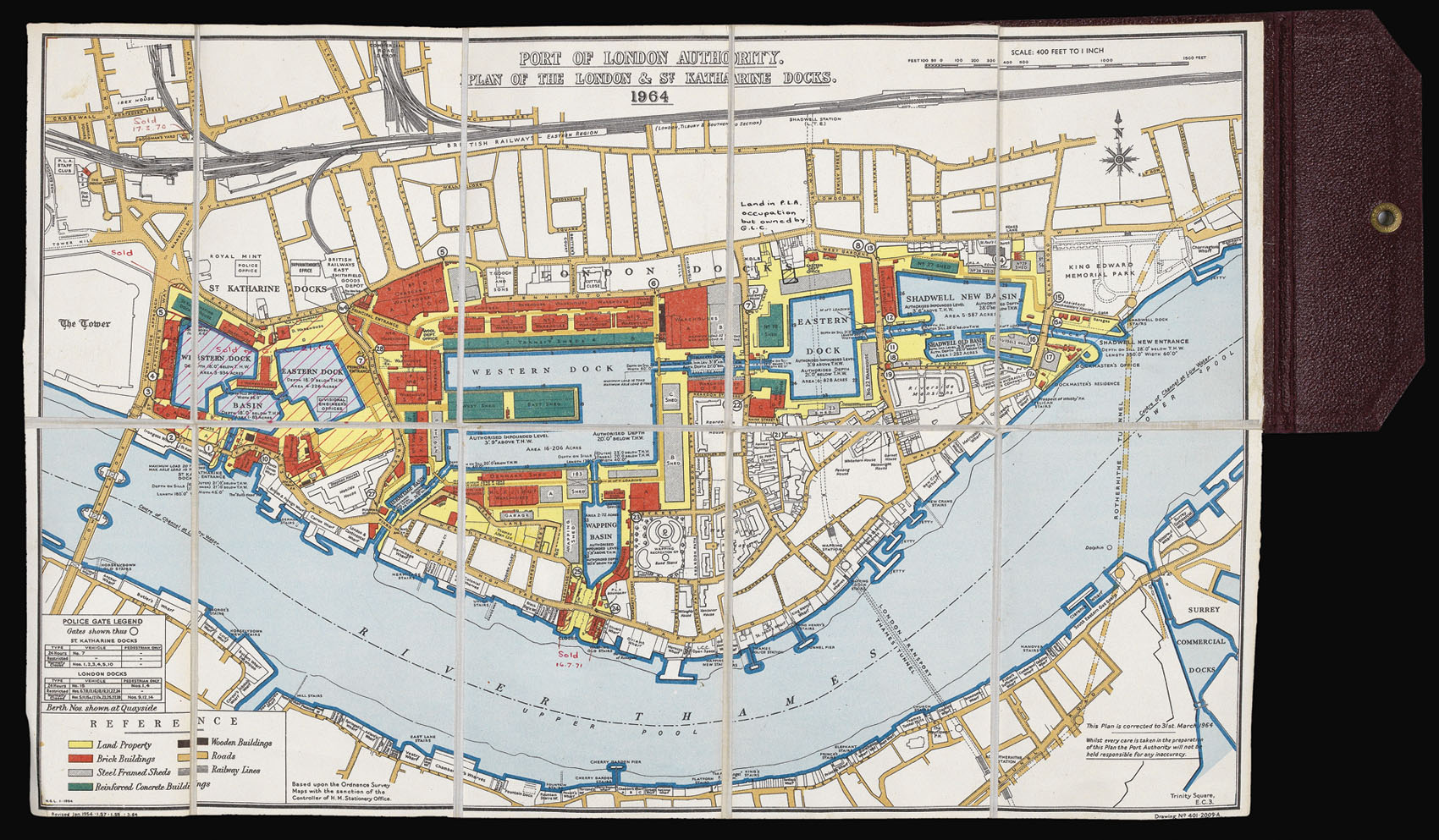
In the early nineteenth century the Port of London came under pressure, and new docks were needed. Parliament selected a site in the Docklands in 1825, and construction began in 1827. The new docks were designed by Thomas Telford, a prominent contemporary civil engineer known as 'The Colossus of Roads', after overseeing several highway-building projects. It was his only major project in London, carving out two basins from the Thames accessed through a lock. The docks were m...
In the early nineteenth century the Port of London came under pressure, and new docks were needed. Parliament selected a site in the Docklands in 1825, and construction began in 1827. The new docks were designed by Thomas Telford, a prominent contemporary civil engineer known as 'The Colossus of Roads', after overseeing several highway-building projects. It was his only major project in London, carving out two basins from the Thames accessed through a lock. The docks were made so that ships could unload directly from the water into the warehouses, reducing the quayside traffic.
The new docks were named after St Katharine's Hospital, founded by Matilda of Boulogne in 1147, which was demolished along with the slums that had grown up around it to make way for the new development. The area was particularly popular with foreign craftsmen, as it was exempt from the London guild restrictions.
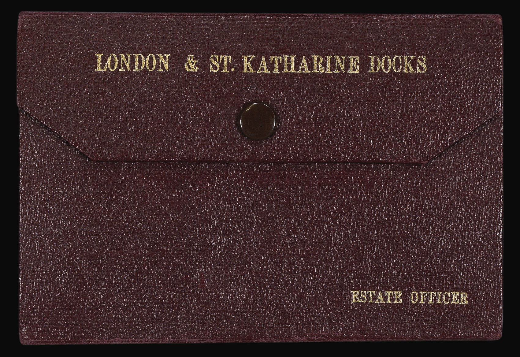
This map was owned by the Estate Officer, and contains annotations showing when land and buildings on the estate were sold off. The docks have now been redeveloped as housing.
The Port of London Authority was formed in 1909. It was prompted by a series of industrial actions by dock workers, including their demand for the 'Docker's Tanner', a wage of 6d. an hour, in 1889. The Port was a vital part of the British economy: refining and processing industries grew up around goods brought in to the docks and it was the centre of British shipbuilding and repair. The PLA continues to supervise and manage the Port of London, the docks, and the London stretch of the River Thames. This map was issued from the former PLA headquarters in Trinity Square.