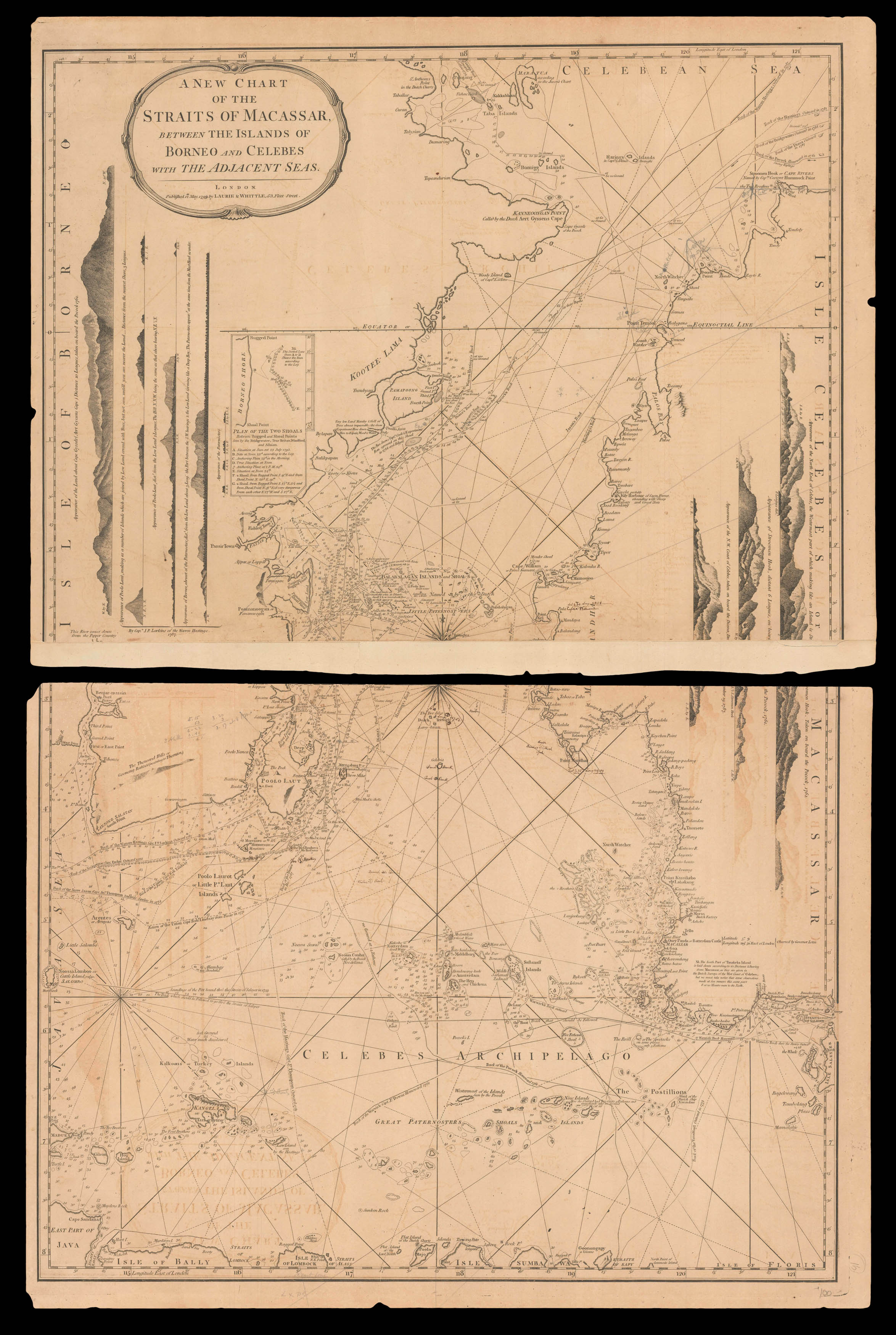
A new chart of the Straits of Macassar between the islands of Borneo and Celebes with the adjacent seas.
London,
Laurie & Whittle,
12th May 1799.
Engraved chart on two sheets, joined.
640 by 470mm. (25.25 by 18.5 inches).
17614
notes:
An exceptionally detailed chart of the Celebes archipelago and the relatively narrow strait between the islands of Borneo and Celebes. The tracks of several English vessels from the late 1780s are recorded, and the chart is filled with helpful notes and depth soundings. Coastal profiles are included along the side edges.
From Laurie & Whittle's 'East India Pilot', which was published as a practical guide to navigators aboard ships of the Royal Navy and East India...
From Laurie & Whittle's 'East India Pilot', which was published as a practical guide to navigators aboard ships of the Royal Navy and East India...
bibliography:
provenance:
With numerous annotations in pencil and in ink, recording positions of previously unrecorded shoals.


