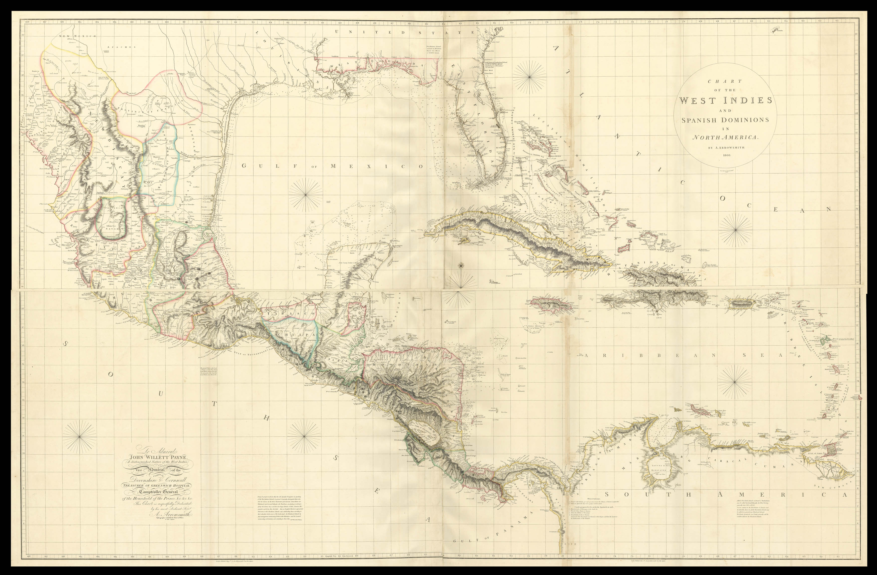
and Spanish Dominions in North America. By A. Arrowsmith. 1803. To Admiral John Willett Payne (A distinguished Native of the West Indies.) Vice Admiral... Treasurer of Greenwich Hospital. Comptroller General of the Household of the Prince, &c.. &c., &c. This Chart is respectfully Dedicated by his most obedient Serv[an]t. A. Arrowsmith. Hydrographer to H.R.H. the Prince of Wales. 10 Soho Square.
First edition of this large and detailed map of the Caribbean and Mexico, extending from Mexico's Pacific coast to the Leeward Islands, and so incorporating the whole of the Caribbean, and with a dedication to Admiral John Willett Payne.
This monumental map was at the time of publication, the most accurate survey of the region. Arrowsmith drew on the best available information, most notably the pre-Revolutionary War surveys of John William Gerard De Brahm (Georg...
First edition of this large and detailed map of the Caribbean and Mexico, extending from Mexico's Pacific coast to the Leeward Islands, and so incorporating the whole of the Caribbean, and with a dedication to Admiral John Willett Payne.
This monumental map was at the time of publication, the most accurate survey of the region. Arrowsmith drew on the best available information, most notably the pre-Revolutionary War surveys of John William Gerard De Brahm (Georgia), Bernard Romans (Florida), and the Spanish coastal surveys for Texas and the Gulf of Mexico. Streeter mentions one particular chart the 'Carta Esferica' of 1799 - the first to name the bays of Galveston and Bernardo - from which Arrowsmith based much of the coastline, but notably with the longitude of the Sabine Pass greatly improved. The later editions of Arrowsmith's map only extend to the east coast of Mexico, presumably because Arrowsmith published his large map of Mexico in 1810.
John Willett Payne (1752-1803), a British rear-admiral born on St. Kitts in the West Indies, would seem to have been the perfect dedicatee. In peacetime he became the private secretary, comptroller of the household, and personal friend of the Prince of Wales. The DNB notes drily "There is no doubt that he was the associate of the prince in his vices and his supporter in his baser intrigues". In 1780 he became Member of Parliament for Huntingdon. Returning to the sea in 1793 he played a distinguished part in the battle of the 'Glorious First of June', 1794, for which he received the gold medal. In 1799 he was promoted to the rank of rear-admiral, and in August he was appointed treasurer of Greenwich Hospital, where he died.
Aaron Arrowsmith (1750-1823) was the finest cartographer of his generation. Although he received little formal education it is believed that he was taught some mathematical instruction by William Emerson, author of several books on the application of mathematics to the area of cartography. Around 1770, Arrowsmith moved to London to seek employment. It is believed that he worked for William Faden before joining John Cary Sr. in the early 1780s. There he provided the measurements for John Cary's early publication detailing the roads from London to Falmouth, his first signed work. Arrowsmith set up on his own in 1790 and over the next thirty years produced some of the most beautiful and elegant maps of the era.
Stevens and Tree only list two editions, 1803 and 1810, but Phillips lists an 1811 and an 1816 edition.