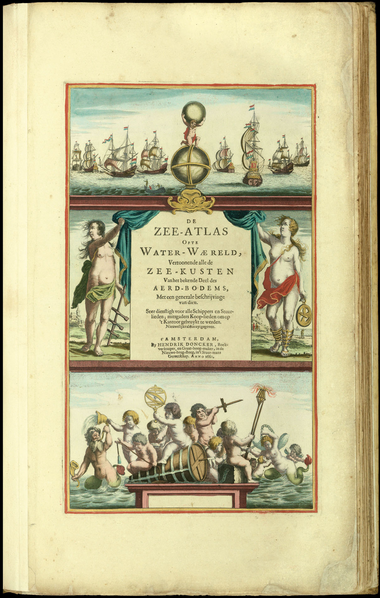
Vertoonende all de Zee-Kusten Van het bekende Deel des Aerd-Bodems, Met een generale beschrijvinge van dien. Seer dienstigh vooralle Schippers en Stuurlieden; mitsgaders Koop-lieden om op't Kantoor gebruykt te werden Nieuwelijks aldus uytgegeven.
By Hendrik Doncker, Boekverkooper, en Graat-boog-maker, in de Nieuwe-brug-steeg, in 't Stuur-mans Gerectschap,
1660.
Folio atlas (540 by 340mm), title, preface, index, 22pp. text, 21 double-page engraved charts, FINE ORIGINAL OUTLINE HAND-COLOUR, HEIGHTENED IN GOLD, contemporary vellum, remains of green cloth ties.
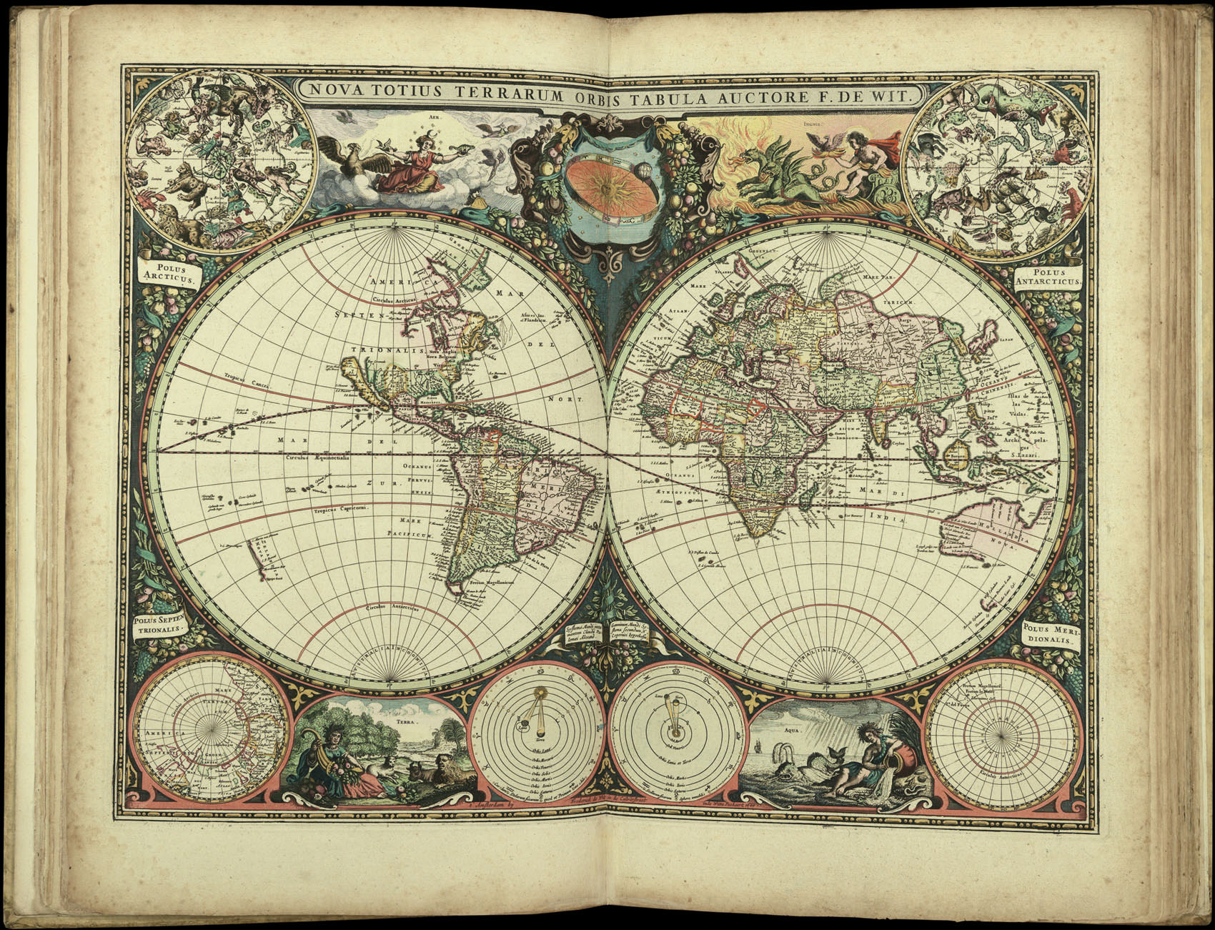
Although not the first to publish a sea atlas in Amsterdam – that honour went to Janssonius – the first edition of Doncker's 'Zee-Atlas', published in 1659, was superior both in coverage and utility to the rival publications of Johannes Janssonius and Arnold Colom, neither of which were reprinted after 1659.
Koeman notes: "Doncker's charts were the most up-to-date in the second half of the seventeenth century. Although there is some similarity to those charts pu...
Although not the first to publish a sea atlas in Amsterdam – that honour went to Janssonius – the first edition of Doncker's 'Zee-Atlas', published in 1659, was superior both in coverage and utility to the rival publications of Johannes Janssonius and Arnold Colom, neither of which were reprinted after 1659.
Koeman notes: "Doncker's charts were the most up-to-date in the second half of the seventeenth century. Although there is some similarity to those charts published by Van Loon, Goos, Lootsman, and Doncker, the latter's charts are original. More frequently than... [his] contemporaries, Hendrik Doncker corrected and improved his charts. He often replaced obsolete charts by new ones... This consciousness of the high demands of correctness is reflected by the development of Doncker's sea atlas".
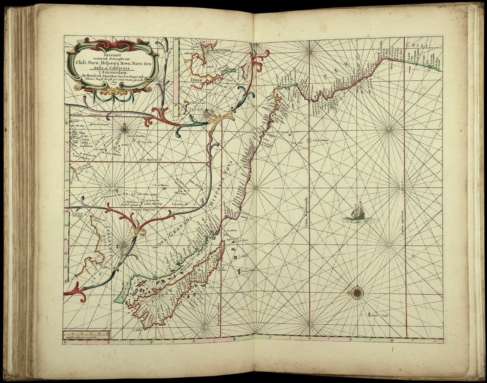
The list of charts in the atlas conforms to Koeman Don 9A, with the dedication and introduction taken from the 1660 edition but containing the additional charts up until 1665. Seven of the charts bear the date 1664, with a further two dated 1665.
The first edition of the 'Zee-Atlas' was published in 1659, and only one example of that edition is known, in the National Library of Australia. Between then and 1669 the number of maps was extended from nineteen to fifty. In 1676 Doncker introduced the larger format 'De nieuwe groote vermeerderde Zeeatlas'. The atlas was re-issued until as late as the early 1700s when it was published by Doncker's son, also Hendrick, who continued the business following his father's death in 1699.
All editions of Doncker's atlas are rare. We are only able to trace four examples coming up at auction in the last 30 years.