Second issue of Doncker's chart of the Pacific coast of North and South America from Doncker's 'Zee-Atlas'; distinguished by the addition of the outline of the Yucatan Peninsula and the east / Gulf coast of Central America. California is prominently depicted as an island. With three vignettes of the discoveries of Abel Jansz. Tasman in New Zealand; Maerten Gerritsz Vries's voyage around northern Japan; and the Ladrones islands in the Pacific.
The first edition o...
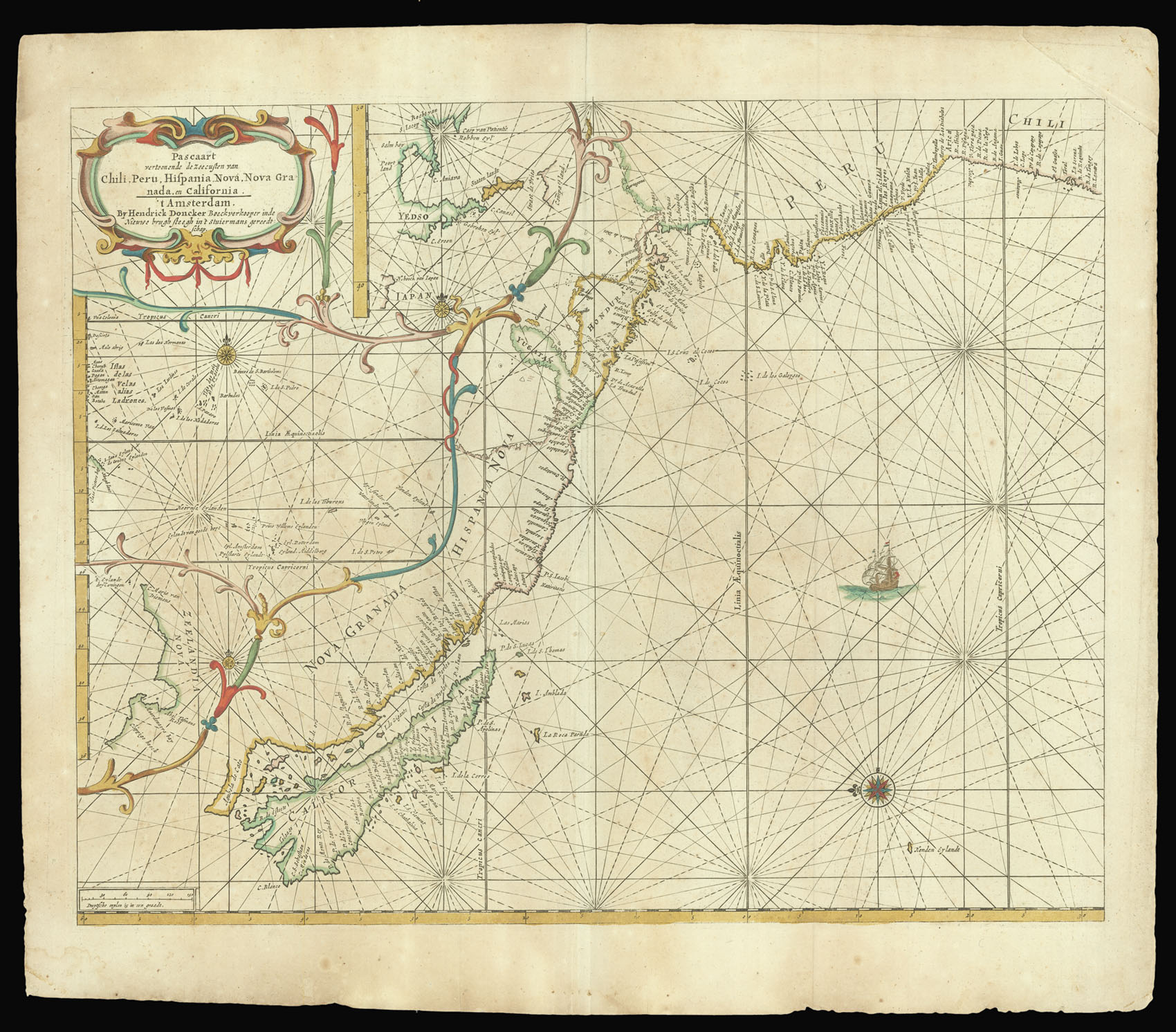
Second issue of Doncker's chart of the Pacific coast of North and South America from Doncker's 'Zee-Atlas'; distinguished by the addition of the outline of the Yucatan Peninsula and the east / Gulf coast of Central America. California is prominently depicted as an island. With three vignettes of the discoveries of Abel Jansz. Tasman in New Zealand; Maerten Gerritsz Vries's voyage around northern Japan; and the Ladrones islands in the Pacific.
The first edition of the 'Zee-Atlas' was published in 1659, and only one example of that edition is known, in the National Libary of Australia. Between then and 1669 the number of maps was extended from nineteen to fifty. In 1676 Doncker introduced the larger format 'De nieuwe groote vermeerderde Zeeatlas'. The atlas was re-issued until as late as the early 1700s when it was published by Doncker's son, also Hendrick, who continued the business following his father's death in 1699.