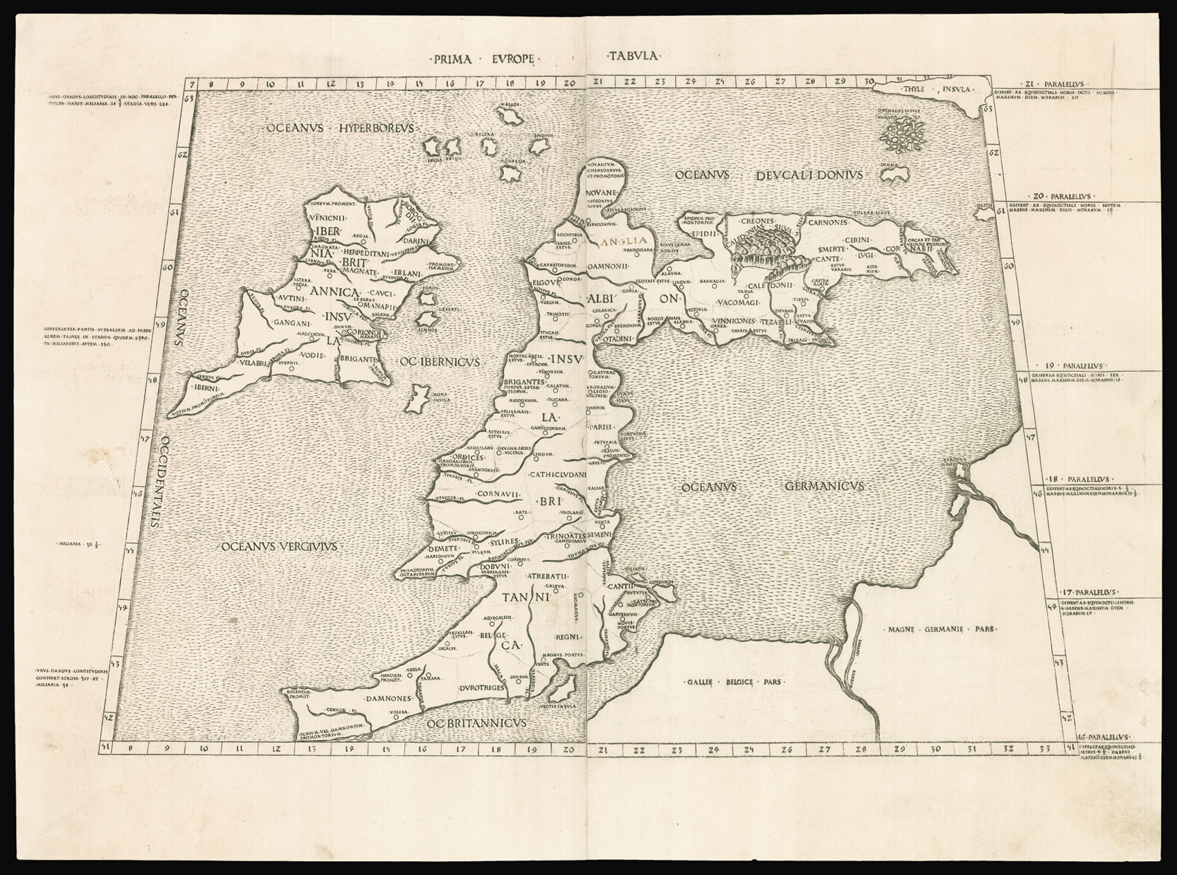
The second printed map of the British Isles, and a representation of what Ptolemy considered to be the edge of the known world. The coastline is harshly rendered, Ireland is too far north, and Scotland is elongated and droops to the right. The main towns are highlighted with a circle and a dot, whilst the sea is pock-marked.
"This handsome edition is a reprinting of the copper-plate maps of the 1478 Ptolemy [the first Rome edition by Conrad Sweynheym and Arnold B...
The second printed map of the British Isles, and a representation of what Ptolemy considered to be the edge of the known world. The coastline is harshly rendered, Ireland is too far north, and Scotland is elongated and droops to the right. The main towns are highlighted with a circle and a dot, whilst the sea is pock-marked.
"This handsome edition is a reprinting of the copper-plate maps of the 1478 Ptolemy [the first Rome edition by Conrad Sweynheym and Arnold Buckinck, whose] maps are considered the finest Ptolemaic ones produced up to the time that the great Mercator engraved his Ptolemy of 1578... It is believed that Sweynheym was the one who first thought of applying the very new art of copper-engraving to the printing of maps, and he might have taken a hand in the actual engraving of them himself" (World Encompassed). While the Bologna edition of 1477 was the first atlas to use copperplate maps, the present series is generally regarded as superior for its clear captions, accurate projections and overall design. Also, there are indications the Bologna edition was hurried through the press: the captions were not engraved but stamped into the plates. The early Italian Ptolemys, particularly the Rome editions, are "superb testimonials of Italian craftsmanship without the picturesque but unscientific monsters of the medieval maps or the addition of the adventitious decoration of later work, relying for their beauty solely on the delicacy of their execution and the fineness of the material employed" (Tooley).