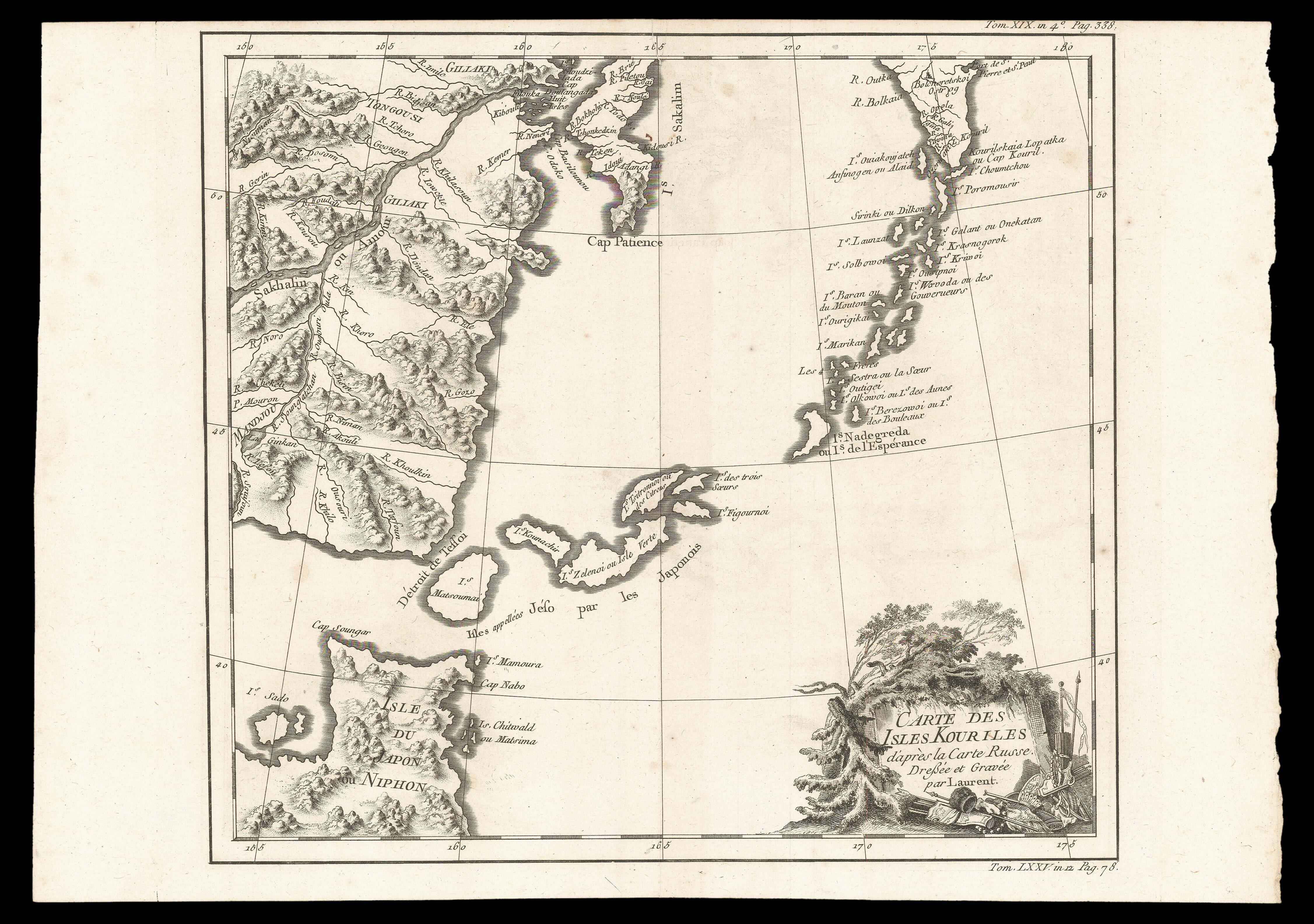
A map of Northern Japan and the contiguous islands and coastline. The second state of Jacques Nicolas Bellin's map of the Kuril Islands.
Jacques-Nicolas Bellin (1703-1772) was among the most important mapmakers of the eighteenth century. In 1721, at the age of eighteen, he was appointed hydrographer (chief cartographer) to the French Navy. In August 1741, he became the first Ingénieur de la Marine of the Depot des cartes et plans de la Marine (the French Hydrogr...
A map of Northern Japan and the contiguous islands and coastline. The second state of Jacques Nicolas Bellin's map of the Kuril Islands.
Jacques-Nicolas Bellin (1703-1772) was among the most important mapmakers of the eighteenth century. In 1721, at the age of eighteen, he was appointed hydrographer (chief cartographer) to the French Navy. In August 1741, he became the first Ingénieur de la Marine of the Depot des cartes et plans de la Marine (the French Hydrographic Office) and was named Official Hydrographer of the French King.
During his term as Official Hydrographer, the Depot was the single most active centre for the production of sea charts and maps, including a large folio format sea-chart of France, the Neptune Francois. He also produced a number of sea-atlases of the world, e.g., the Atlas Maritime and the Hydrographie Francaise. These gained fame, distinction, and respect all over Europe and were republished throughout the eighteenth and even in the succeeding century.
Bellin also produced maps of smaller format, such as the 1764 Petit Atlas Maritime, containing 580 finely detailed charts. He contributed a few maps to the 15-volume Histoire Generale des Voyages of Antoine François Prévost or simply known l'Abbe Prevost.
Bellin set a very high standard of workmanship and accuracy, thus can be regarded as a leading role in European cartography and geography.