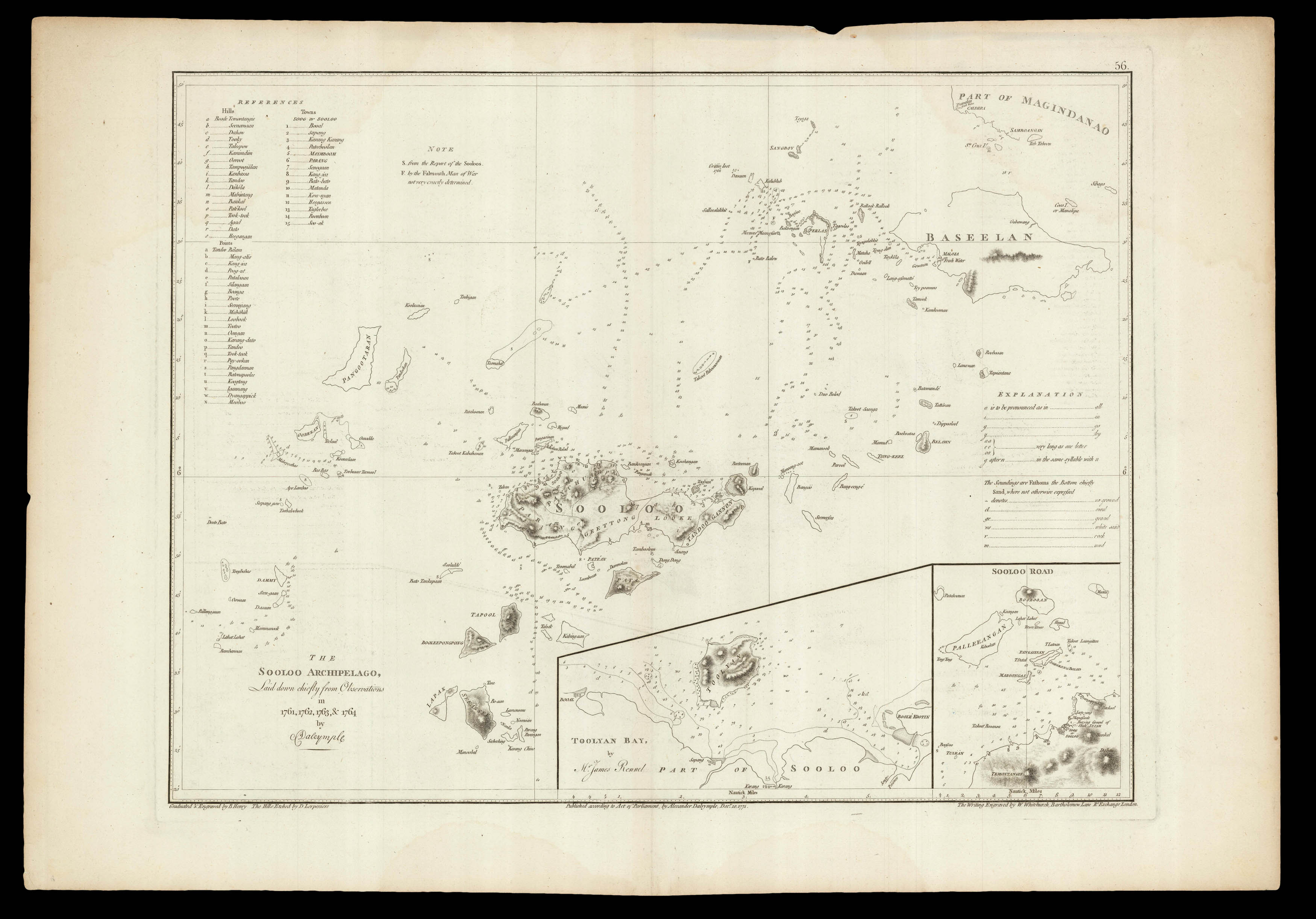
Navigable chart of the, present-day, Sulu Archipelago, northeast of Borneo, with two smaller inset charts of "Sooloo Road" and "Toolyan Bay" by James Rennel. As early as April 1766, Dalrymple had approached the EIC with the idea of issuing a series of uniform charts of Borneo, Palawan, Mindanao, and Sulu, that would help to promote his plan of creating a trading settlement on the island of Balambangan. The charts would be based on his own observations made during his two vo...
Navigable chart of the, present-day, Sulu Archipelago, northeast of Borneo, with two smaller inset charts of "Sooloo Road" and "Toolyan Bay" by James Rennel. As early as April 1766, Dalrymple had approached the EIC with the idea of issuing a series of uniform charts of Borneo, Palawan, Mindanao, and Sulu, that would help to promote his plan of creating a trading settlement on the island of Balambangan. The charts would be based on his own observations made during his two voyages to the area. In 1769 the EIC issued Dalrymple with a grant to support his project, which resulted in 'A collection of Charts and Memoirs' (1772).
"Graduated & Engraved by B. Henry. The Hills Etched by D. Lerpeniere. The Writing Engraved by W. Whitchurch, Bartholomew Lane R.l Exchange, London", the chart was included in Dalrymple's rare pilot 'General Introduction to the Charts and Memoirs', 1772; and subsequently published in d'Apres de Mannevillette's 'Le Neptune Oriental'.
The first hydrographer to the British Admiralty, Alexander Dalrymple (1737-1808) is best known for his researches regarding a great Southern Continent, as well as a proponent of the search for the Northwest Passage (thereby influencing Vancouver's survey). Through family connections, Dalrymple was made a "writer" (the most junior position) for the East India Company and sent to Madras where he arrived in May 1753. He was afforded access to Robert Orme's library and grew increasingly fascinated with the EIC's activities in Burma, Indo-China and Borneo. He turned down a promotion so that he might undertake a voyage to the east of his own. "In February 1759, Pigot freighted the Cuddalore (Captain George Baker) for Dalrymple 'to attempt to discover a new route to China through the Molucca Islands and New Guinea'. Dalrymple made three voyages between 1759 and 1764 to the Philippines, Borneo, and Sulu. In the first, based at Canton (Guangzhou), he reconnoitred Borneo, the Philippines, and the coast of Cochin-China. For the second, in the London in 1762, he had James Rennell as companion for a voyage to Sulu and Balambangan, where he had obtained for the company a grant of land. In Madras in 1763 he went through the formality of resignation, confident of reinstatement, to return to London to promote a trading settlement at Balambangan. En route to Canton for passage to England he became provisional deputy governor at Manila for a short period in April 1764, in the aftermath of the treaty of Paris, and he arrived in London in the summer of 1765 …" (ODNB)