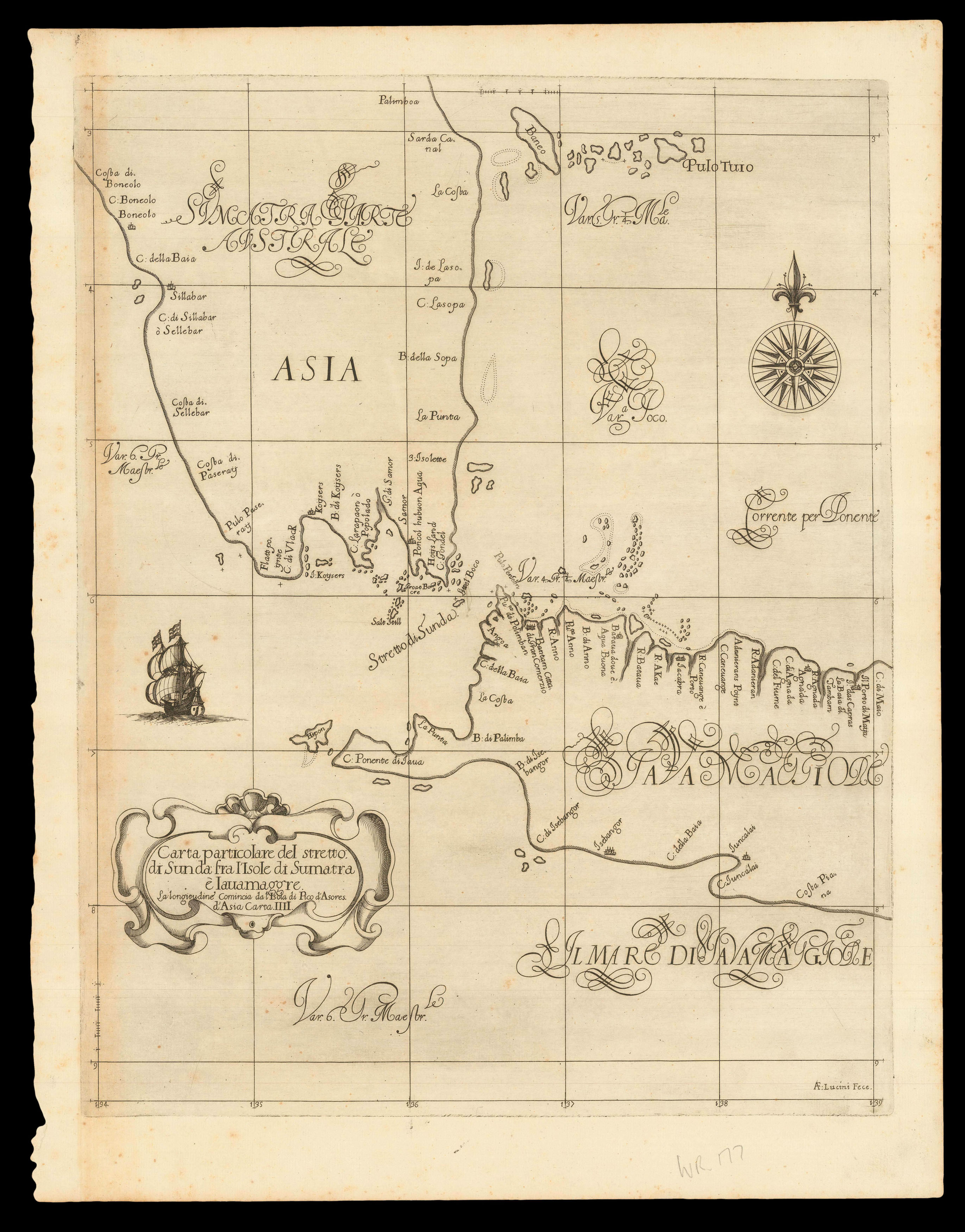
Dudley's beautiful chart of the Sunda Strait between the island of Sumatra and Java, showing Batavia, other coastal towns, harbours and islands. The chart is based on various sources, but essentially expands on the first large-scale map of the Strait by Lucas Janszoon Waghenaer in his 'Thresoor' of 1602. The Strait had been of great importance to the Dutch in their early attempts to establish a stronghold in Southeast Asia as the Malacca Strait, between Sumatra and the Mala...
Dudley's beautiful chart of the Sunda Strait between the island of Sumatra and Java, showing Batavia, other coastal towns, harbours and islands. The chart is based on various sources, but essentially expands on the first large-scale map of the Strait by Lucas Janszoon Waghenaer in his 'Thresoor' of 1602. The Strait had been of great importance to the Dutch in their early attempts to establish a stronghold in Southeast Asia as the Malacca Strait, between Sumatra and the Malay peninsula, had been historically controlled by the Portuguese.
From the first edition of 'Dell'arcano del mare, di D. Ruberto Dudleo Ducadi Nortumbria e conte di vvarvich, libri sei...'.
The 'Arcano del Mare', one the "greatest atlases of the world" (Wardington), was first published in 1646 when its author, Robert Dudley, was 73, it was not only the first sea atlas of the world, but also the first to use Mercator's projection; the earliest to show magnetic deviation; the first to show currents and prevailing winds; the first to expound the advantages of 'Great Circle Sailing' – the shortest distance between two points on a globe; and "perhaps less importantly the first sea-atlas to be compiled by an Englishman, albeit abroad in Italy" (Wardington).
Robert Dudley (1574-1649) was the son of the Earl of Leicester (the one time favourite of Elizabeth I) and Lady Douglas Sheffield, the widow of Lord Sheffield. Although born out of wedlock, Robert received the education and privileges of a Tudor nobleman. He seems to have been interested in naval matters from an early age, and in 1594, at the age of 21, he led an expedition to the Orinoco River and Guiana. He would later, like all good Tudor seamen, sack Cadiz, an achievement for which he was knighted.
His success upon the high-seas was not matched, unfortunately, by his luck at court, and at the beginning of the seventeenth century he was forced to flee, along with his cousin Elizabeth Southwell, to Europe. Eventually, in 1606, he ended up in Leghorn, Italy, which he set about turning into a great international naval and commercial seaport, in the service of Ferdinand I. Dudley, successful at last, married his cousin, converted to Catholicism, helped Ferdinand wage war against the Mediterranean pirates, by designing and building a new fleet of fighting ships for the Italian navy, served as Grand Chamberlain to three Grand-Duchesses of Tuscany in succession: Maria Maddelena, widow of Cosimo II; then Christina of Lorraine, widow of Ferdinand I; then to Vittoria della Rovere, Princess of Urbino, and wife of Ferdinand II, who created Dudley Duke of Northumberland.
bibliography:
bibliography:
Suarez 'Early Mapping of Southeast Asia', pages 205-207