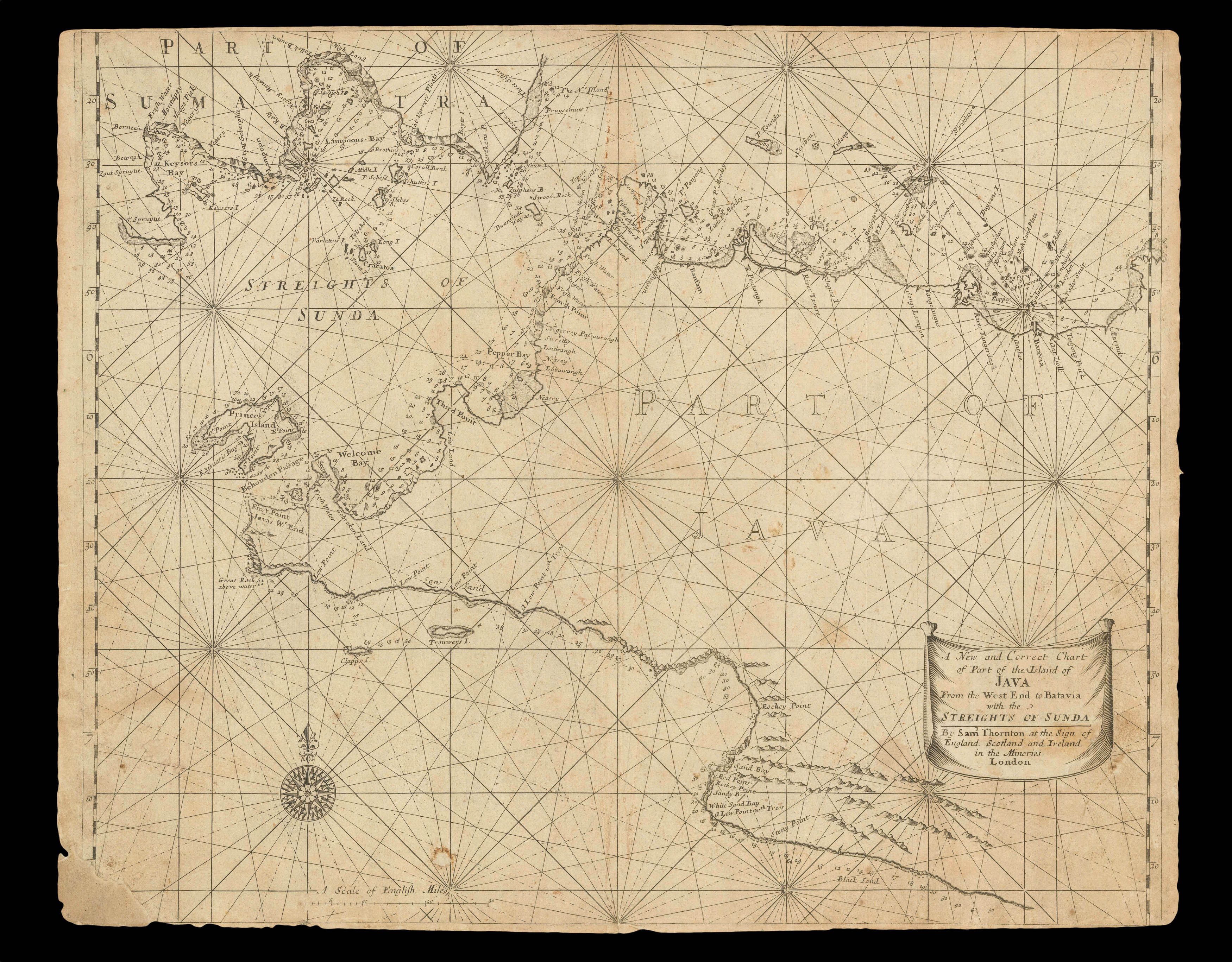
The important Sunda Strait lies between the southern tip of Sumatra and the western end of Java to Batavia. This large-scale and detailed chart pays particular attention to the numerous treacherous islands which pilots must navigate.
The great 'English Pilot' project had been started by John Seller in 1671, with the first edition of the 'Oriental Navigation (Third Book)' published in 1675. Seller's financial troubles, however, precluded any further editions, and...
The important Sunda Strait lies between the southern tip of Sumatra and the western end of Java to Batavia. This large-scale and detailed chart pays particular attention to the numerous treacherous islands which pilots must navigate.
The great 'English Pilot' project had been started by John Seller in 1671, with the first edition of the 'Oriental Navigation (Third Book)' published in 1675. Seller's financial troubles, however, precluded any further editions, and it was not until four years after his death, in 1701, that the 'Third Book' was reissued by Thomas Mount and William Page. To confuse matters, John Thornton published a rival edition in 1703. Thornton was part of the consortium that had overseen the publication of the first edition of 1675, and his position as hydrographer to the East India Company meant he had a ready supply of charts of the area. A subsequent edition of 1711 would be published by his son Samuel and, after Samuel's death in 1715, the plates were acquired by William Mount and Thomas Page. The following year they issued a new edition complete with Thornton's charts.
John Thornton (1641-1708) was a leading English chart-maker, active between 1667 and 1708. He was apprenticed to John Burston in the Draper's Company in 1656; at the time, and despite the name, the Draper's Company was the epicentre for the leading makers of manuscript charts in England, with Burston a prominent figure in the "school" and Thornton emerges as a skilled practitioner both as a maker, and possibly as an engraver. He described himself as Hydrographer to the East India Company and Hydrographer to the Hudson Bay Company, although he is not recorded as such in the records of either company.
He was the first member of the "school" to make the transition from manuscript to printed charts, publishing three charts relating to the Americas or Atlantic in 1673, but his career path changed dramatically in 1677 when he entered into partnership with a group, including William Fisher, to assist John Seller in continuing his chart publishing business. When the partnership ended Thornton retained some of Seller's materials, and moved firmly into publishing.
The core of his business was chart publishing, the most important of his atlases being the 'English Pilot. The Fourth Book' (1689), the first English sea atlas devoted to the English colonies in North America and the West Indies, published jointly with William Fisher, and much reprinted. He also published 'The English Pilot. The Third Book … the Oriental Navigation' (1703), the first printed sea atlas of southeast Asia and the East Indies.
John was succeeded by his son Samuel (c1665–1712) on his death in 1708, but Samuel died shortly after, and the stock was acquired by Mount and Page.