The signing of the Twelve Year Truce in 1609, by the Dutch Republic, the Southern Netherlands and Hapsburg Spain, proved a catalyst for another version of the Leo Belgicus.
In around 1611, Claes Janszoon Visscher published his 'Bestandskaart' or 'Truce Map' - "one of the peaks of 17th century cartography" (van der Heijden) – a lion at rest in a sitting position, his right paw on the hilt of a lowered sword. The map is replete with allusions to the fruits of pea...
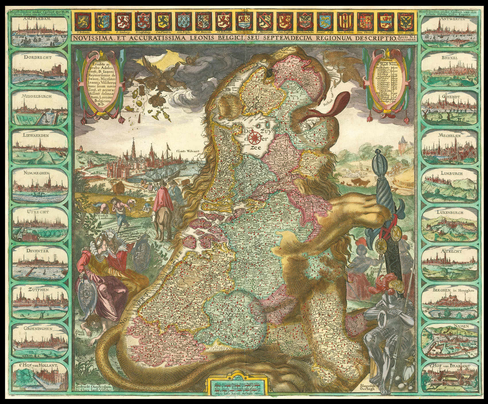
The signing of the Twelve Year Truce in 1609, by the Dutch Republic, the Southern Netherlands and Hapsburg Spain, proved a catalyst for another version of the Leo Belgicus.
In around 1611, Claes Janszoon Visscher published his 'Bestandskaart' or 'Truce Map' - "one of the peaks of 17th century cartography" (van der Heijden) – a lion at rest in a sitting position, his right paw on the hilt of a lowered sword. The map is replete with allusions to the fruits of peace: to the right of the lion, war – personified by a knight in a full suit of armour – is shown asleep, and to the left personifications of North and South are shown seated together with 'd'Oude Twist' (the old rancour) buried under foot. A cherub pours the sweet nectar of the 'Bestant van 12 jaer' (the 12 Year Truce) into the mouth of the lion; heavenly blessing ('zeghen des hemels' )descends upon the country. These bring with it arts and sciences ('Const en Wetenschap'); safety ('Vailighe Tijdt'); knowledge and wealth ('Kennisse en Rijkdom'); prosperous towns (' 't Vergrooten der Steden'); the cultivation of the land (' 't Vredich Lantbouwen'); and trade ('Coophandel'). Yet even in these peaceful times, the frontier guard ('Frontier Wacht') remains alert.
Although the map celebrated the truce, it also implied – with the personification of north and south - the break-up of the XVII Provinces. This is further re-enforced by the individual north and south medallions that can be seen suspended from the lion's sword.