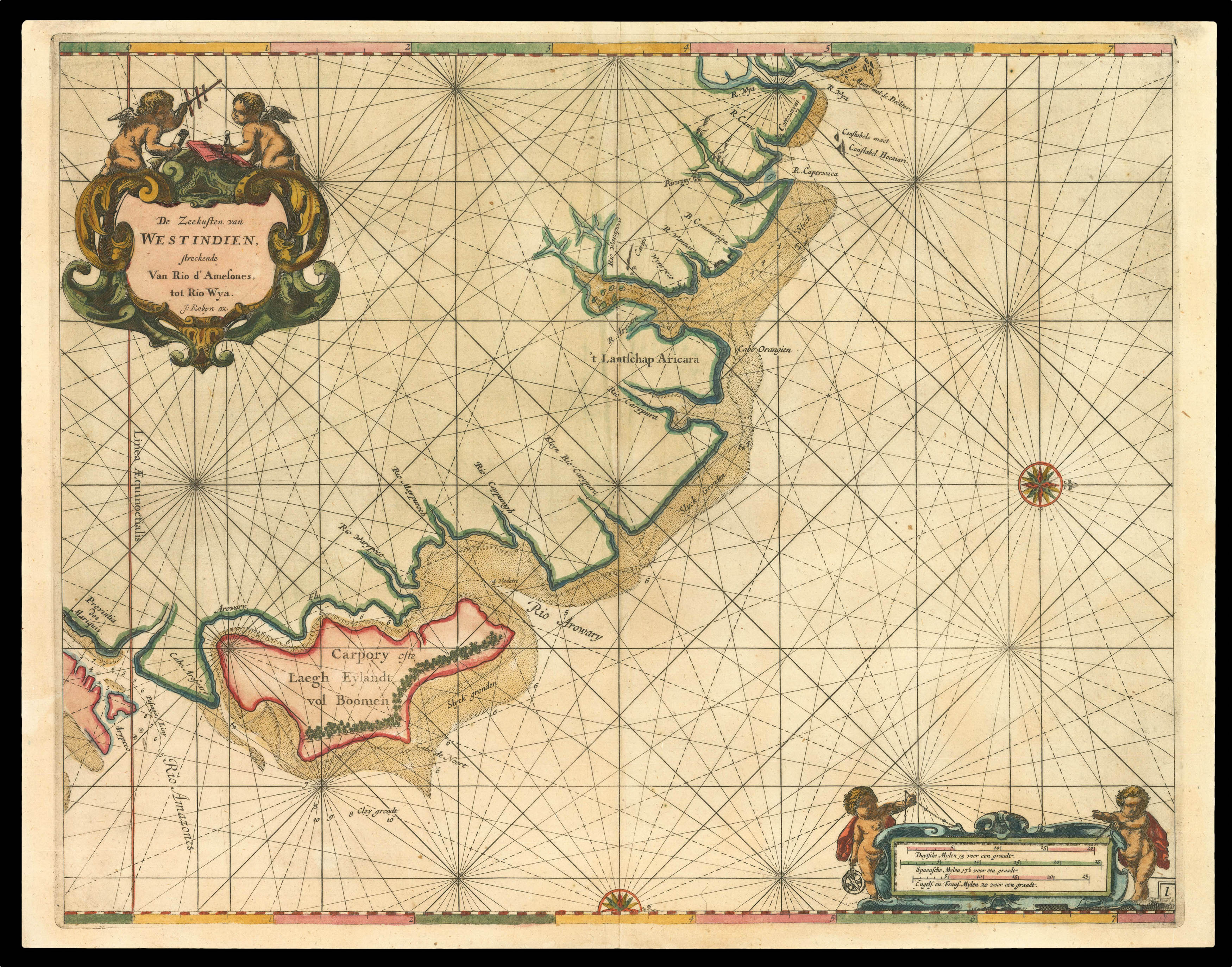
Roggeveen's rare large scale chart of the Amazonian delta - published in Roggeveen's exceedingly rare sea pilot 'Het Brandende Veen'.
This map shows the northern end of the Amazonian delta which empties out into the Atlantic to the lower leftmost corner, with the "Linea Aequinoetialis", or equator, clearly delineated. The coastal outline progresses into Brazil's northeastern coast in the Brazilian state of Amapa, whose River Oyapock (identified as "Rio Warypoco" ...
Roggeveen's rare large scale chart of the Amazonian delta - published in Roggeveen's exceedingly rare sea pilot 'Het Brandende Veen'.
This map shows the northern end of the Amazonian delta which empties out into the Atlantic to the lower leftmost corner, with the "Linea Aequinoetialis", or equator, clearly delineated. The coastal outline progresses into Brazil's northeastern coast in the Brazilian state of Amapa, whose River Oyapock (identified as "Rio Warypoco" in this map) marks the border between Brazil and French Guyana. Amapa was an historical administrative division of the former Portuguese colonial empires, who warded off English and Dutch invaders.
Roggeveen, born in Delshaven, came to Middleburg, the seat of both the Dutch East and West India Companies, in 1658. He worked for both companies teaching the art of navigation and helped to maintain their collections of hydrographic manuscripts and charts, including Spanish portolans of the West Indies. In the mid-1660s, assisted by his access to these collections, Roggeveen embarked upon compiling a series of large-scale charts of the North American coastline, West Indies, and, later, West Africa. Many of his charts are based upon the earlier large-scale work of Hessel Gerritsz and Joan Vingboons, both cartographers for the Dutch East and West India Companies, but Roggeveen's work was the first to show the whole coastline of North America and the Caribbean. He called this pilot 'Het Brandende Veen' or 'The Burning Fen'; a pun on his name, as 'veen' means 'fen', and a heap of burning fen represents a fire on the coast to guide or warn ships.
The first edition of the atlas was published in 1675 by Pieter Goos, however, due to the death of Goos in the same year, and that of Roggeveen four years later, a second edition would not be published until 1680, by which time the plates had been acquired by the chart dealer Jacobus Robijn. Robijn went on to republish the second edition in 1689, with a third edition appearing in 1698.