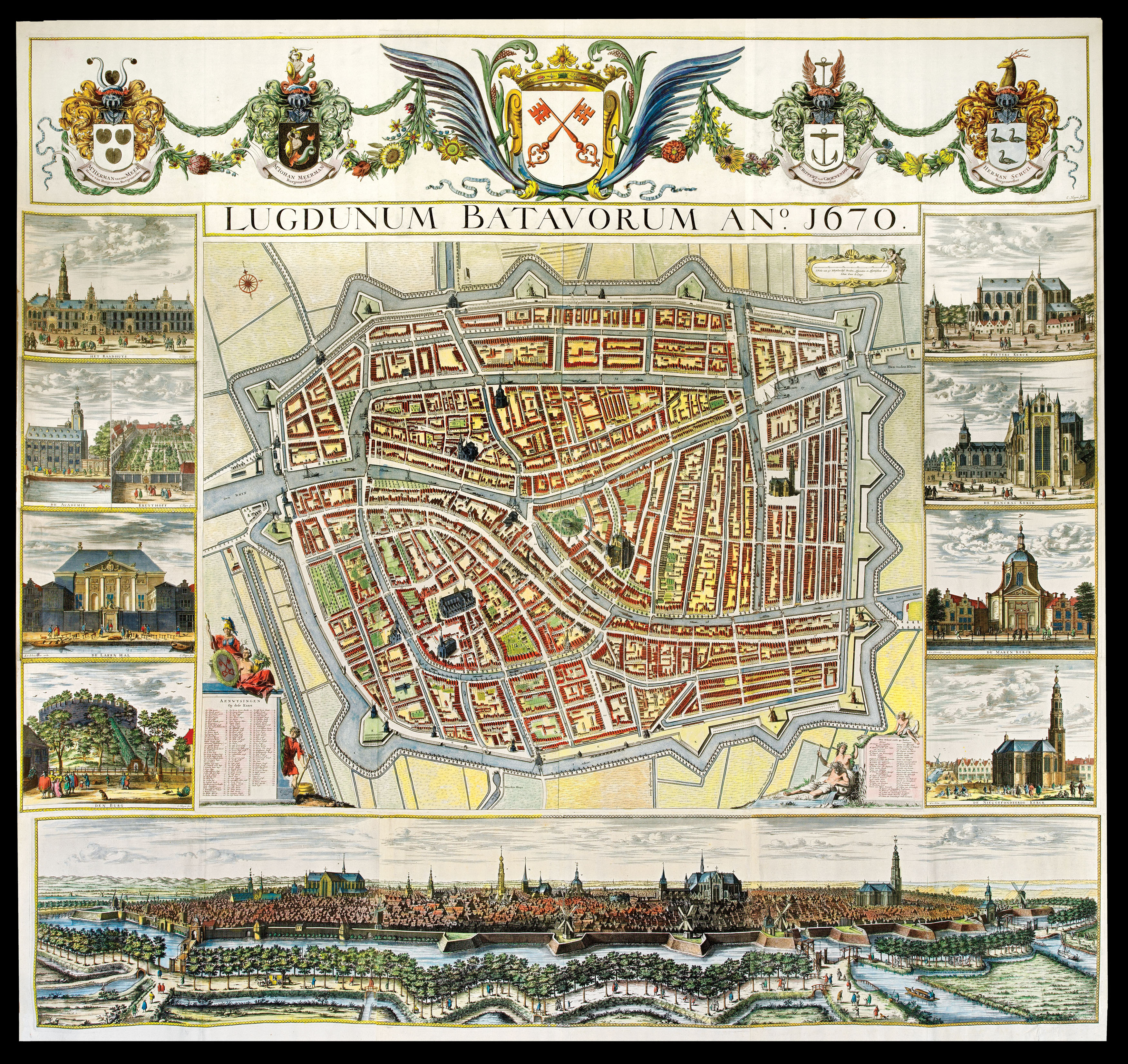
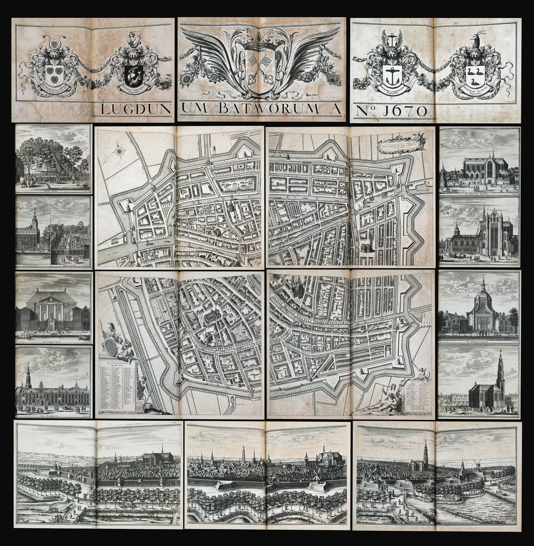
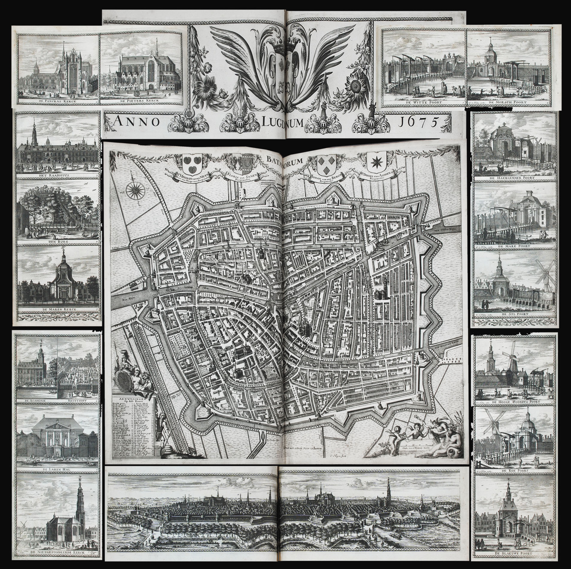
A fine wall map of Leiden, by Christiaan van der Hagen.
At the centre is a plan of Leiden, with a panorama of the city below, vignette views of notable landmarks to each side (among them Pieterskerk, the town hall, the university, the castle, and the cloth hall), and the elaborate coats-of-arms of the city and of the four mayors at the top. In the corners of the plan are cartouches, decorated with allegorical figures, which detail the names of streets and of buil...
A fine wall map of Leiden, by Christiaan van der Hagen.
At the centre is a plan of Leiden, with a panorama of the city below, vignette views of notable landmarks to each side (among them Pieterskerk, the town hall, the university, the castle, and the cloth hall), and the elaborate coats-of-arms of the city and of the four mayors at the top. In the corners of the plan are cartouches, decorated with allegorical figures, which detail the names of streets and of buildings, as well as the name of the sherif and of 40 council members.
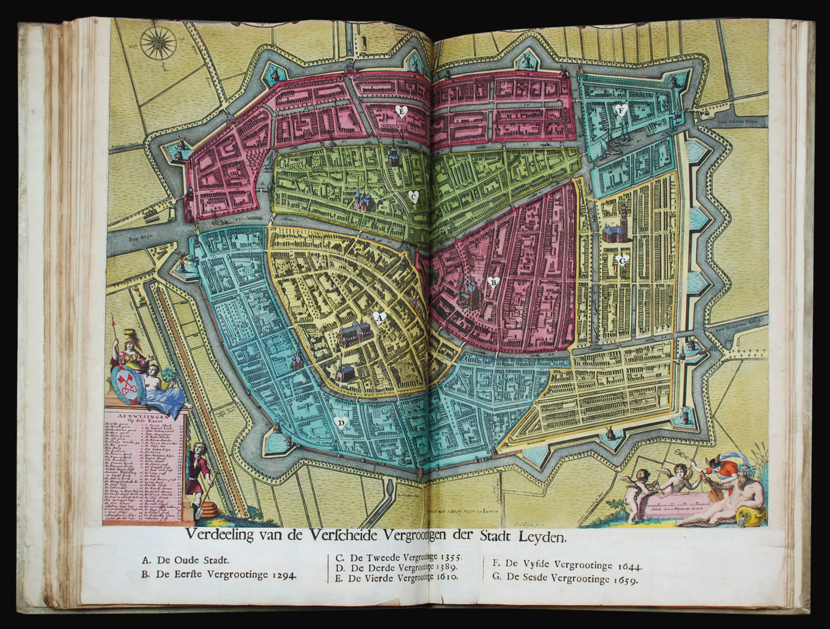
The turn of the seventeenth century was a period of significant growth for Leiden, both as a hub for trade, with the extensive migration of skilled Calvinist textile workers from the southern Netherlands, and as an intellectual centre, with its university, many printers, academic publishers, and bookshops. This growth also meant, however, that Leiden became increasingly overpopulated and dense with poor-quality, cramped, unsanitary housing. In response, the city expanded significantly, enlarged in 1611, to the north, and, in 1659, to the east, then surrounded by a defence-system of moats, walls, ramparts, and gates, visible on the present plan.
Once this expansion was complete, a new large-scale plan of Leiden was commissioned, in 1667, both to provide an up-to-date, accurate map, and to serve as a tool by which to advertise the city's new grandeur.
The map, which took the surveyor Jan Dou (1642-1690) over eighteen months to put together, was originally meant to be engraved and published by cartographic icon Johannes Blaeu (1596-1673). With Blaeu's publishing house, however, destroyed by fire in 1672, the work was ultimately completed by Christiaan van der Hagen (c1635-1688), who produced both this large wall-map, known as the "Grote Hagen", and a smaller one, for which works, today, he is best remembered.