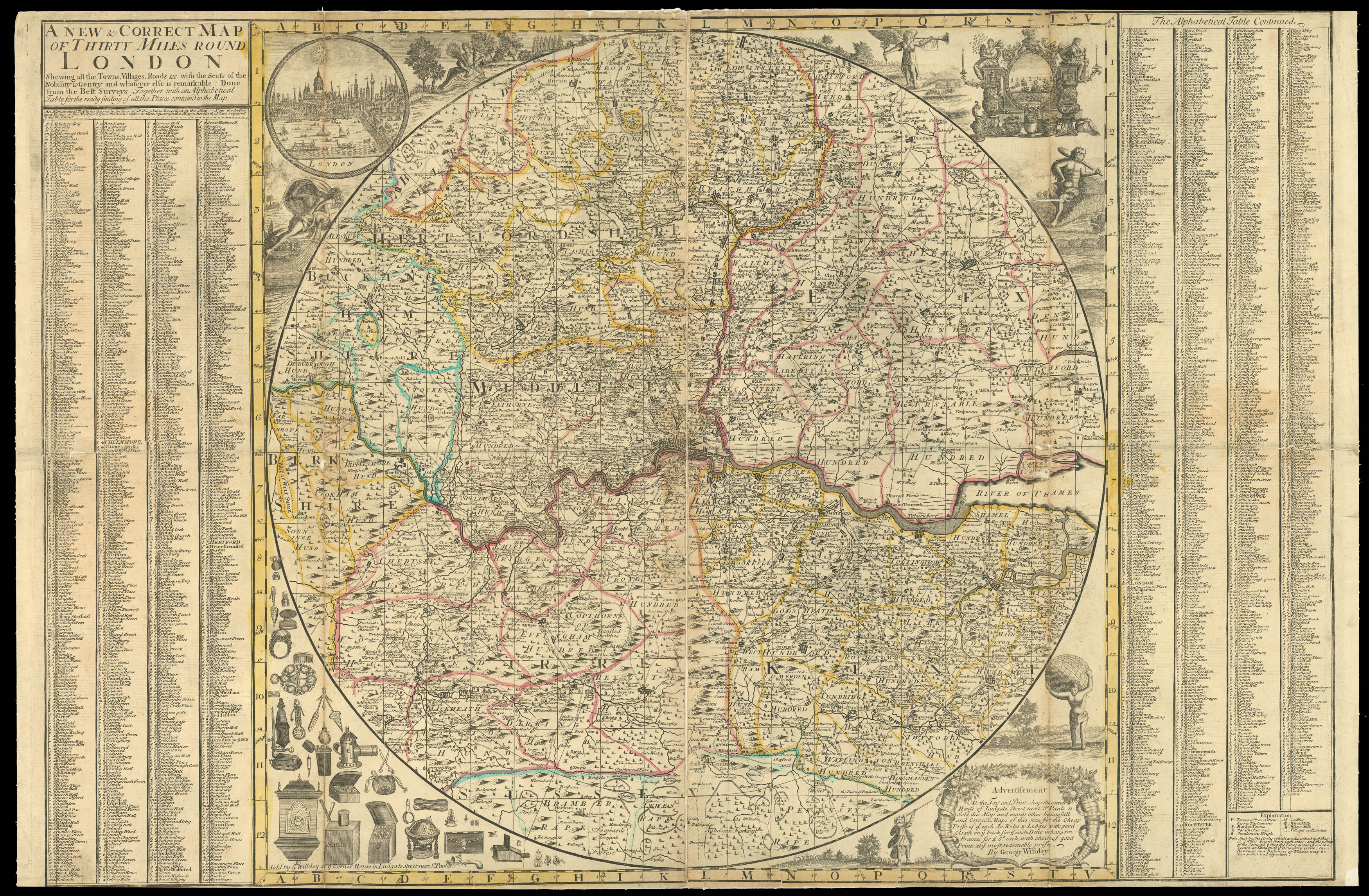
Shewing all the Towns, Villages, Roads &c with the Seats of the Nobility & Gentry & whatever else is remarkable: Done from the Best Surveys Together with an Alphabetical Table for the ready find of all the Places contain'd in the Map.
Sold by G. Willdey at ye Corner House in Ludgate Street next St. Pauls,
[c.1720].
Engraved circular map, on two sheets joined, hand-coloured in outline, table of place names to left and right of map, mounted on new linen, some minor loss to old folds, trimmed to upper and lower neatlines.
The map extends from Wokingham in the west to Rochford in the east, and from Stevenage in the north to Horsham in the south. the map bears grid lines for ease of reference, and a key to the bottom right gives details of towns, market towns, parish churches, gentlemen's houses, castles, windmills, watermills, villages, and hamlets. Surround the map are vignette view of London, upper left, London's commerce, upper right; depictions of Ceres, Hercules, a river god (probably th...
The map extends from Wokingham in the west to Rochford in the east, and from Stevenage in the north to Horsham in the south. the map bears grid lines for ease of reference, and a key to the bottom right gives details of towns, market towns, parish churches, gentlemen's houses, castles, windmills, watermills, villages, and hamlets. Surround the map are vignette view of London, upper left, London's commerce, upper right; depictions of Ceres, Hercules, a river god (probably the Thames), a winged messenger (most likely Mercury), and Atlas beard the world on his shoulders. Below the map are the goods available at Willdey's shop together with an advertisement, offering reasonably priced prints and maps.
George Willdey (fl.1707-1737) had broad commercial interests; his shop was stocked with all manner of goods and commodities, many of which are listed and illustrated on this map, including snuff, clocks, globes, wallets, lanterns, a camera obscura, and many scientific instruments. However, the cartographic side of his business seems not to have been very successful, and few examples of his maps survive.
![BACH PHI, P. [for Seagate Technology] Silicon Valley 1991](https://omega.crouchrarebooks.com/wp-content/uploads/2025/03/15015_1H-3-scaled.jpg) Seagate's promotional poster map of Silicon Valley
Seagate's promotional poster map of Silicon Valley