|
× |
![WOUTNEEL, Hans; Crispin de PASSE, the elder and younger; and VISSCHER, Claez Jansz, after Jacob and Joris HOEFNAGEL, Assuerus van LONDERSEEL, Nicolaes de BRUYN, and Adrian COLLAERT [Untitled album of Natural History engravings].](https://omega.crouchrarebooks.com/wp-content/uploads/2025/03/16352_1H.jpg) |
An album of engravings from the most famous natural history artists of the late sixteenth and early seventeenth centuries, collected and bound for an English patron
1 x
£45,000
|
£45,000 |
|
£45,000 |
|
× |
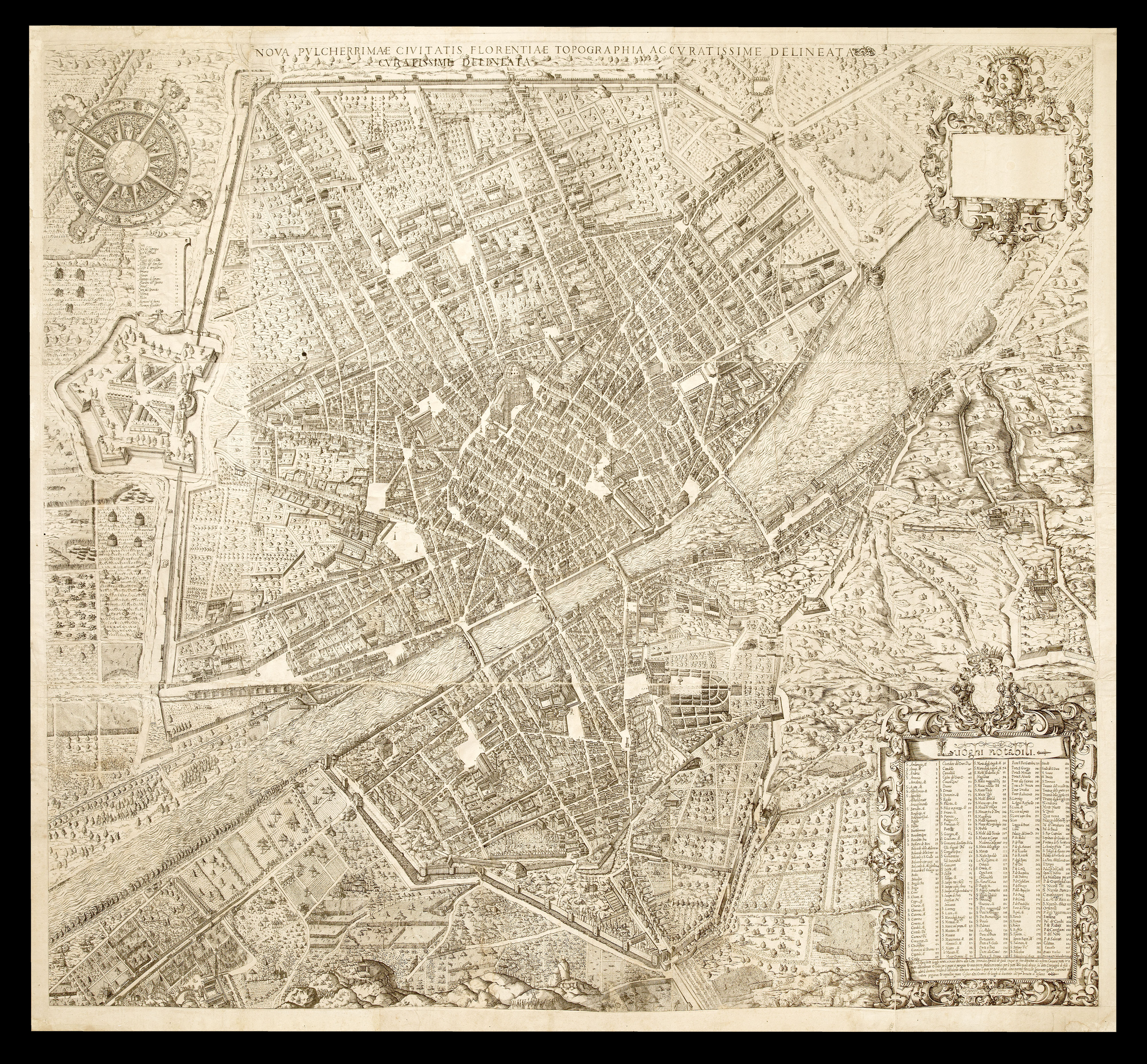 |
The only large scale plan of Florence produced in the Sixteenth Century
1 x
£250,000
|
£250,000 |
|
£250,000 |
|
× |
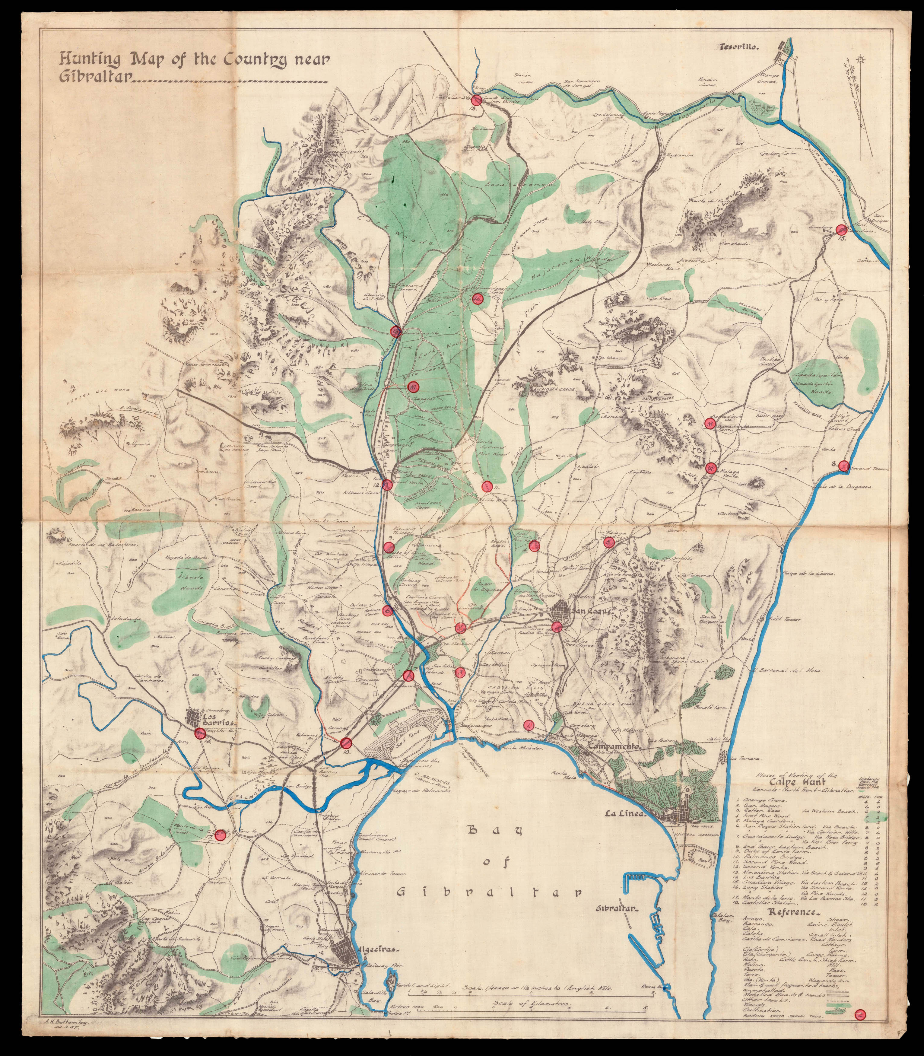 |
The hunting ground of the Calpe
1 x
£750
|
£750 |
|
£750 |
|
× |
![PTOLEMAEUS, Claudius [translated by ANGELUS, Jacobus, edited by GERMANUS, Nicolaus] Tabula quinta Europa](https://omega.crouchrarebooks.com/wp-content/uploads/2025/03/16470_1H.jpg) |
Ptolemy's map of the countries of the Adriatic
1 x
£15,000
|
£15,000 |
|
£15,000 |
|
× |
![ROSE, F[rederick] W[illiam] Angling in Troubled Waters](https://omega.crouchrarebooks.com/wp-content/uploads/2025/03/14585_1H.jpg) |
Tsar Nicholas II puppet master
1 x
£4,500
|
£4,500 |
|
£4,500 |
|
× |
![[SMIT, Jan] Gezigt van de Haringpakkers toren, nevens de Haarlemmers sluis, en Nieuwe Vismarkt tot Amsterdam. van 't y aan te zien.](https://omega.crouchrarebooks.com/wp-content/uploads/2025/03/14427_1H.jpg) |
View from outside the Haringpakkerstoren towards the Koepelkirk
1 x
£3,900
|
£3,900 |
|
£3,900 |
|
× |
![[ANONYMOUS] [Original design for a Printer's Trade Card].](https://omega.crouchrarebooks.com/wp-content/uploads/2025/03/17663_1H.jpg) |
A manuscript medley featuring a map of Sicily
1 x
£1,200
|
£1,200 |
|
£1,200 |
|
× |
 |
More graceful figures than those now seen' (Dickens)
1 x
£10,000
|
£10,000 |
|
£10,000 |
|
× |
!["Nothing was more important for [ancient] Geography than to know the size of the Earth, and nothing seemed more difficult to undertake" (Cassini)](https://omega.crouchrarebooks.com/wp-content/uploads/2025/04/21950_1H.jpg) |
"Nothing was more important for [ancient] Geography than to know the size of the Earth, and nothing seemed more difficult to undertake" (Cassini)
1 x
£75,000
|
£75,000 |
|
£75,000 |
|
× |
![HOLLAR, W[enceslaus] The Abbey of Groenendael](https://omega.crouchrarebooks.com/wp-content/uploads/2025/03/18261_1H.jpg) |
Groenendael Abbey
1 x
£600
|
£600 |
|
£600 |
|
× |
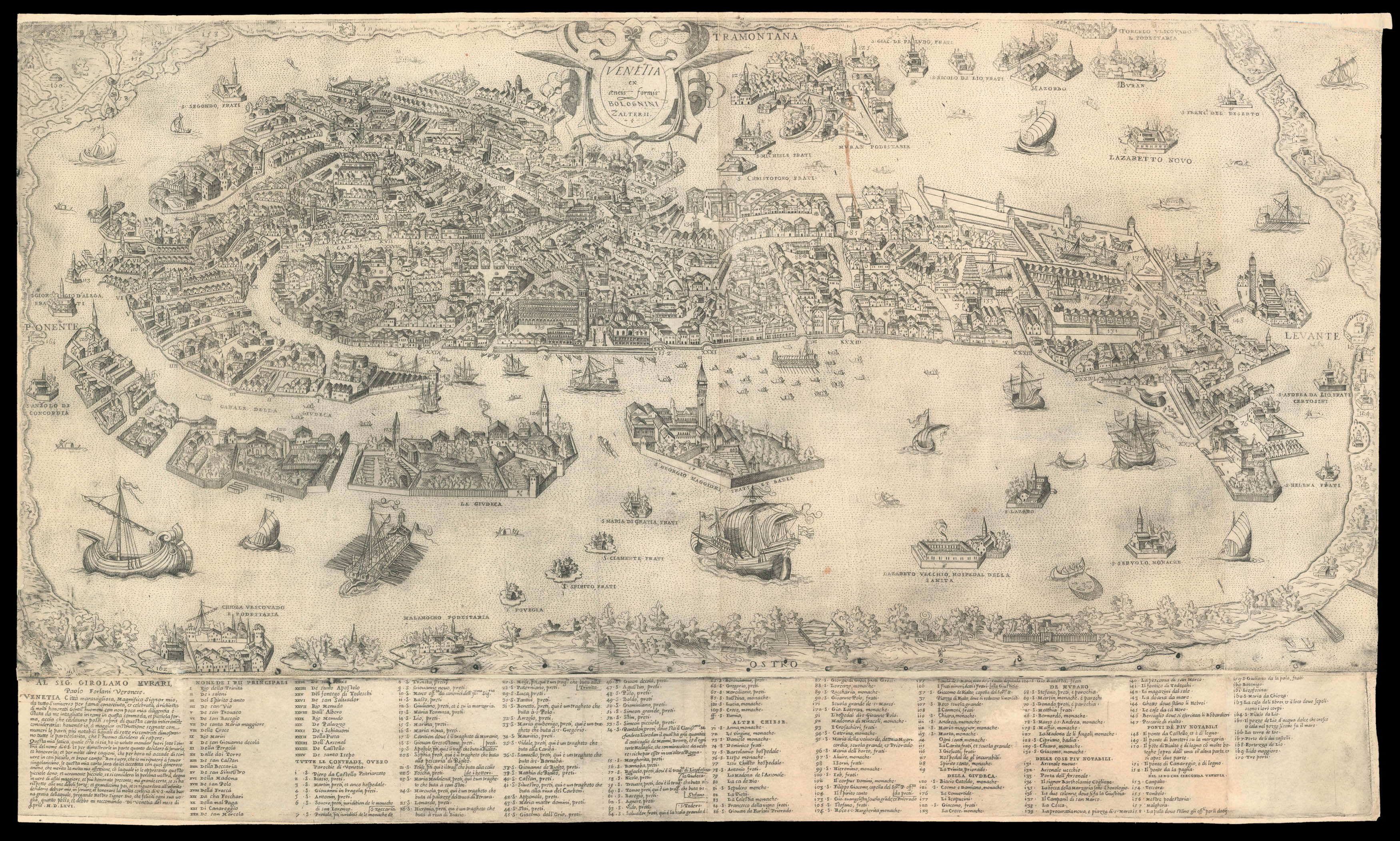 |
Forlani's magnificent plan of Venice
1 x
£30,000
|
£30,000 |
|
£30,000 |
|
× |
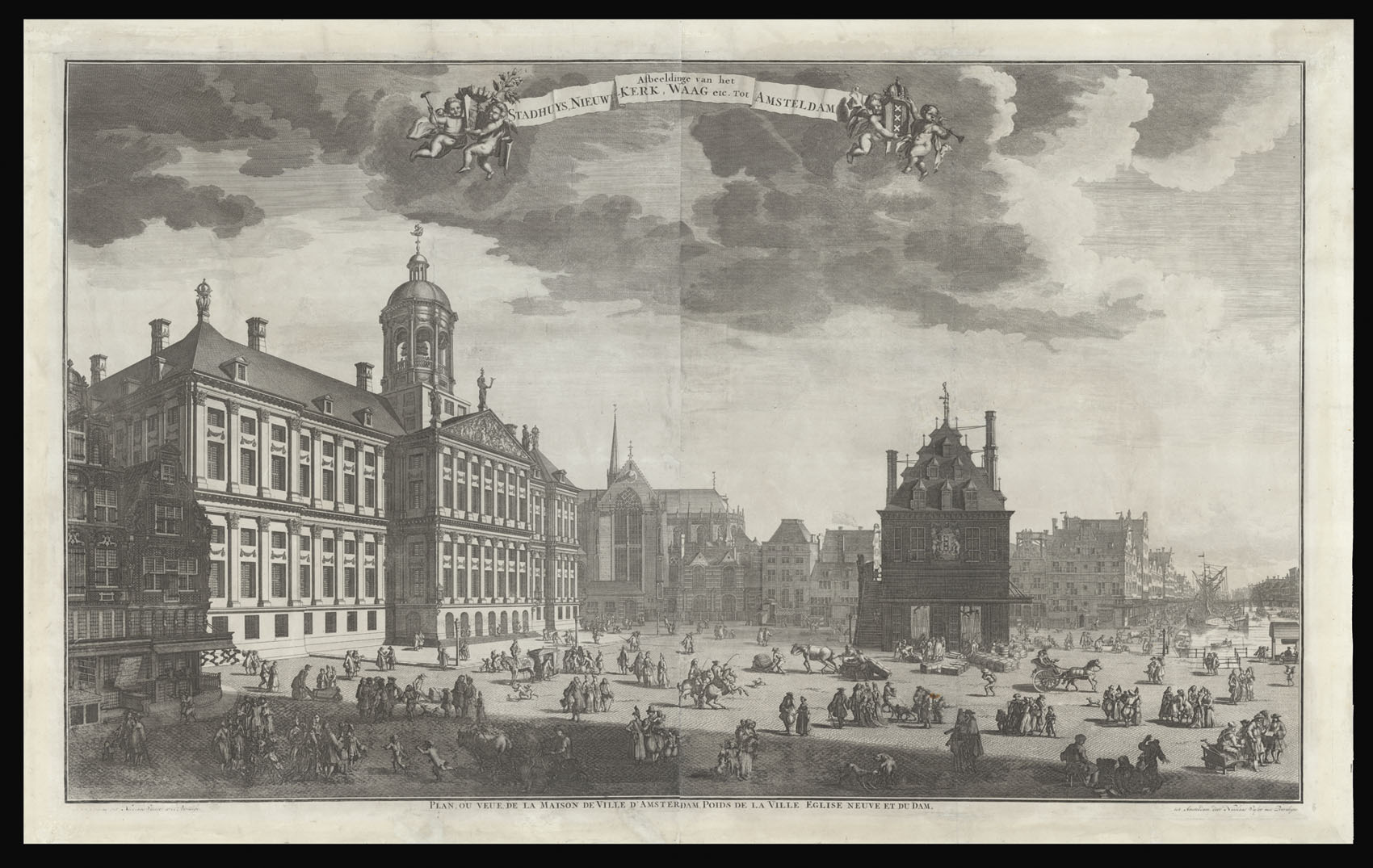 |
View of the Dam with the Koninklijk Paleis and the Waag
1 x
£4,600
|
£4,600 |
|
£4,600 |
|
× |
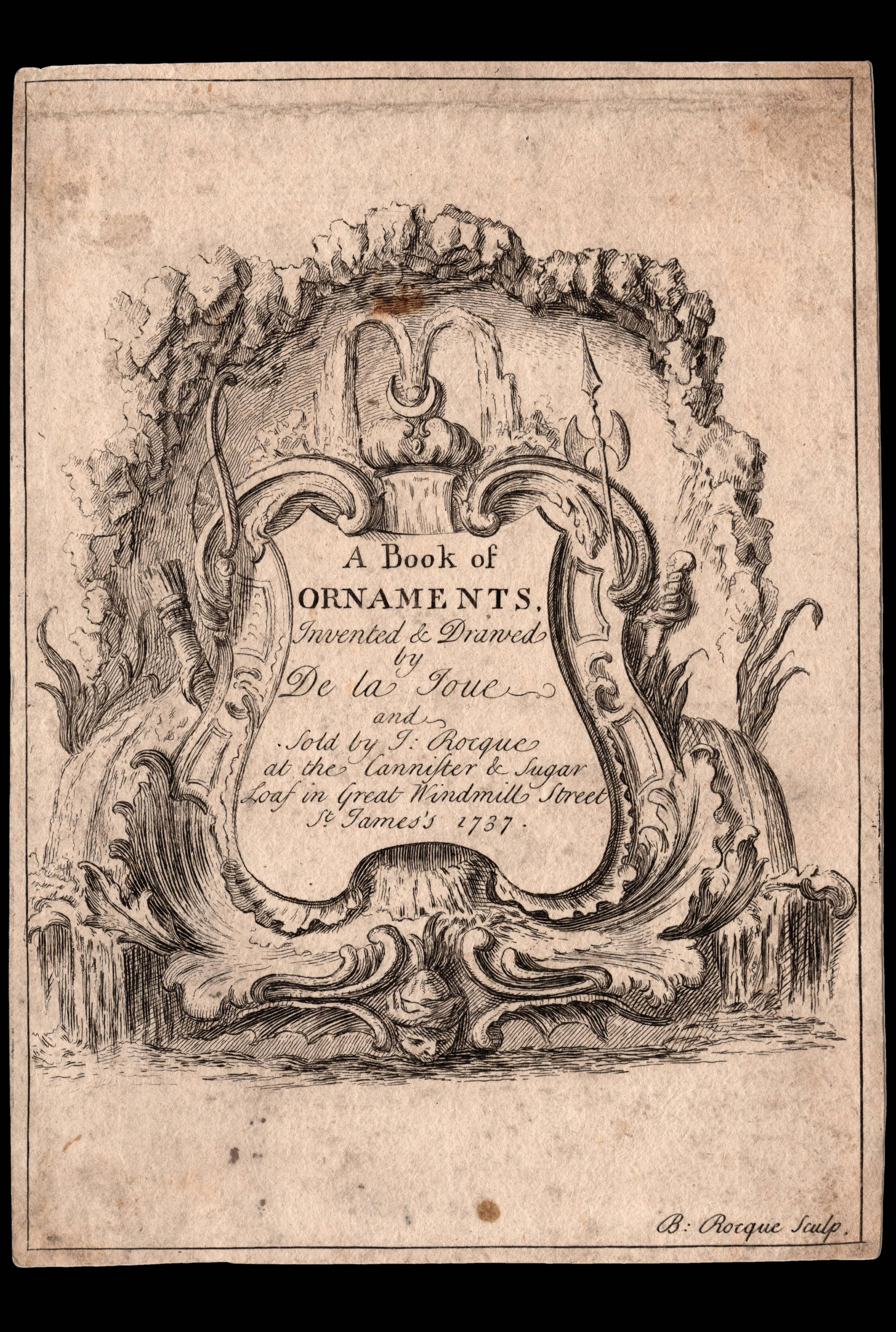 |
Advertising an unpublished book of rococo ornaments
1 x
£2,000
|
£2,000 |
|
£2,000 |
|
× |
![BAKER, W[illiam] E[merson]. This Porcineograph.](https://omega.crouchrarebooks.com/wp-content/uploads/2025/03/15815_1H.jpg) |
America Hams it Up
1 x
£12,000
|
£12,000 |
|
£12,000 |
|
× |
![[Anonymous] Kussenkast.](https://omega.crouchrarebooks.com/wp-content/uploads/2025/03/23919_1H.jpg) |
Cabinet de la routte marinesque
1 x
£40,000
|
£40,000 |
|
£40,000 |
|
× |
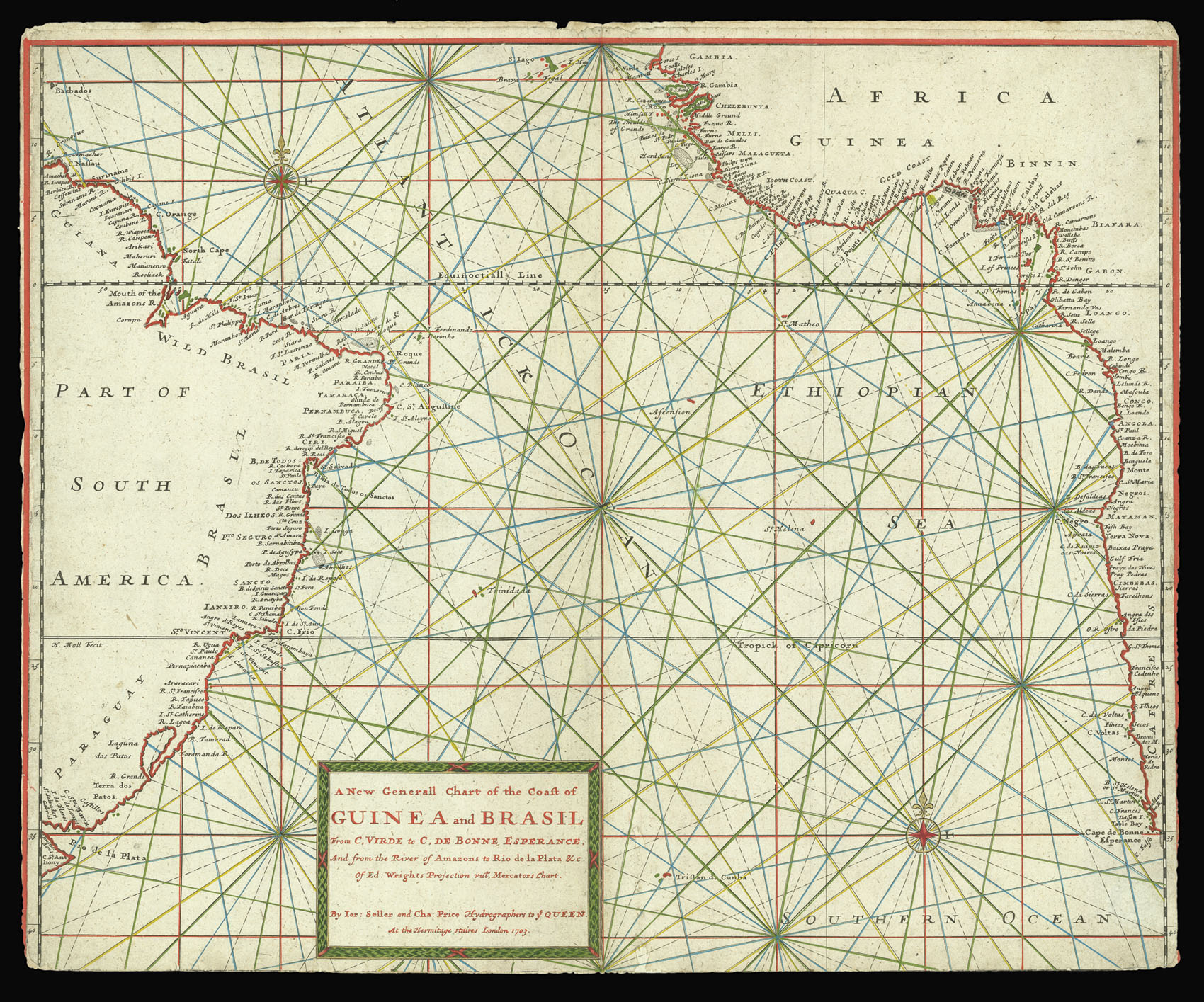 |
Seller and Price's extremely rare chart of the Southern Atlantic
1 x
£2,000
|
£2,000 |
|
£2,000 |
|
× |
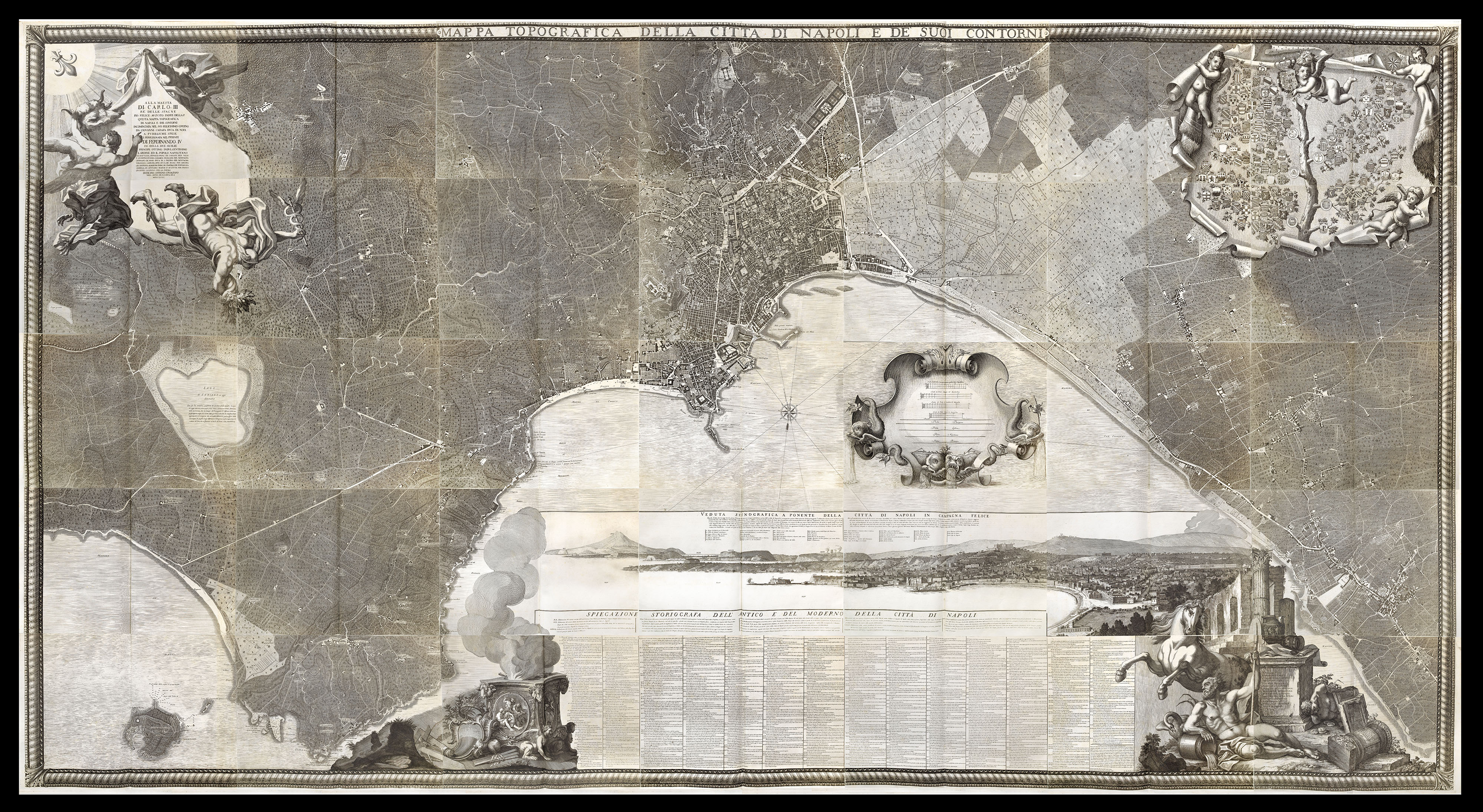 |
Carletti's magnificent plan of Naples
1 x
£45,000
|
£45,000 |
|
£45,000 |
|
× |
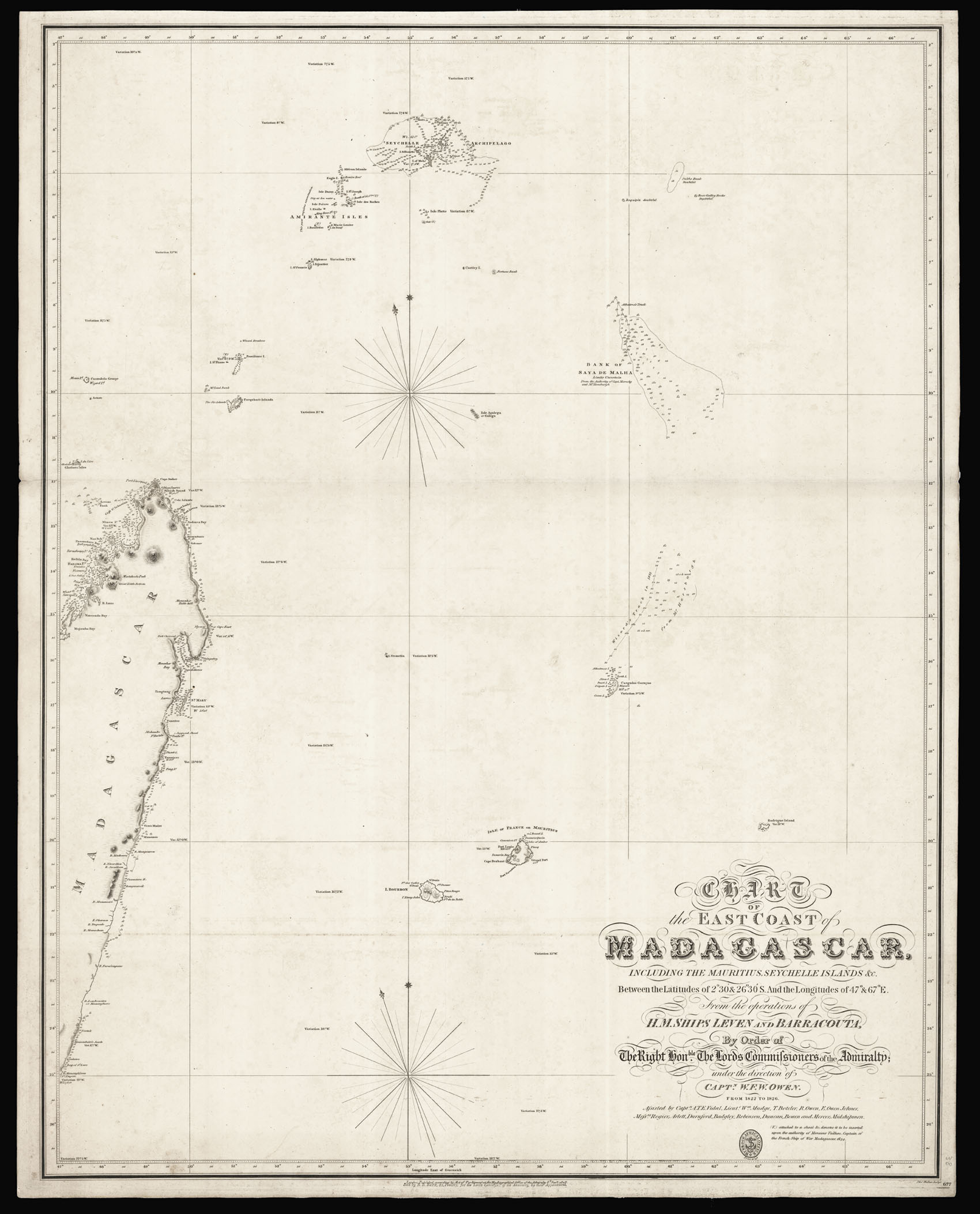 |
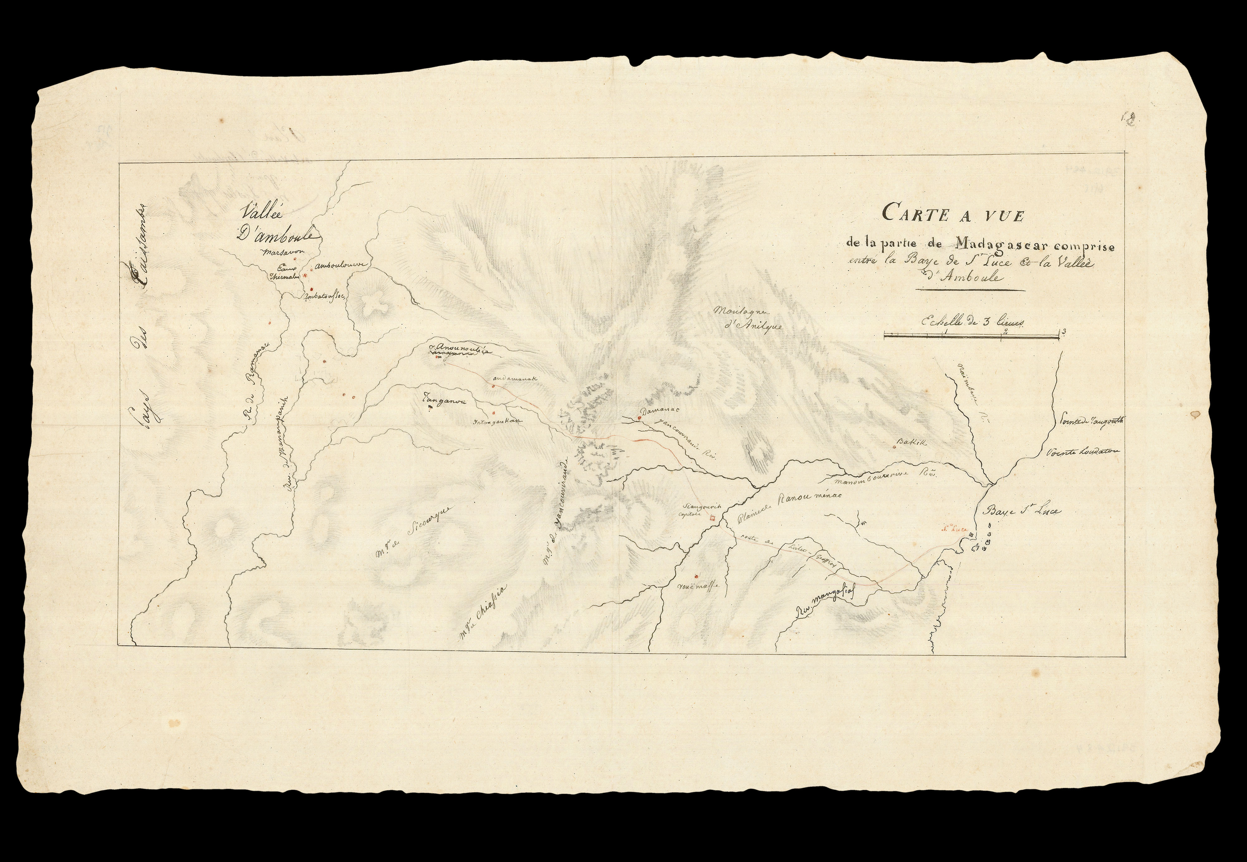
"such parts of the coast of Madagascar as you may conceive not to have been accurately ascertained"
1 x
£2,500
|
£2,500 |
|
£2,500 |
|
× |
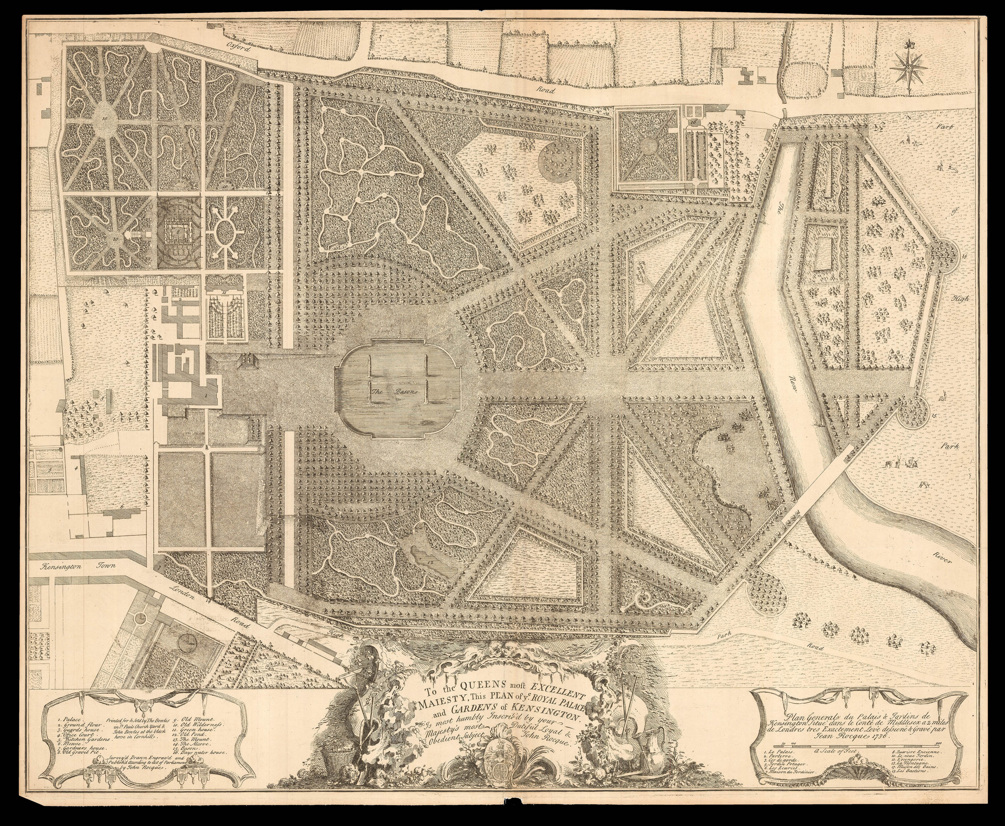 |
Rocque's plan of Kensington Palace and Gardens
1 x
£2,000
|
£2,000 |
|
£2,000 |
|
× |
 |
"Dr Livingstone, I presume?"
1 x
£20,000
|
£20,000 |
|
£20,000 |
|
× |
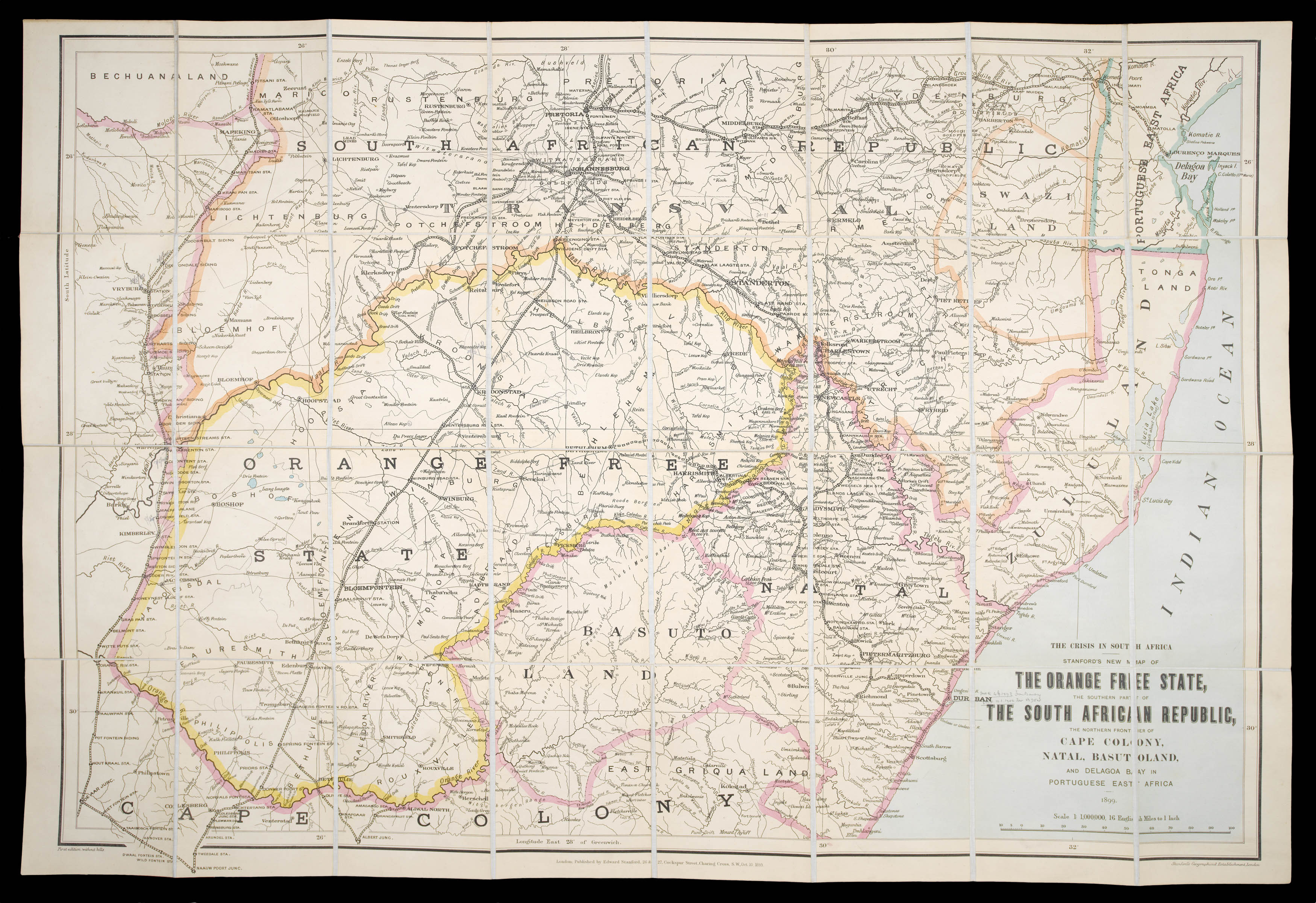 |
Boer War Map of Africa
1 x
£300
|
£300 |
|
£300 |
|
× |
 |
An early chart of the Southern Atlantic
1 x
£1,200
|
£1,200 |
|
£1,200 |
|
× |
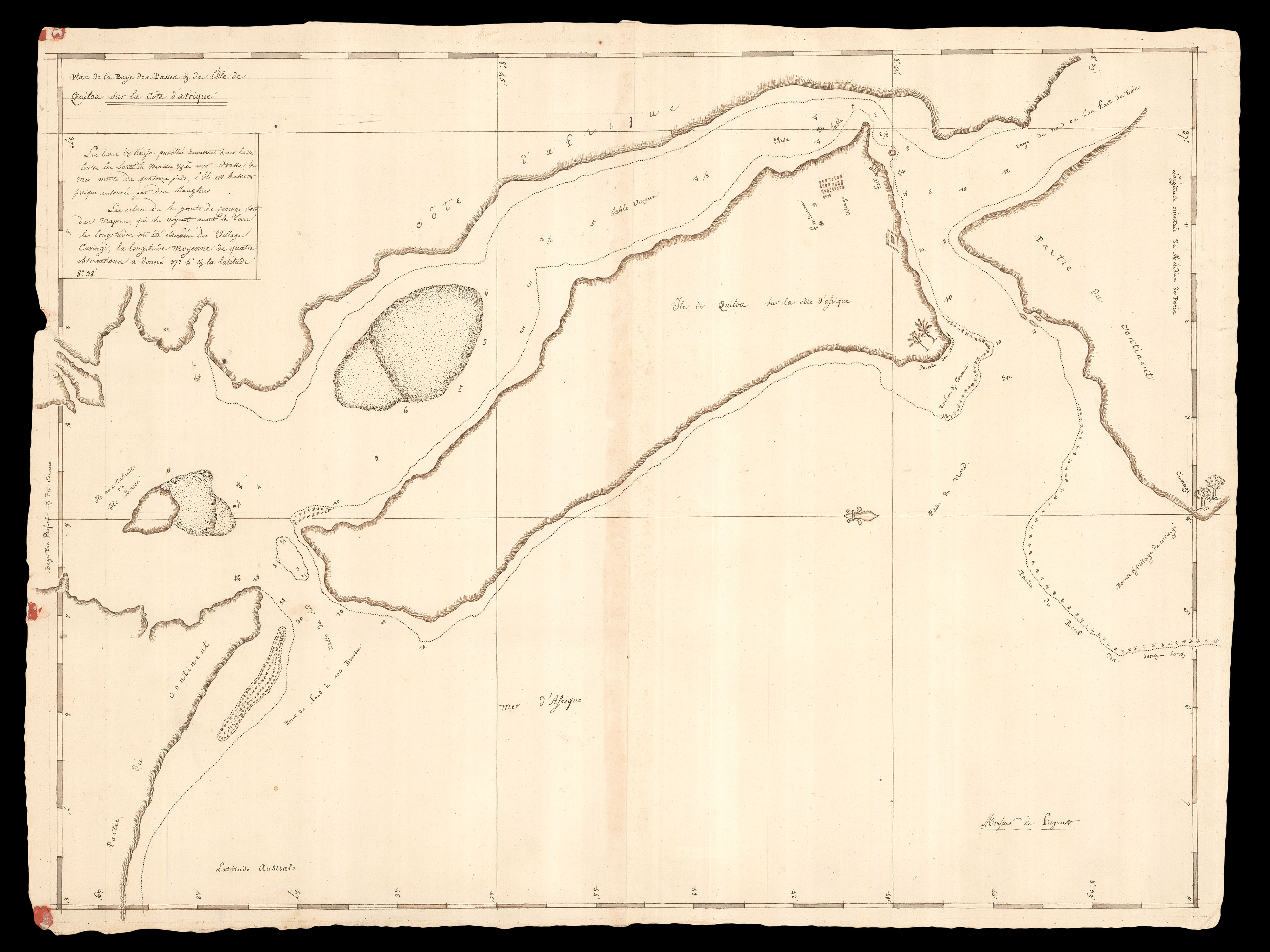 |
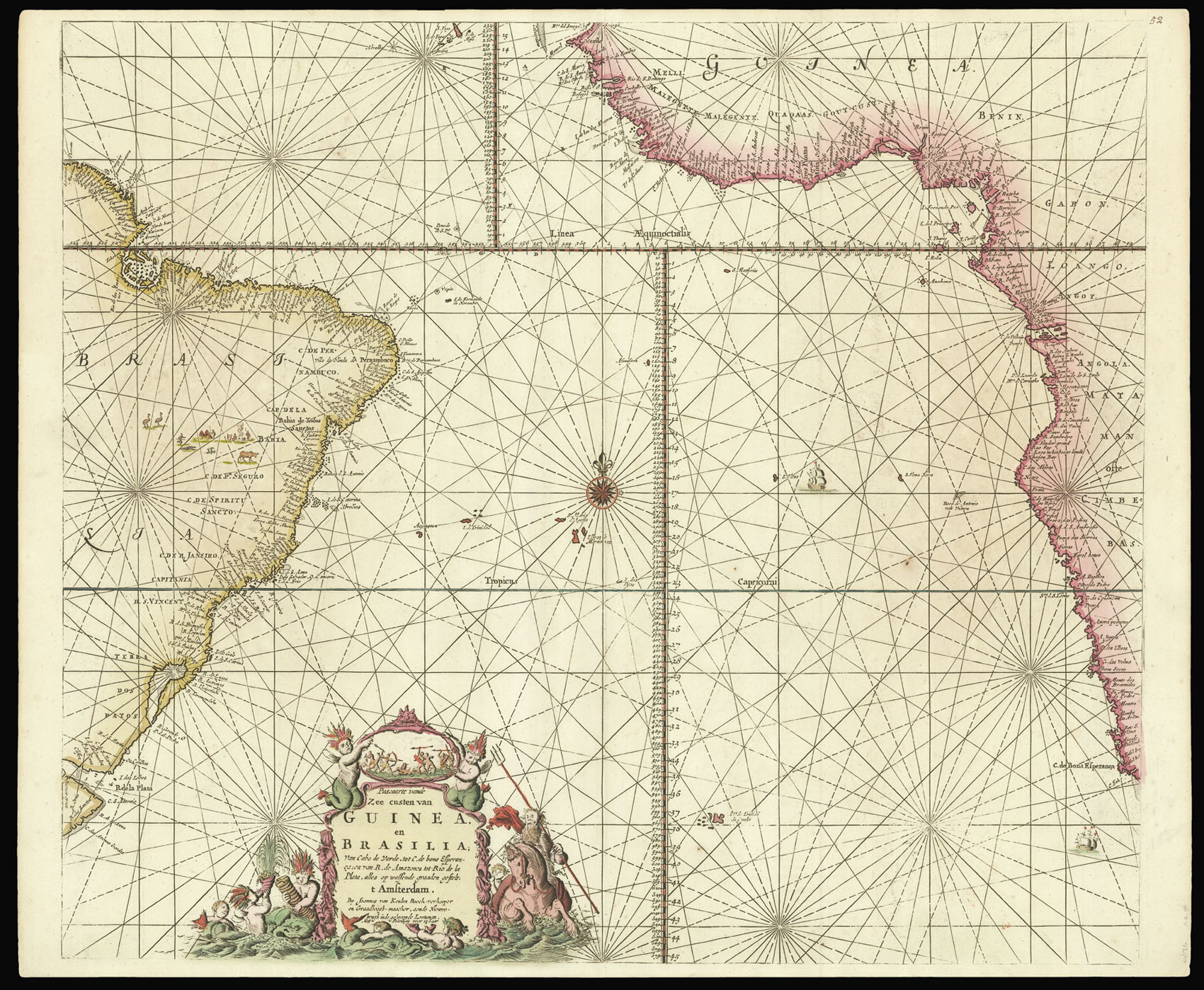
"...The island is low and almost surrounded by mangroves"
1 x
£5,000
|
£5,000 |
|
£5,000 |
|
× |
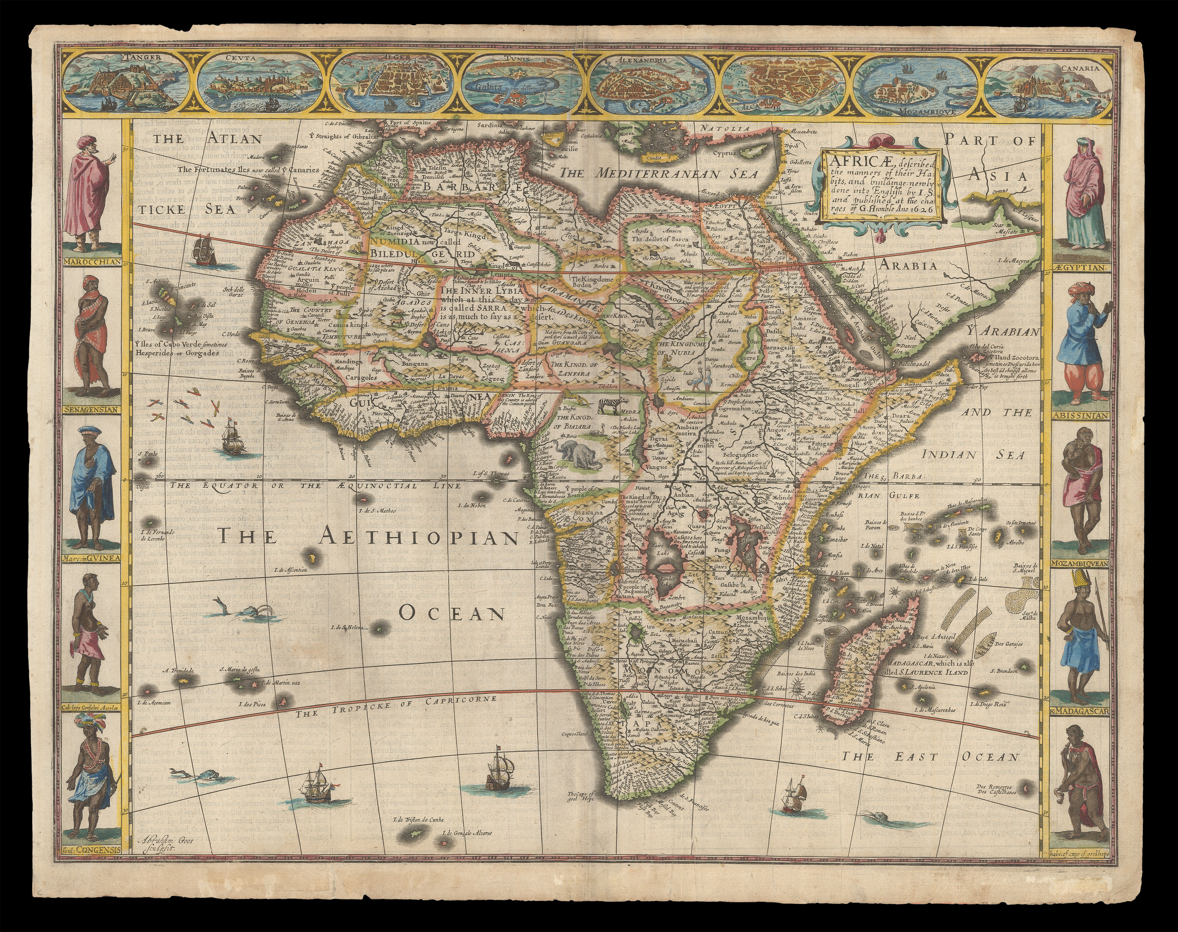 |
The first English map of Africa
1 x
£2,500
|
£2,500 |
|
£2,500 |
|
× |
 |
The heart of darkness
1 x
£15,000
|
£15,000 |
|
£15,000 |
|
× |
 |
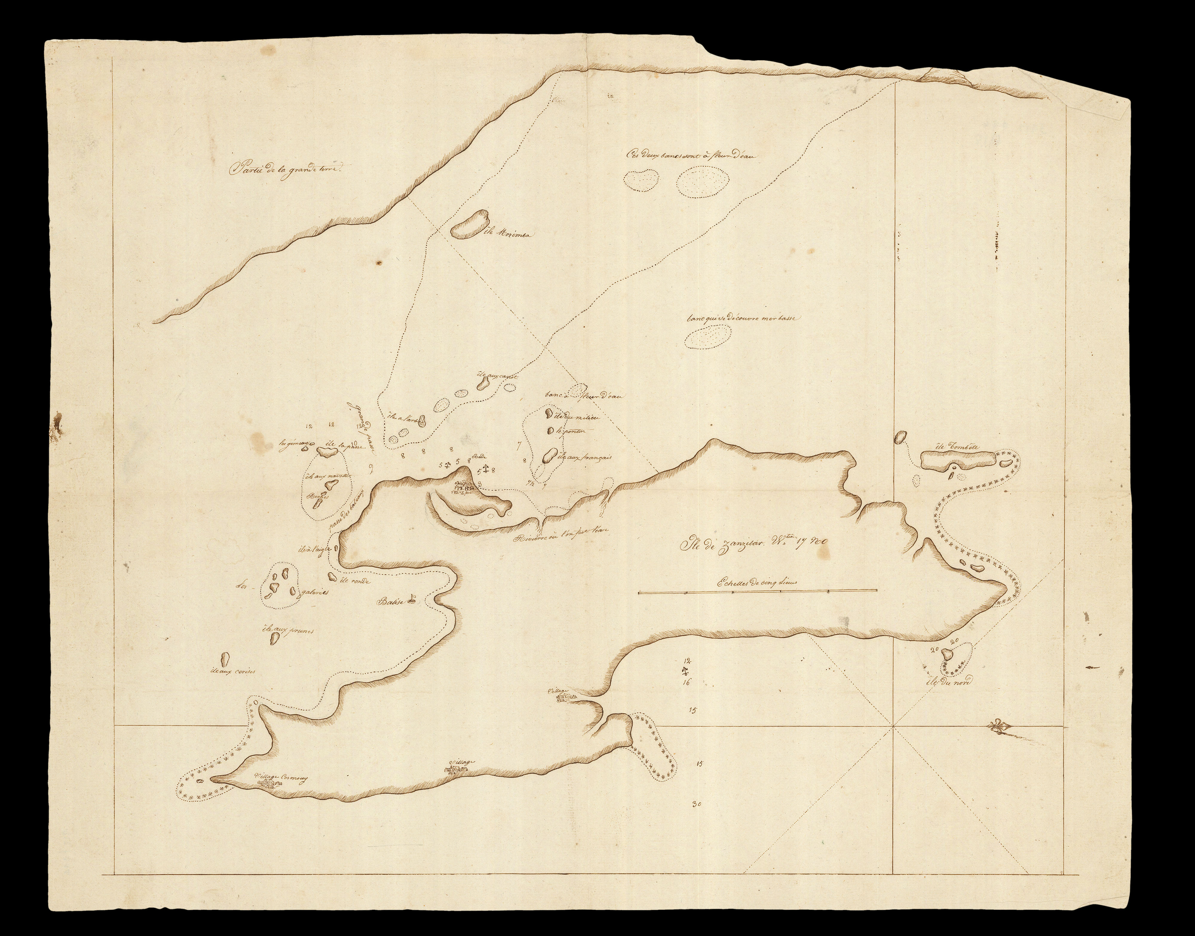
The only hope for survival for the French islands in the Indian Ocean
1 x
£3,000
|
£3,000 |
|
£3,000 |
|
× |
![PTOLEMAEUS, Claudius [translated by ANGELUS, Jacobus, edited by GERMANUS, Nicolaus] [Central Asia and China] Septima Asie tabula.](https://omega.crouchrarebooks.com/wp-content/uploads/2025/03/18406_1H.jpg) |
A striking map of Central Asia and China from the 1482 Ulm Ptolemy
1 x
£12,000
|
£12,000 |
|
£12,000 |
|
× |
![PTOLEMAEUS, Claudius [translated by ANGELUS, Jacobus, edited by GERMANUS, Nicolaus] [Himilayas and Central Asia] Octava Asie tabula.](https://omega.crouchrarebooks.com/wp-content/uploads/2025/03/18407_1H.jpg) |
A striking map of the Himilayas and Central Asia and China from the 1482 Ulm Ptolemy
1 x
£9,000
|
£9,000 |
|
£9,000 |
|
× |
![HOLLAR, W[enceslaus] [Views of Tangiers]](https://omega.crouchrarebooks.com/wp-content/uploads/2025/03/18646_1H.jpg) |
Views of Tangiers
1 x
£1,500
|
£1,500 |
|
£1,500 |
|
× |
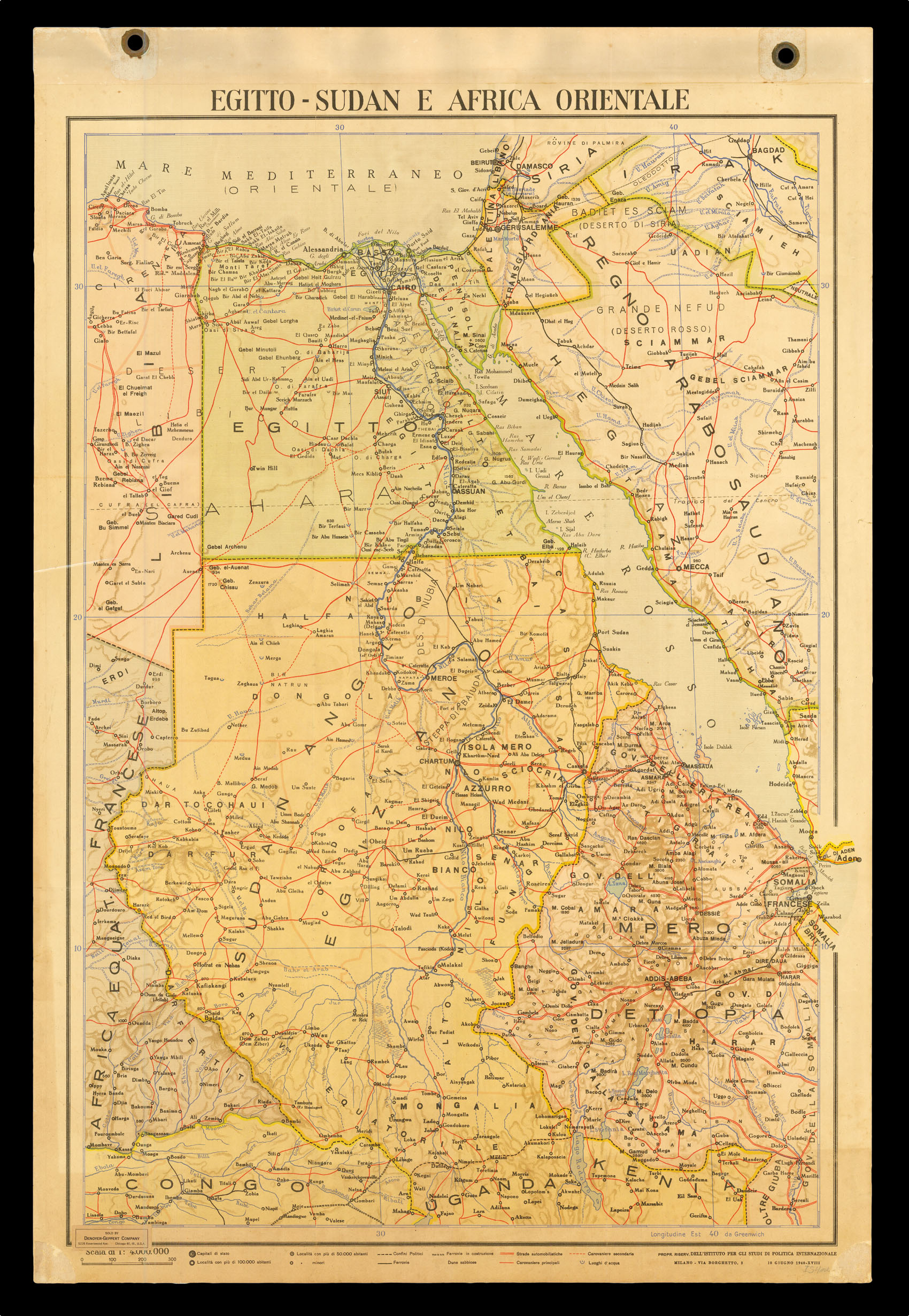 |
Italian colony in Africa during WWII
1 x
£100
|
£100 |
|
£100 |
|
× |
![[PTOLEMAEUS, Claudius] Secunda Africae Tabula.](https://omega.crouchrarebooks.com/wp-content/uploads/2025/03/12985_1H.jpg) |
Northern Africa
1 x
£2,000
|
£2,000 |
|
£2,000 |
|
|


