No products in the basket.
Return to shop
Map of Shanghai, China, and vicinity by “Chinese Gordon”
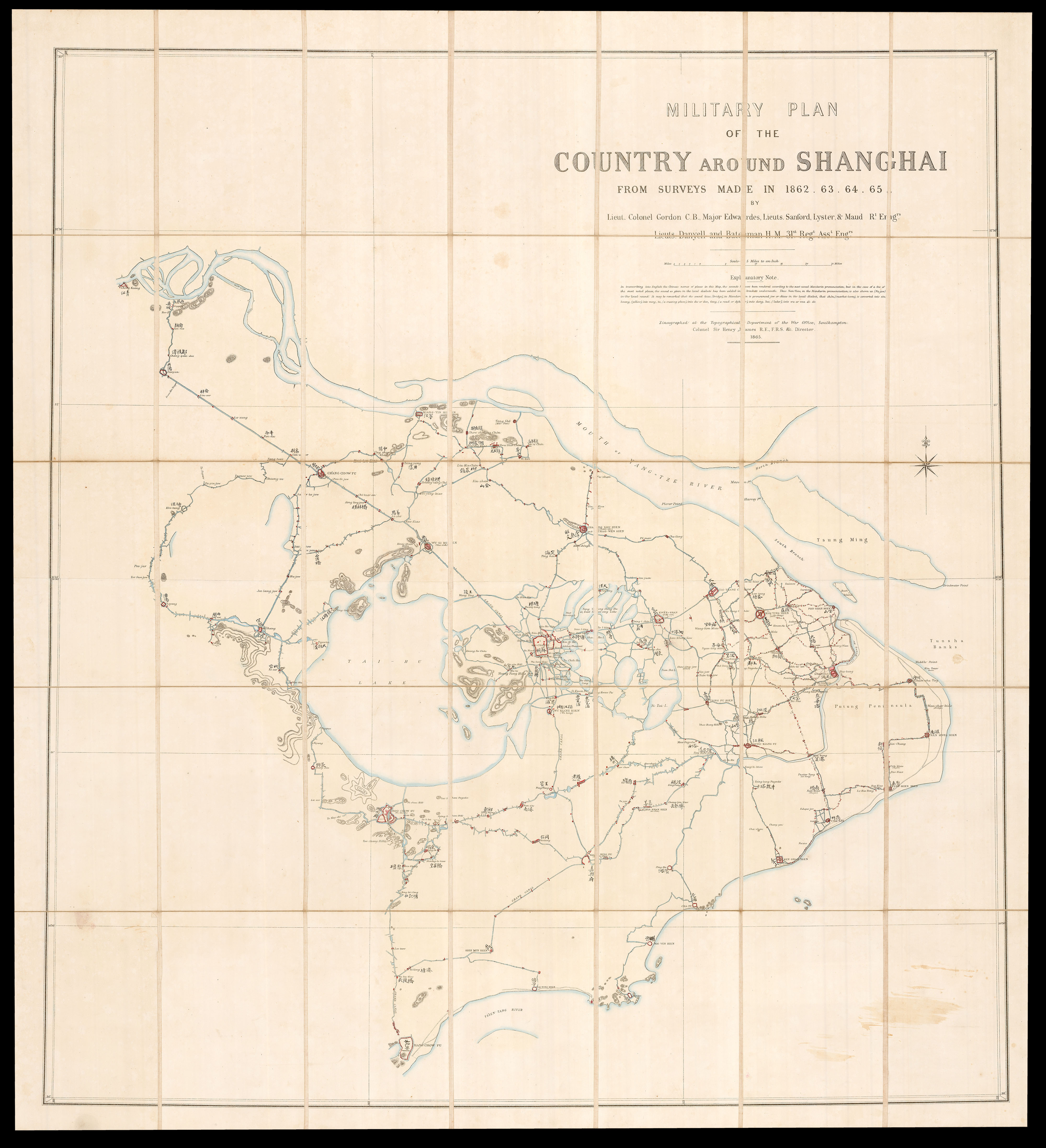
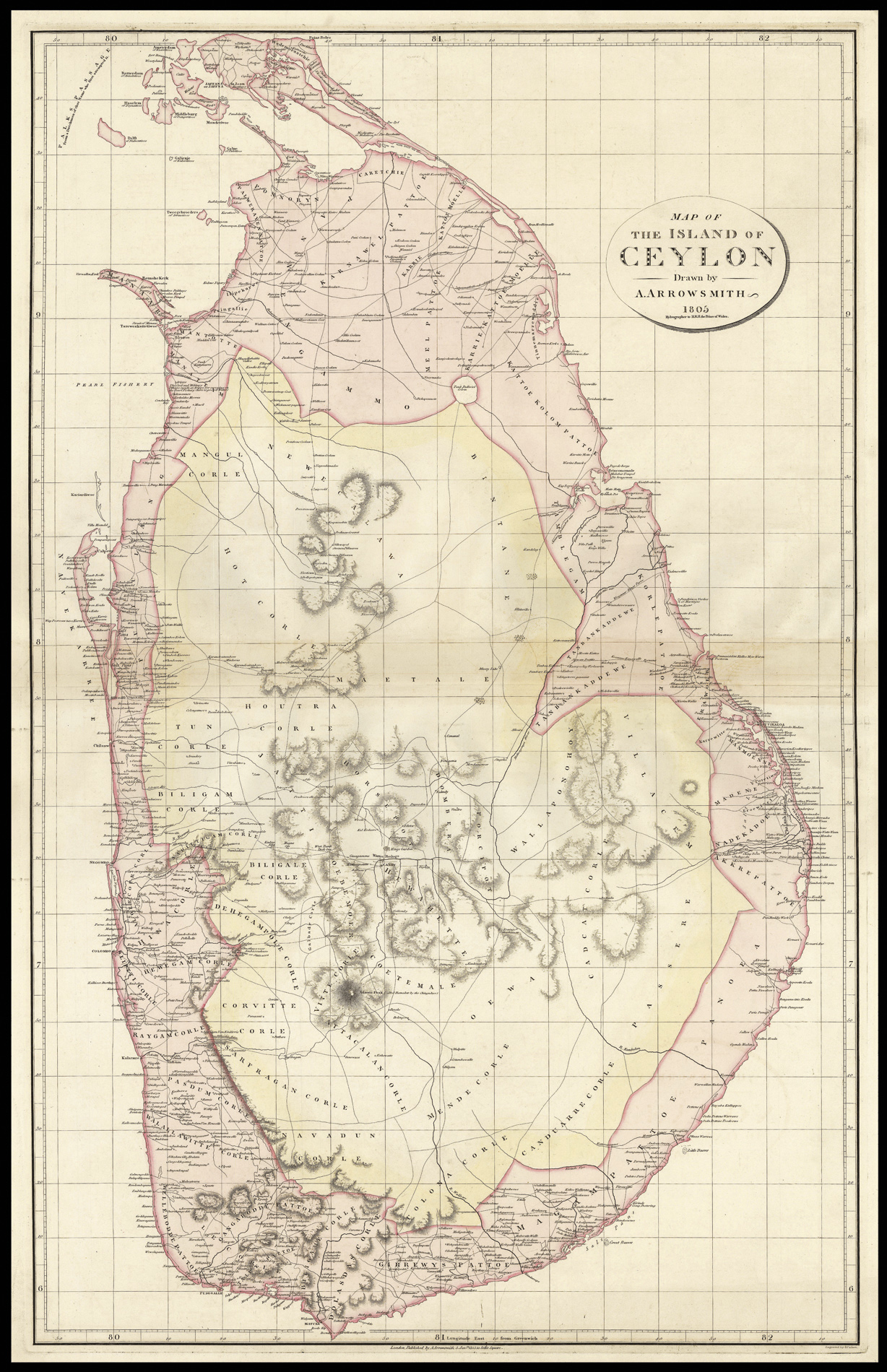
By GORDON, Lieutenant Colonel Charles George, 1865
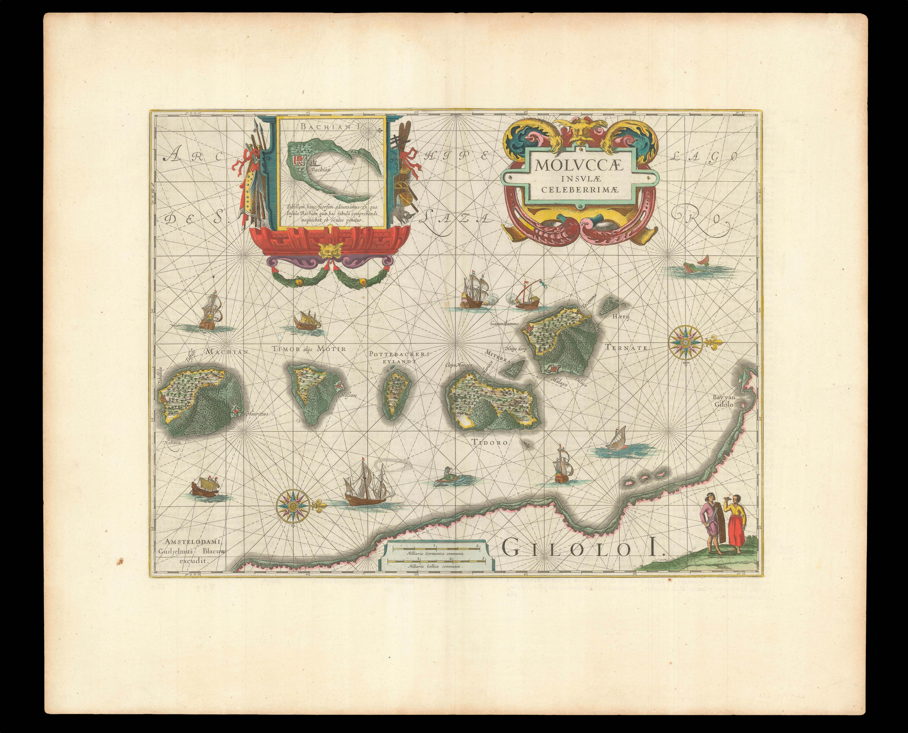
The first sea chart of Japan on Mercator’s Projection
By DUDLEY, Robert, 1661].
The Grierson pirated edition of Moll’s map of southeast Asia
By MOLL, Herman, 1735].
Dalrymple proposes an EIC settlement on Balambangan
By DALRYMPLE, Alexander, Nov.r 30, 1770.
The Moluccas
By VALENTYN, Francois, 1724-1726].
Katip Celebi’s Rare Map of Japan
By CELEBI, Katip, 1732].
Admiralty chart of Malay coast from Pulau Merambong to Singapore
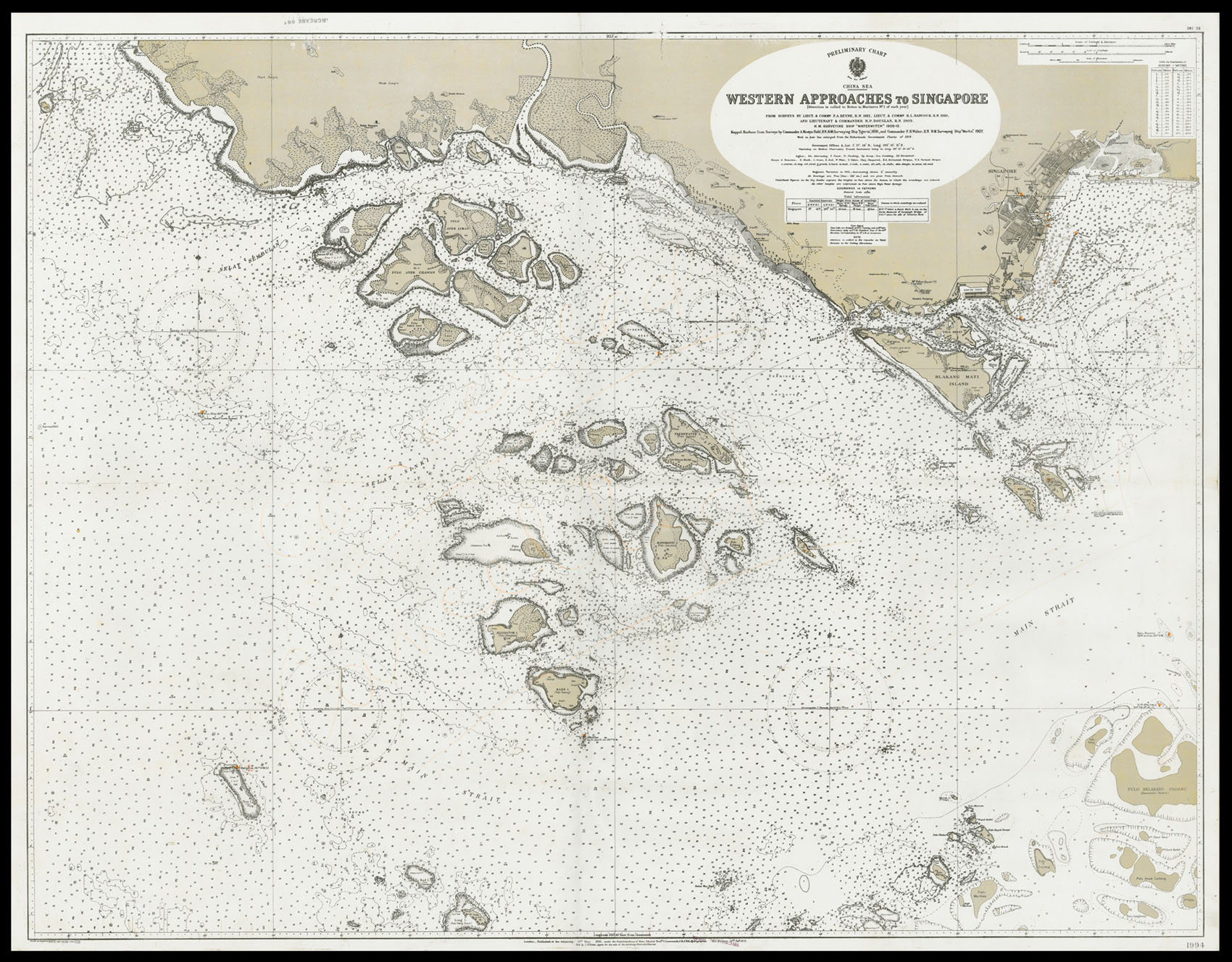
By HYDROGRAPHIC OFFICE, New Edition 19th February, 1923.
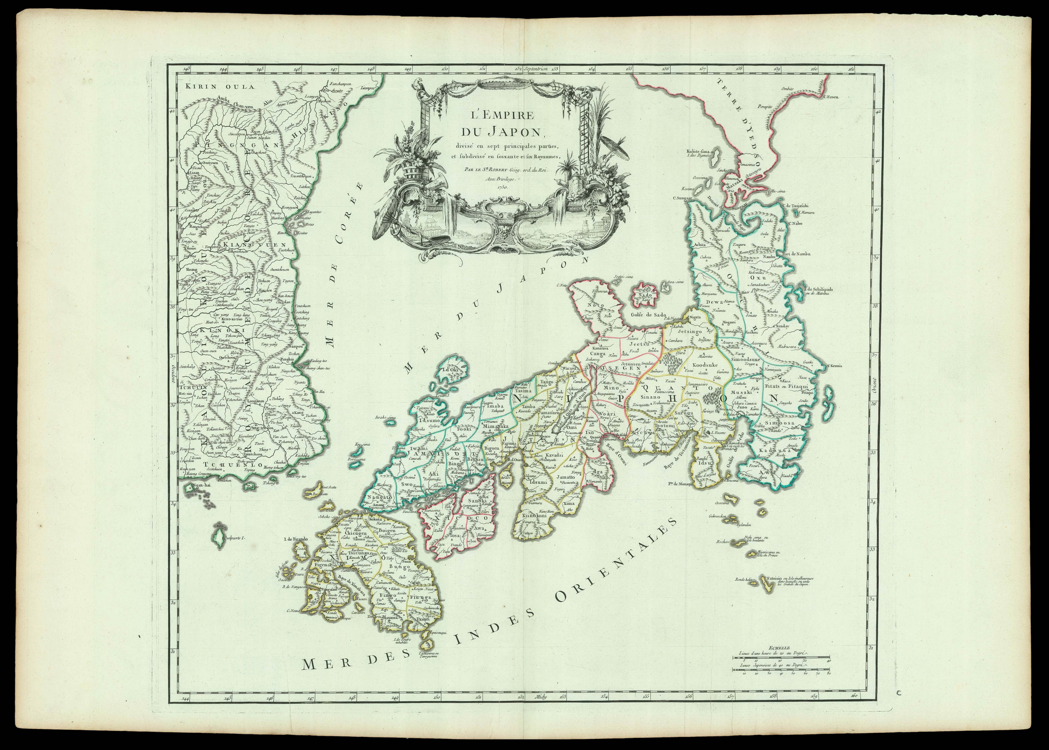
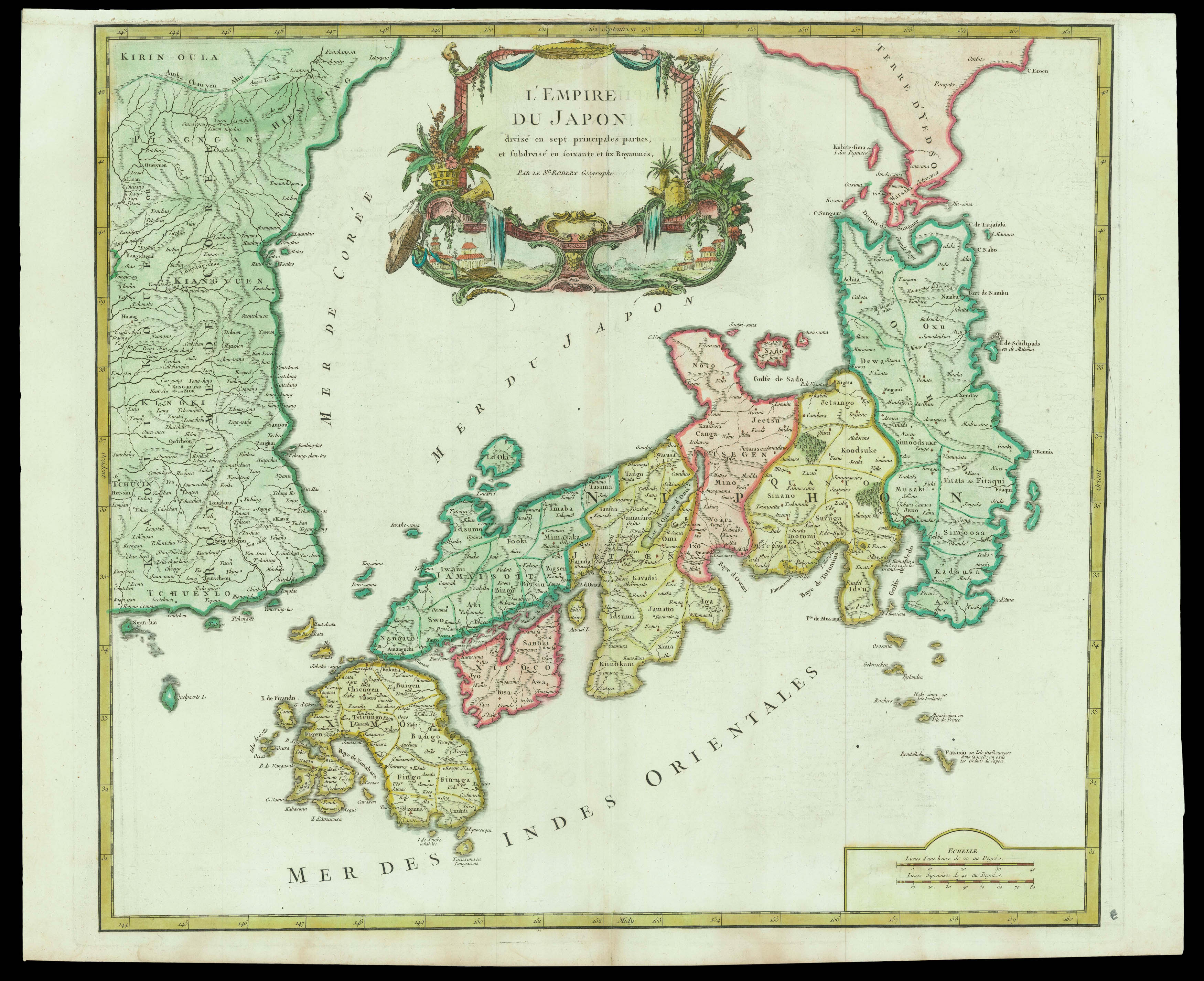
Early British rule in Sri Lanka
By ARROWSMITH, Aaron, 5th Jan[ua]ry 1805.
Map of Japan drawn after Aaron Arrowsmith
By [ARROWSMITH, Aaron], 1804].
The Empire of Japan
By ROBERT DE VAUGONDY, Gilles, 1750 [but 1757].
By ROBERT DE VAUGONDY, Gilles, [after 1787].
The first printed large-scale chart of the Spice Islands
By BLAEU, Willem Janszoon, 1635].
Username or email address *Required
Password *Required
Remember me Log in
Lost your password?
Email address *Required
A link to set a new password will be sent to your email address.
Your personal data will be used to support your experience throughout this website, to manage access to your account, and for other purposes described in our privacy policy.
Register